[Click images for large version and again for full resolution]
Before the start of COVID (c. March 2020) my exercise regimen consisted of
rock climbing at Ironworks (the local gym);
a twice-weekly "core strength" class at Ironworks;
a weekly Claremont Canyon hike and occasional other hikes.
When COVID hit, the climbing gym closed.
I kept hiking but that wasn't enough exercise,
so I started riding my bike more.
It's a Trek 830 - a heavy, low-end mountain bike.
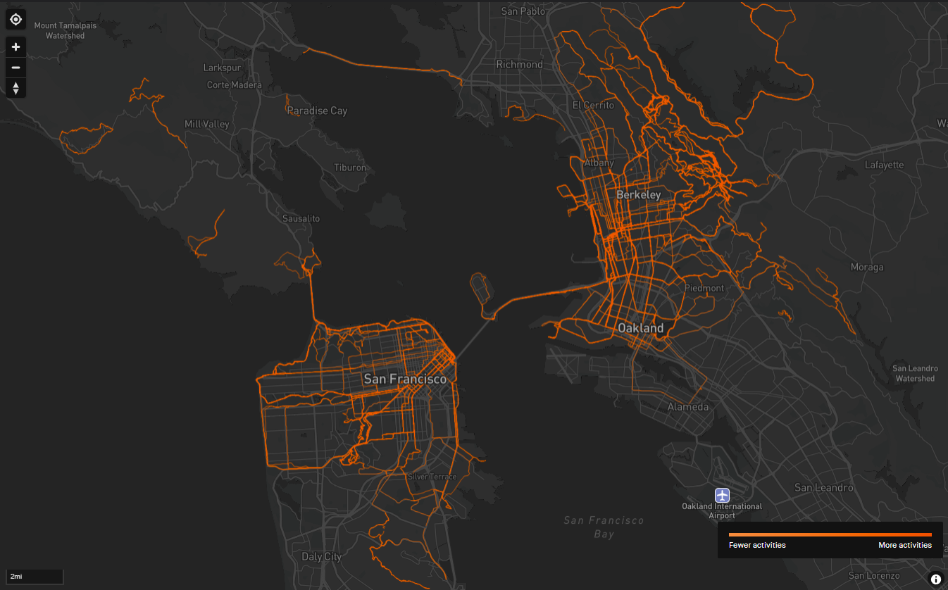
Around that time Dave G. turned me on to Strava.
Strava maps your routes, and graphs elevation and heart rate.
Your friends can give you "kudos" - virtual pats on the back.
I got a Garmin GPS watch, started to record my hikes and rides,
and quickly became a Strava addict.
BTW, getting a little ahead, but here's a Strava map of my bike rides:
In summer 2020 I started riding pretty often,
usually in the evening after dropping off my son Noah.
I got in very good shape, especially for climbing hills,
even very steep hills like Marin Street.
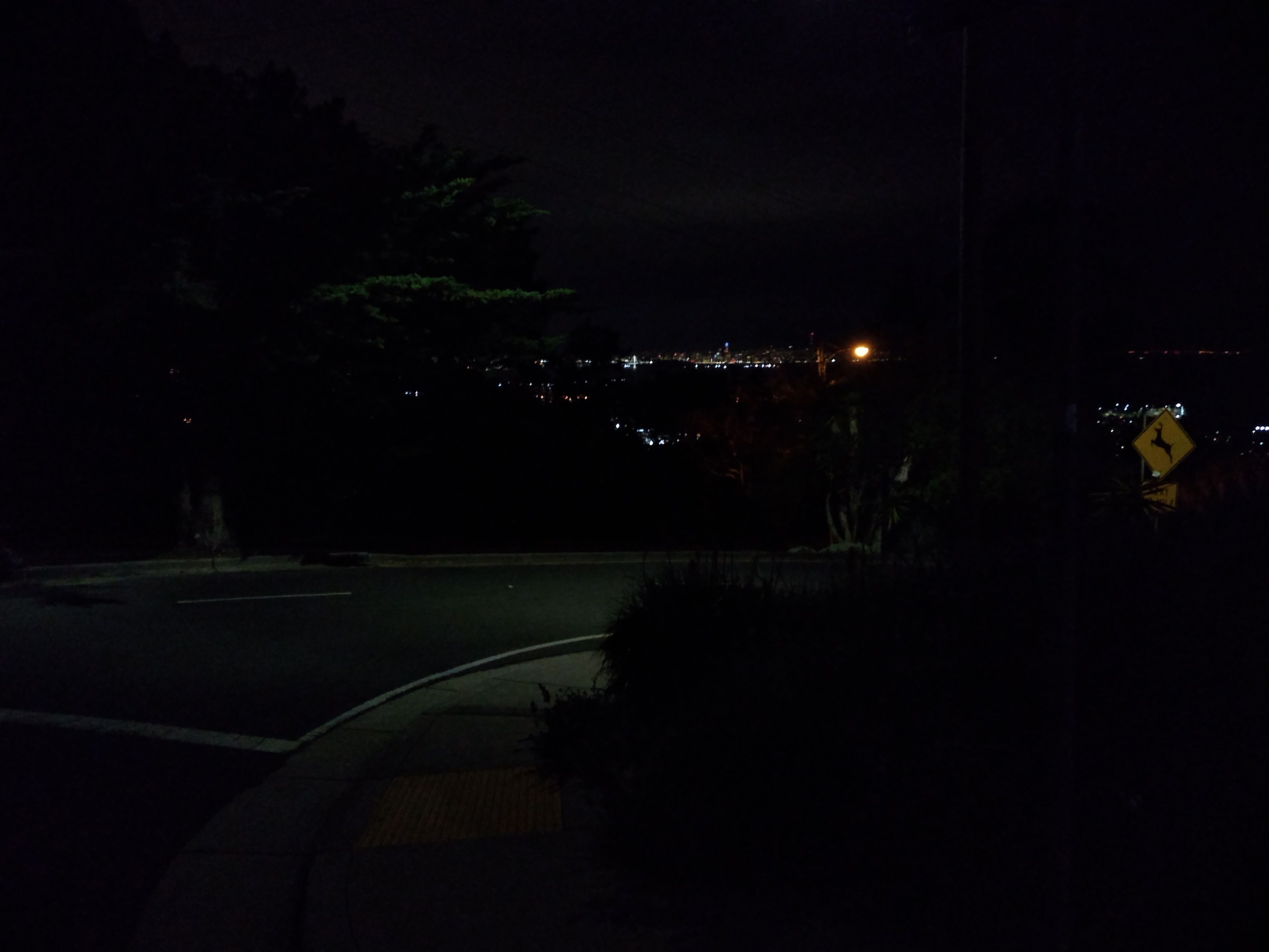
Fall arrived, clocks changed, and it got dark early.
I moved the rides to later at night, starting around 9 or 10 PM.
I bought a USB-charged headlight and taillight.
The nature of the rides changed.
I stopped doing "standard" rides;
instead, I tried to make each ride different.
I sought out remote and unusual destinations - places I had never been
in my ~50 years of living in Berkeley.
The rides began to have a significance other than just exercise:
I'm a risk-taker; small doses of danger make me feel alive.
Normally I get my kicks by climbing mountains and rocks,
but COVID and winter limited this.
So I took bike rides having an element of adventure:
i.e. rides that are physically demanding, or that go through squalid parts of town,
or to remote and isolated places, preferably places I've never been.
The COVID era induced a "Groundhog's Day" effect:
the days are all alike, and they blur together;
time goes by too fast; it feels like it's been lost.
Making the rides unique and unusual provided a way to defeat this effect,
and to make each day feel different and exciting.
Bikes are amazingly efficient.
I typically average about 10 MPH, including hills and traffic lights.
So in a 1-2 hour ride, starting from my house,
I can go so far that Berkeley is just a faint glow on the horizon,
impossibly far away.
I love that feeling.
In Fall 2020 there were lots of wildfires here in NoCal;
many nights I couldn't ride because of bad air quality.
I did most of the rides alone.
I would have enjoyed company, but few people like to ride late at night.
I encountered almost no other bikers on any of the rides.
Apparently I'm the only person in the Bay Area who likes riding at night.
In fact, I encountered very few people period.
In the COVID era no one went out, and everything shut down early.
Most of the people I saw were homeless.
A typical ride goes like this:
I think of a destination, sometimes a day or two in advance.
I do some research using Google Maps.
If the navigation is complex (e.g. the Seven Hills of SF)
I print the street list, fold it up, and put it in my pocket.
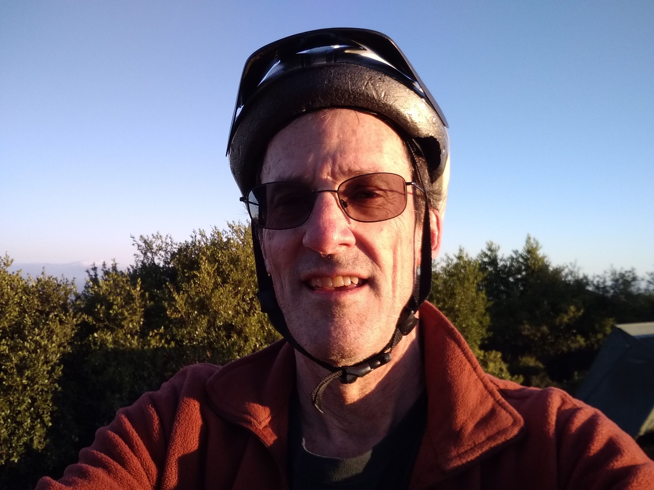
Around 9 PM I put on my biking gear.
This includes a long-sleeve polyester shirt
(sufficient down to about 50 F; if colder than that, I add a fleece jacket),
black fleece gloves, running shoes, GPS watch,
and far-focus glasses.
I take my phone for pictures and videos.
If the ride is in SF, I put the bike rack on the car and load the bike on it.
After the ride, I remove the headlight/taillight and plug them in to recharge.
I pour myself a beer (which always tastes wonderful).
I get the pictures (if any) off my phone,
go to Strava, add a title/description for the ride, and upload the pictures.
Some of the more memorable rides:
Berkeley hills and beyond
Claremont
A steep road to the top of the Berkeley hills.
This was a standard ride.
Generally, from my house I go up Claremont to Tilden's Little Train (1,700' vertical)
and back on South Park Drive.
In one variant,
I continued to the top of Vollmer Peak
(with a brief 41% grade!) and north on Seaview Trail.
On 12/7/20
I did Claremont with my friend Ilya, who was riding a 1-speed bike!
This was ill-advised; there was some stopping, pushing, and cussing.
We came back on Old Tunnel.
Strawberry canyon
This is the canyon behind UC Berkeley.
The Botanical Garden is there but otherwise it's wild,
with stands of redwoods and other conifers, and eucalyptus.
A 4-mile dirt road - the Fire Trail - snakes up the S side and traverses across the top,
ending up at Space Sciences Lab (where I nominally work).
On 11/1/20
I rode up Shasta, along Grizzly, then down the fire trail.
This was my first ride through (sort of) wilderness at night,
which was exciting in a Blair Witch kind of way.
Also, riding down the extremely steep Connector was very exciting.
Similar ride (but up Spruce) on
11/22/20.
Tilden and Wildcat Canyon Park
I did two major night rides through Tilden.
On 3/17/21
I rode (from my house) up to Tilden,
north on Wildcat Canyon trail to Alvarado Park in Richmond,
then back on The Arlington (another significant hill climb).
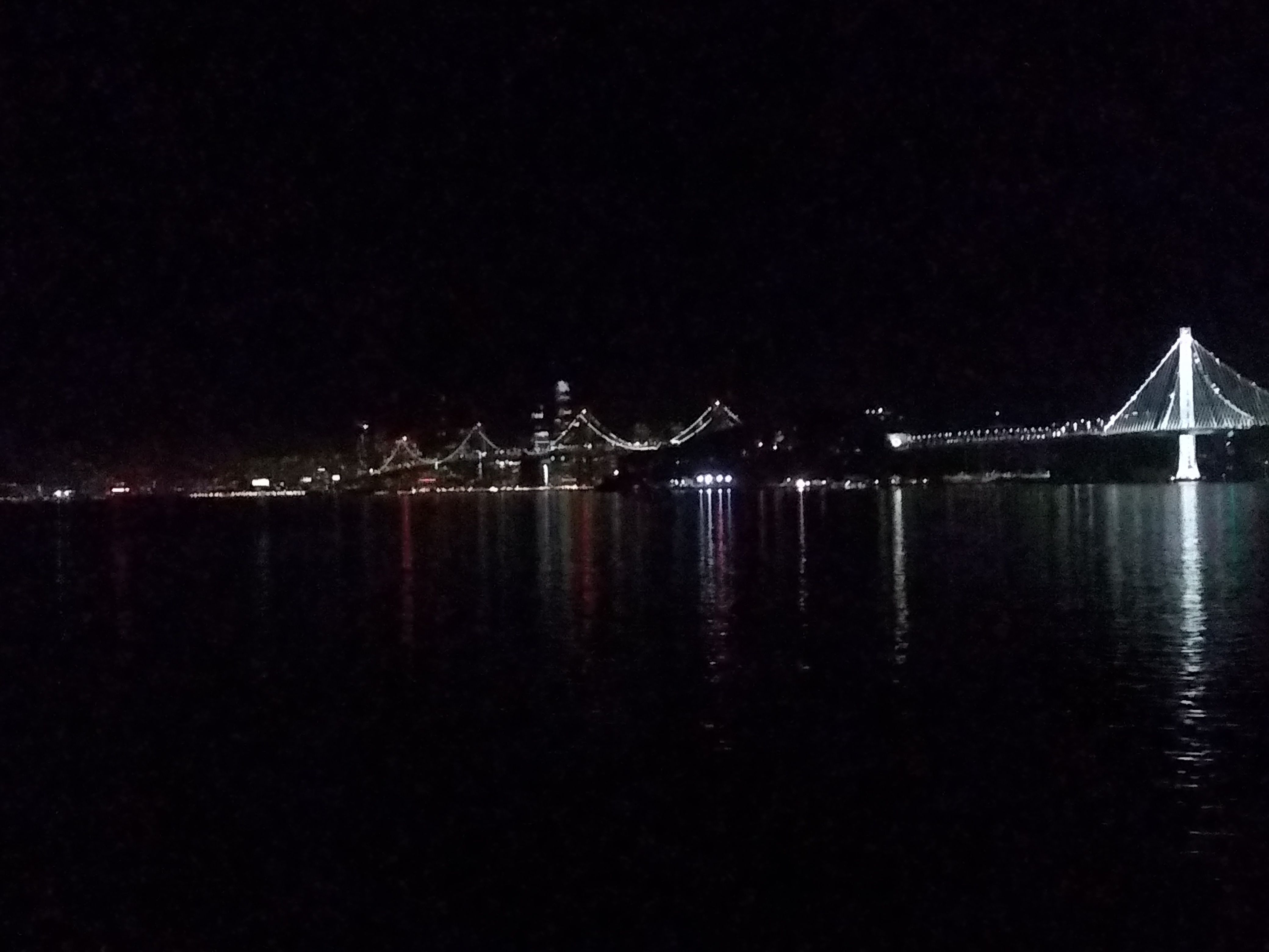
Arlington/Moeser. Lights of SF in the distance
The 2nd was on
4/29/21.
I biked up Centennial, and through Tilden to Inspiration Point.
I rode out Nimitz Rd. to the Nike missile base, then down one of the dirt roads,
up Rifle Range Trail (steep at the end - stop and push)
and back down Moeser.
21 miles, 2,500' vertical.
Three Bears
The Three Bears Loop starting in Orinda is a 19 mile loop
on paved roads, 1,700' vertical.
I did this a number of times in daylight:
6/22/20,
7/5/20.
On 8/1/20
I did it with a side trip to Pig Farm Hill.
On 8/8/2020
I did the first 4 miles (on the old road that meanders through
the reservoir park) and got a flat tire.
I hid the bike in the bushes, ran back to the car
(fortunately I bike in running shoes) and got the bike.
After that I carried a spare tube and tire irons.
On 8/27/20
I did it in 1:23, breaking my PR by 17 minutes
and averaging over 200W energy output for the only time.
Later, on 10/4/20,
I did it with Seth, only a minute slower.
On 1/8/21
I did it at night, just to see what it was like.
The main concern was safety, especially on San Pablo Dam Road.
But it was OK.
There were only maybe a half dozen cars total,
and I could hear/see them far in advance.
I kept way over on the shoulder,
and once I pulled completely off the road and waited for the car to pass.
Mount Diablo
21 miles, 3,240' vertical:
2 hours of uphill grind on a paved road, 20 minutes of high-speed descent.
I did it in daylight on
6/27/20.
I guess I could do it at night,
although the park is nominally closed then.
El Toyonal
On the east side of Tilden, in the hills above Orinda,
is a beautiful area of horse pasture and oaks.
Through this passes El Toyonal, a winding road, washed out at one point
and closed to car traffic.
It runs from Lomas Cantadas (which is extremely steep)
to Wildcat Canyon Rd.
I explored this on an evening ride on
9/23/20,
going down Lomas Cantadas.
It's incredible that there's such an idyllic area
just a mile or two from dense human infestation.
On
12/8/20
I did it the other direction - clockwise - which meant riding up Lomas Cantadas.
This is very steep and fairly long.
I did some zig-zagging.
Later, on 1/1/21,
I did more or less the same ride with Lucas, who's on the biking team at BHS;
he dusted me, as they say.
Oakland Hills
I did various rides into the Oakland hills, e.g. Montclair.
Generally I'd ride back through Lake Temescal.
On 11/20/20
I rode up Moraga and around the Mt. View Cemetery.
On 2/20/21
I rode around Lake Merritt, then up Park Ave. and back through Montclair Village
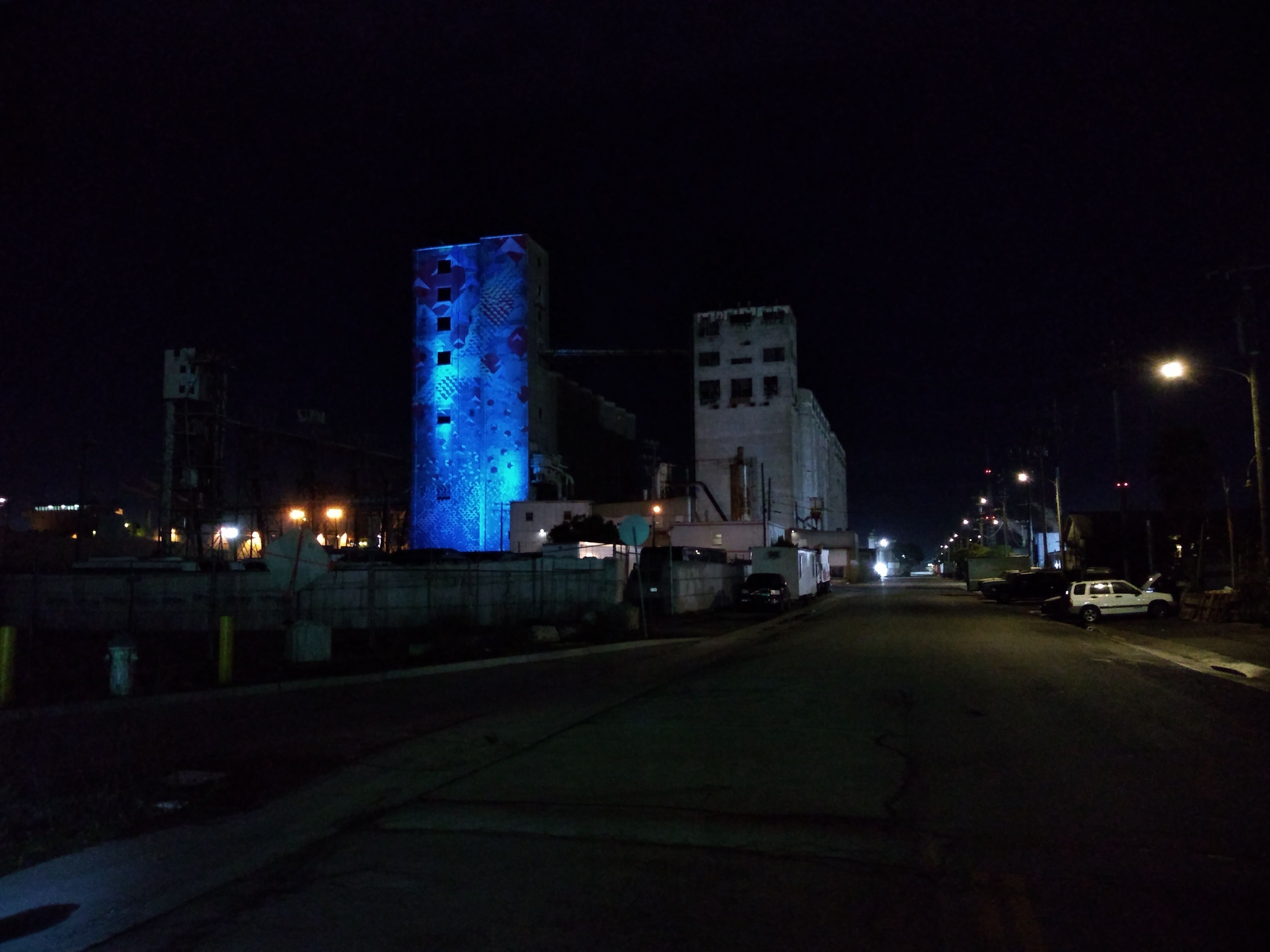
Mysterious silos in W Oakland
A bit of civil disobedience
On 2/22/21
I rode up Old Tunnel, across Skyline, and down Colton.
I did a similar ride on
4/1/21.
On 3/13/21
I did a big loop along Wood St (the poorest part of Oakland)
and then up Mandana and through Piedmont (the richest part).
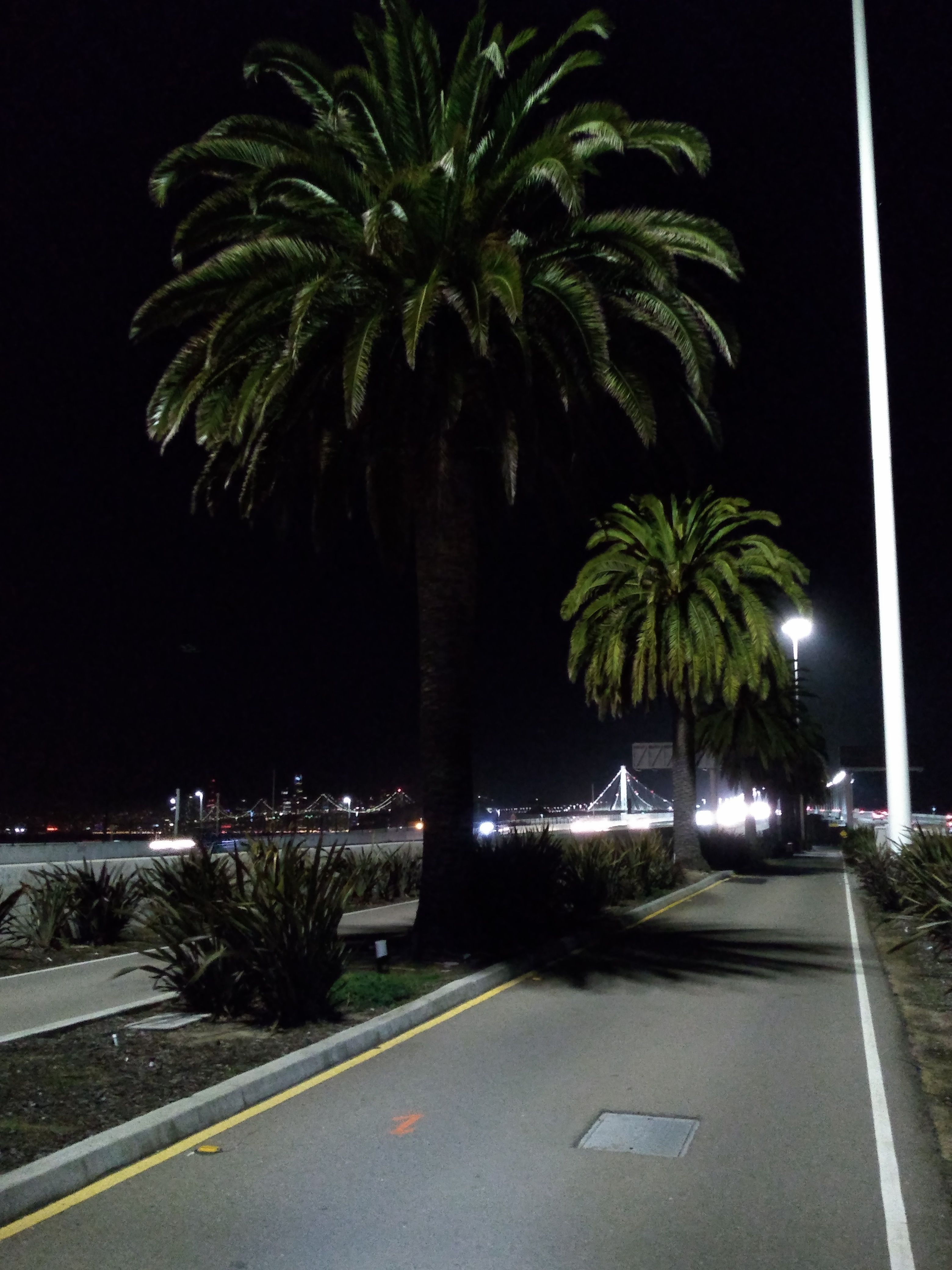
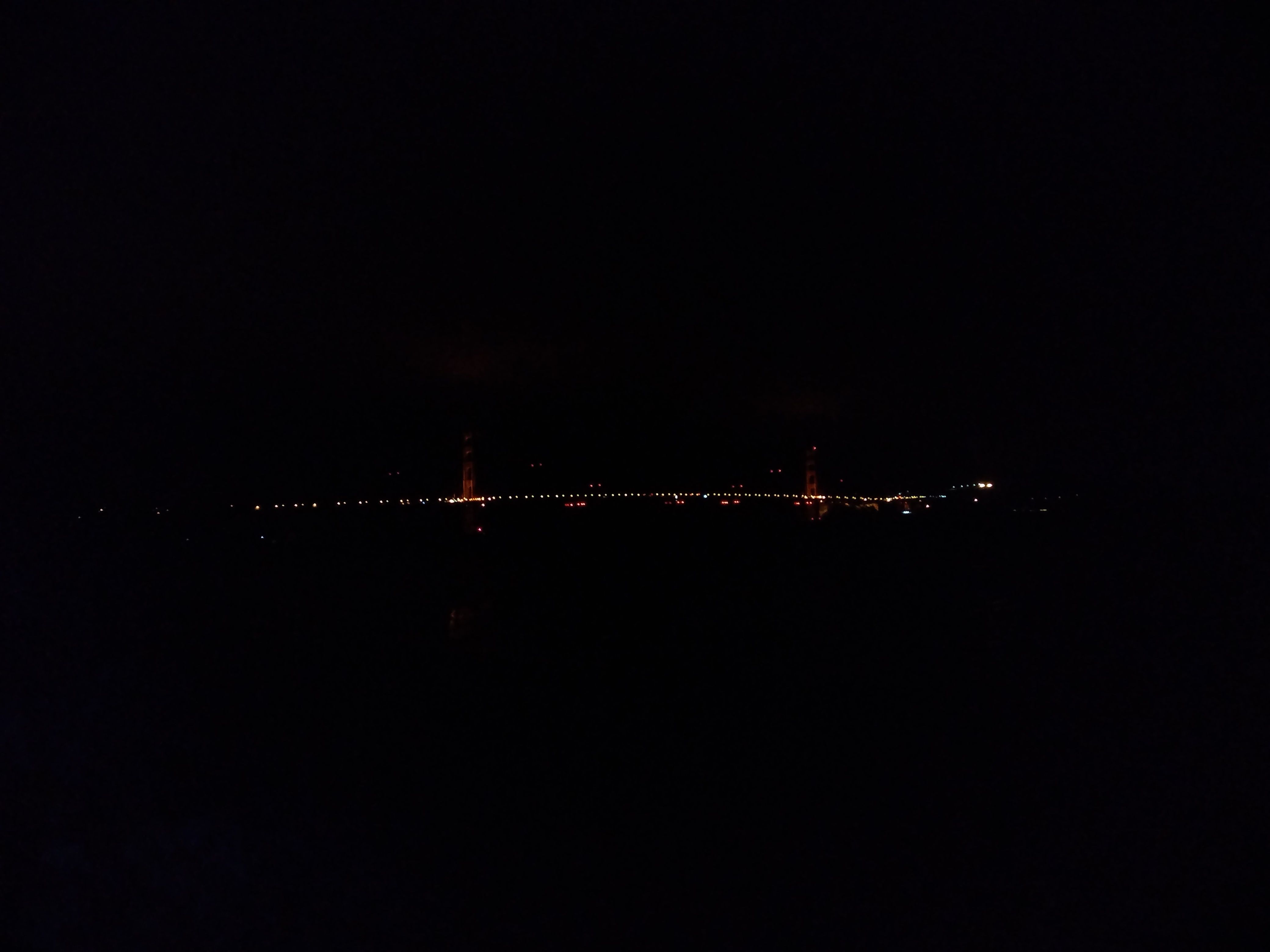
Along the Bay
I live close to the SF Bay.
There's a bike/foot path along much of the coast.
A typical ride:
Bayshore path
and Berkeley Marina, near my house.
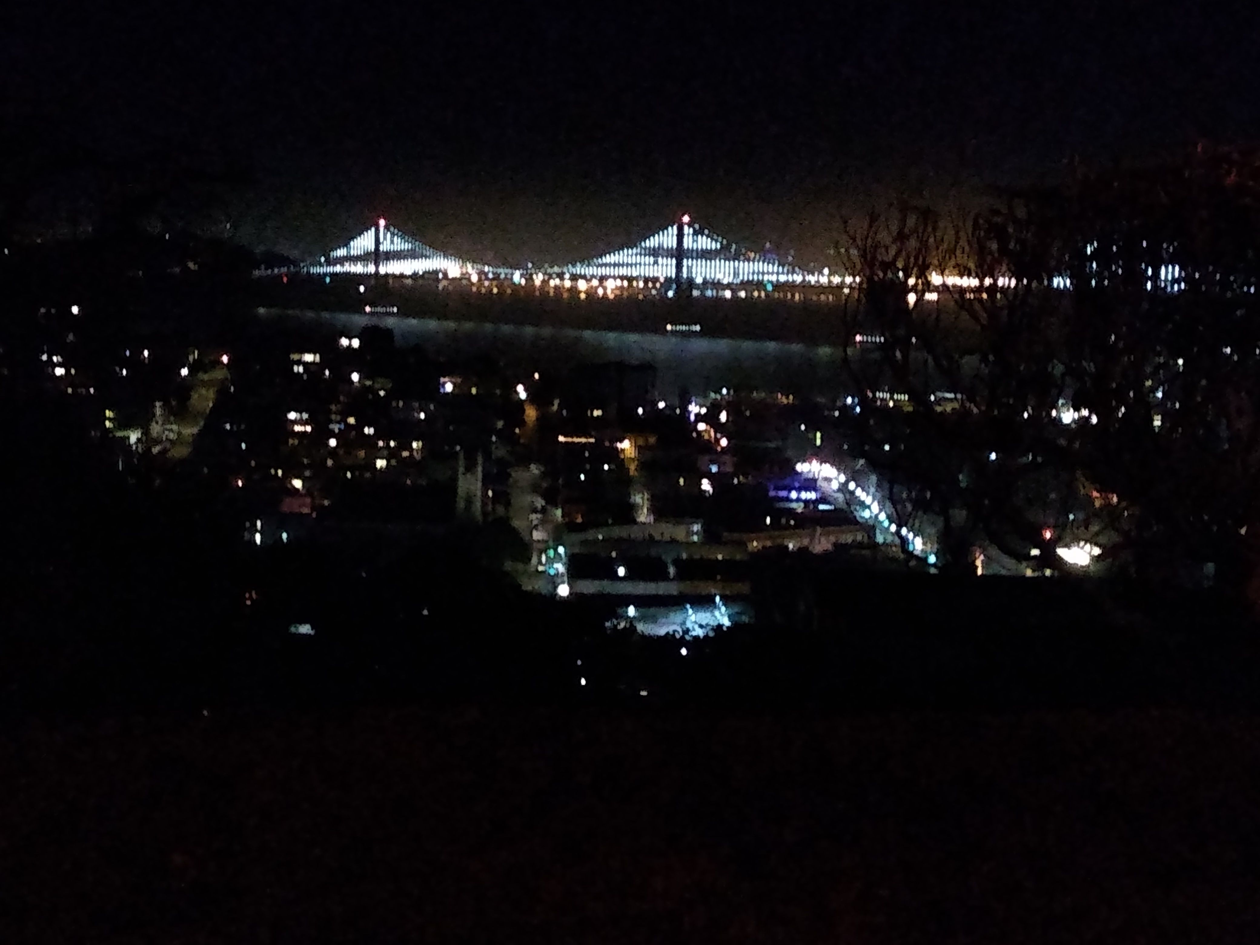
On 8/2/2020
I rode across the Bay Bridge (new span)
and around the perimeter of Treasure Island.
This, together with Yerba Buena Island,
is sadly being turned into a huge luxury condo development;
it should be a state park.
Somewhere in the middle of Treasure Island I looked across the bay,
to where my house was, miles away.
I felt small and vulnerable, and I marveled that I'd be able to
make it back home with only my legs and the little steel machine
of my bicycle.
On 9/15/20,
while doing a bay shore ride,
I had a visual thing where I saw flashing lights at the edge of my vision
when I moved my eyes quickly, or turned my head.
This has gradually subsided; I still need to get my eyes checked.
My only crash (so far) happened on the Bay Bridge path on
10/15/20.
A little kid on a bike cut in front of me;
I went flying and got bloody scrapes on my shin, hip, and elbow.
The kid, unfortunately, was OK.
I've avoided bike paths since then - too many idiots.
On 1/16/21
I road to the base of the Bay Bridge,
out the mini-pier built with a remnant of the old bridge,
then under the bridge and up a palm-lined road that goes
between the 2 halves of the freeway,
back toward the toll plaza.
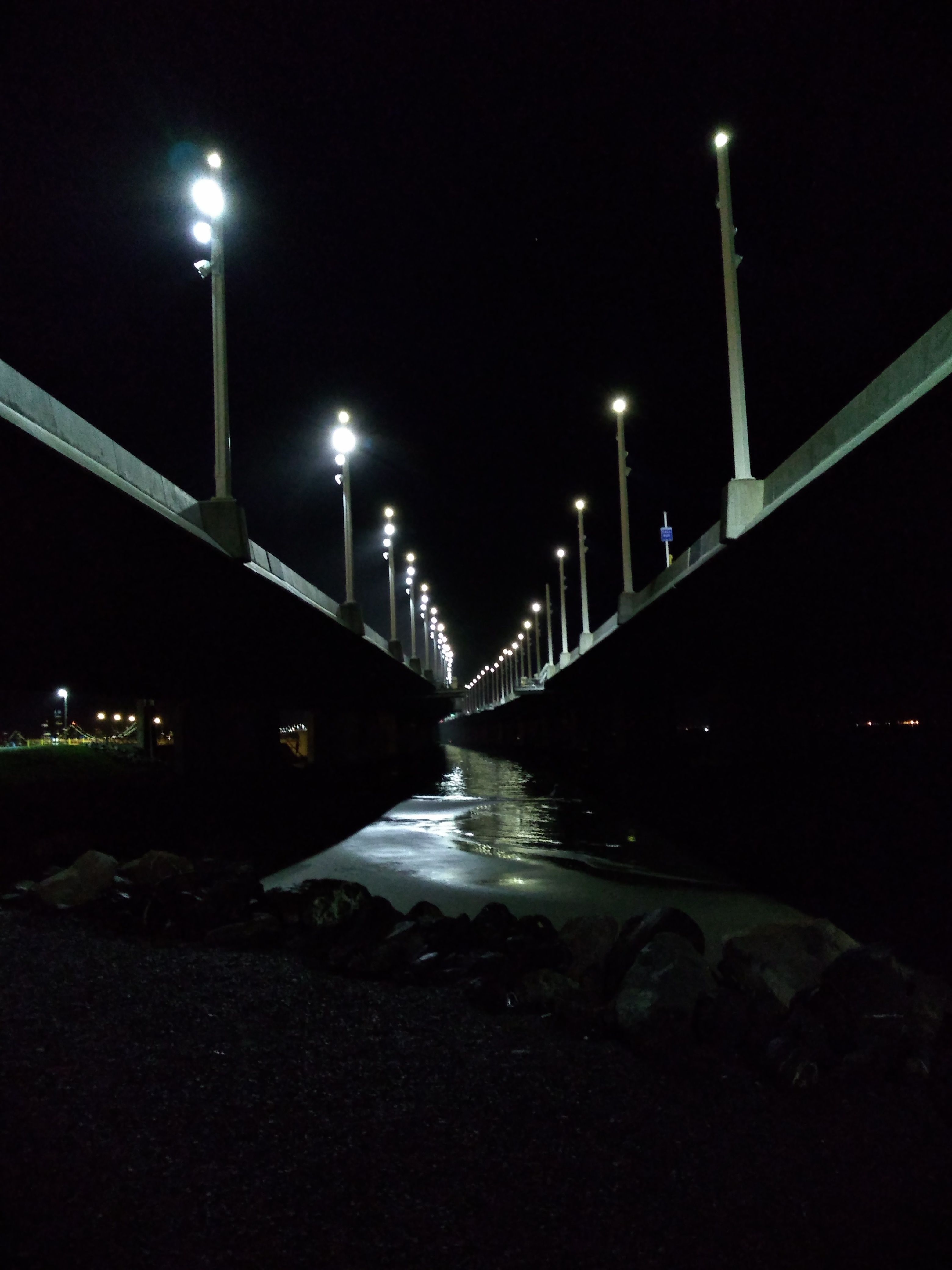
I-80 at the start of the Bay Bridge
Oakland
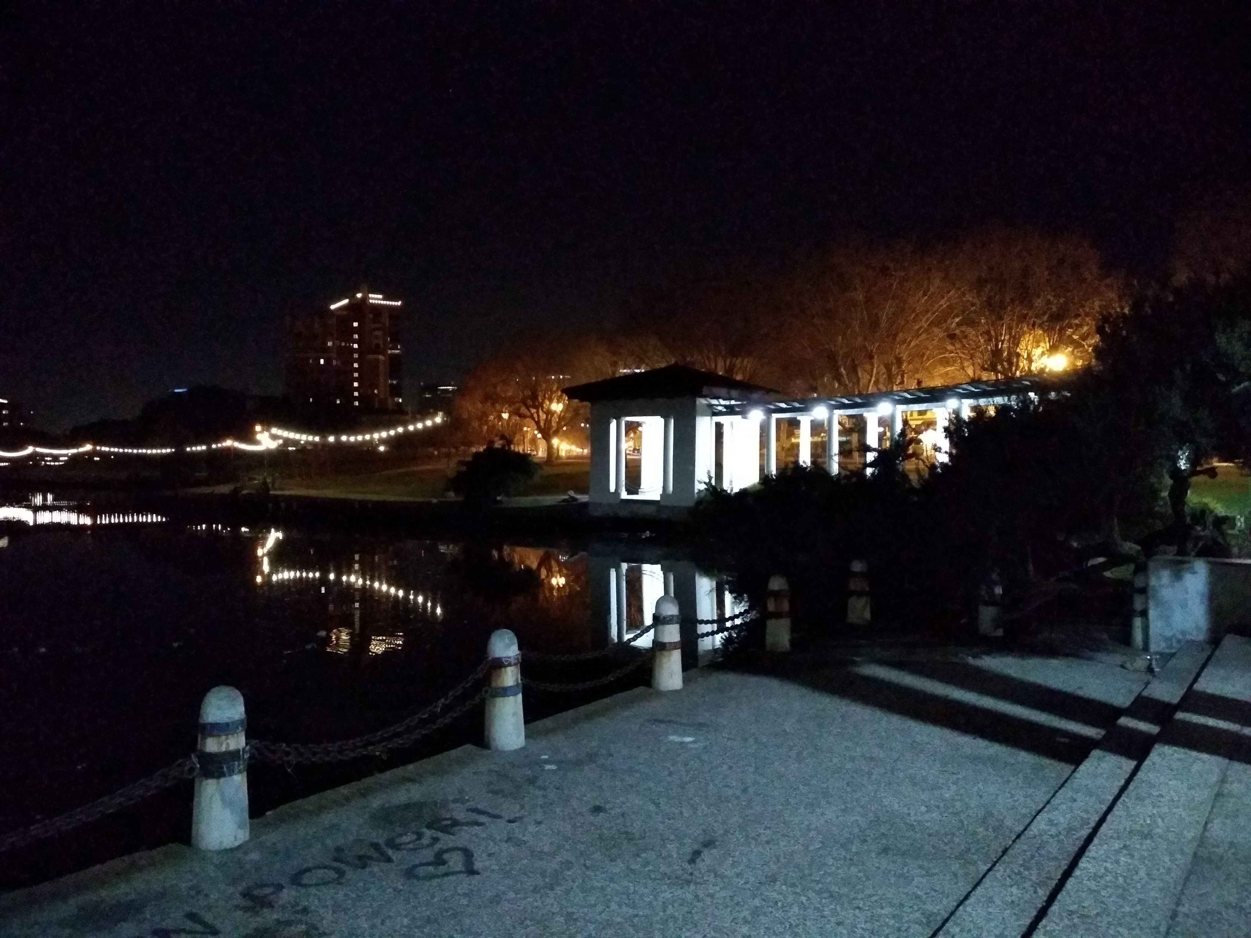
Lake Merritt
Lake Merritt is in the center of Oakland and is beautiful at night
because it's ringed by lights.
Arteries like Telegraph and Broadway go toward it,
but they have no bike lanes.
My first ride
(9/19/20)
was on San Pablo, which was a bit tense because of cars.
On the far side of the lake there was a big Low-Rider type event:
Lots of muscle cars (and a Ferrari) with people playing tunes,
standing around, drinking Coronas.
Where Lakeshore goes under 580 there was a big police barricade,
for no apparent reason other than keeping the partyers (mostly of color)
out of the white business district.
I discovered a good route:
ride through Emeryville to Mandela Parkway
(which I discovered on
9/26/20).
From there, cut over on 7th (disovered on
9/29/20
over earlier on Grand or 14th.
Typically I return via Grand and Pleasant Valley.
You can also go up Lakeshore and through the rich enclave of Piedmont.
International Blvd is a long N/S street in Oakland
that is heavily Central American in parts.
I became interested in riding there,
and in particular going S through Alameda,
then cutting across to International and going N.
The N end of Alameda is connected to Oakland by a pair of tunnels,
one in each direction.
One of these - the
Posey Tube - has a walkway.
It's not officially listed - e.g. Google Maps disavows any knowledge of it -
but some web research showed it's passable, although
it's so narrow that only 1 bike can pass at a time.
So of course I was intrigued.
I did one recon ride on
11/24/20
to locate the tunnel entrance (on Harrison St.).
The
next night
I went for it.
The walkway was indeed narrow - just a few inches of clearance
on either side of my handlebars.
It was noisy as hell inside the tunnel,
so it was a high-stress experience.
I came out in Alameda and rode down the length of it to Park St.
Then I rode over the drawbridge and navigated to International.
The first thing I noticed was 10 or 15 hookers on the sidewalks.
This as kind of jarring:
there used to be hookers along San Pablo in Berkeley,
but not for at least 20 years.
I kept riding.
I smelled smoke, and heard fire truck sirens.
One minute later, I was riding past a house that was
on fire and billowing smoke; I held my breath.
Fire trucks were pulling up; firemen jumped off and unrolled hoses;
I navigated around all this.
This ride was also notable because I had a low blood sugar episode
(weak/clammy feeling) around the tunnel,
and spent the rest of the ride looking for a soda or other source of sugar.
I didn't have a mask with me so I couldn't go into a convenience store.
I looked for a vending machine but these don't seem to exist anymore.
So I toughed it out.
When I got home I revived with a beer,
and did some major cooking (2 lasagnas).
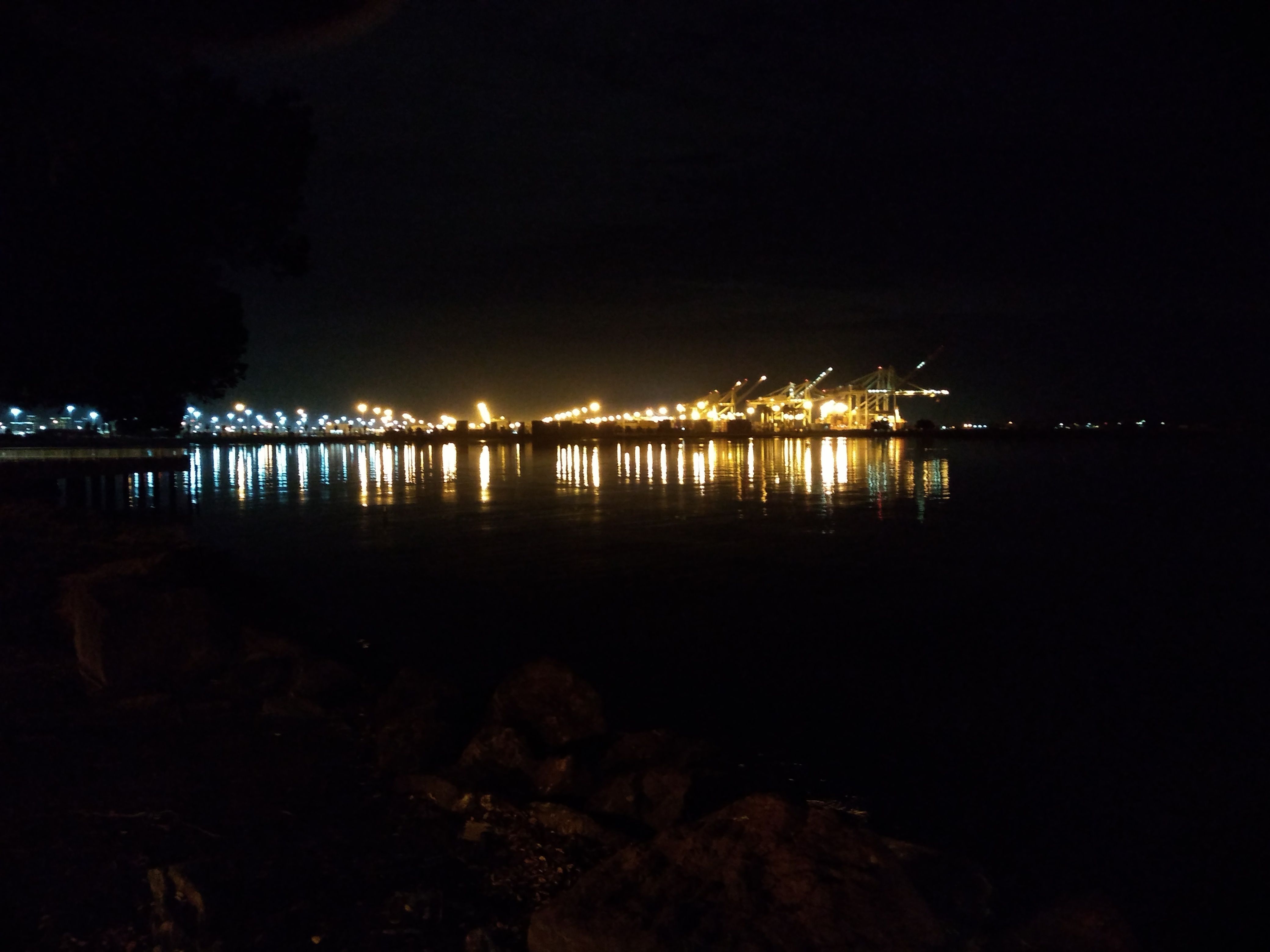
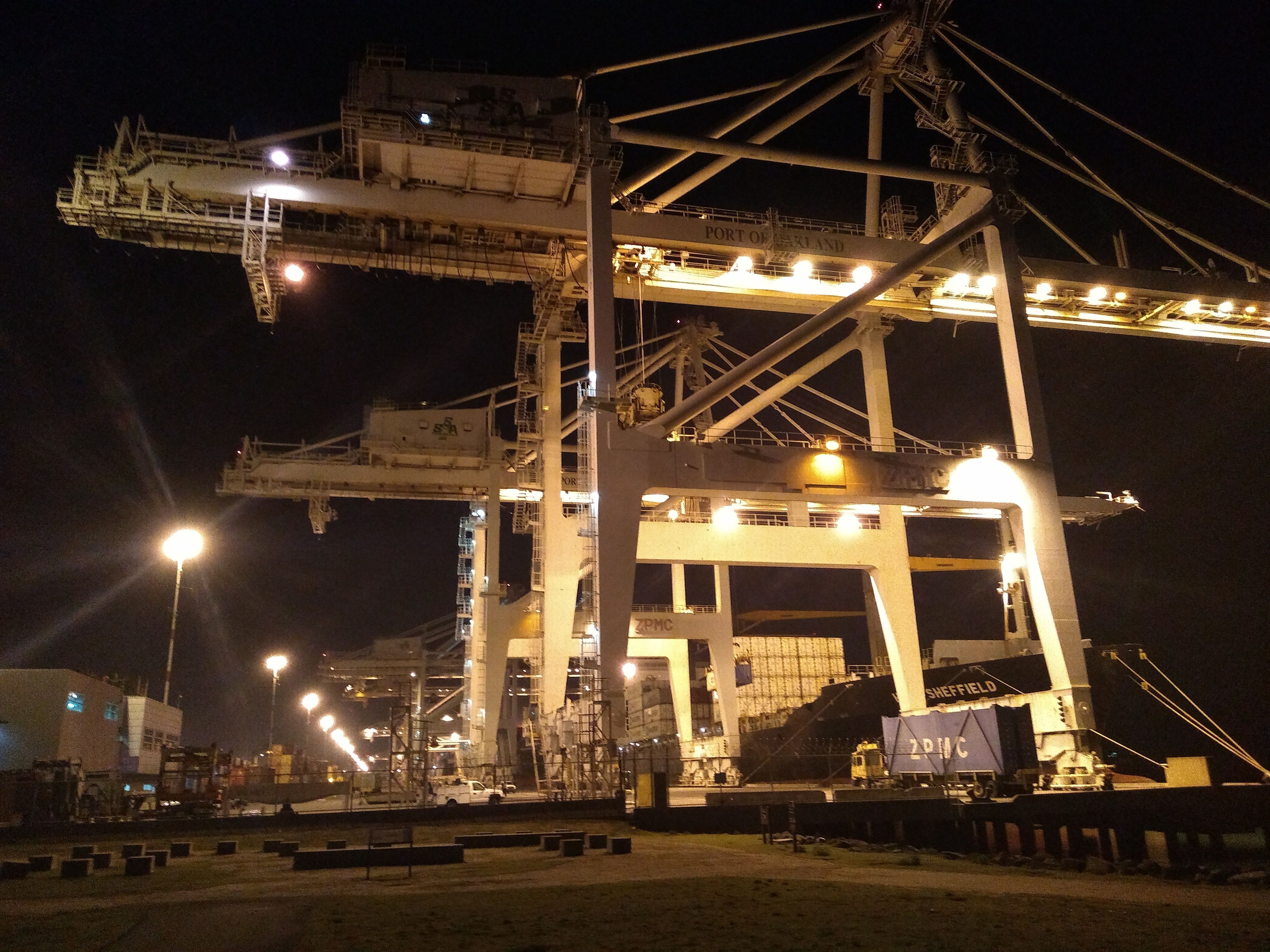
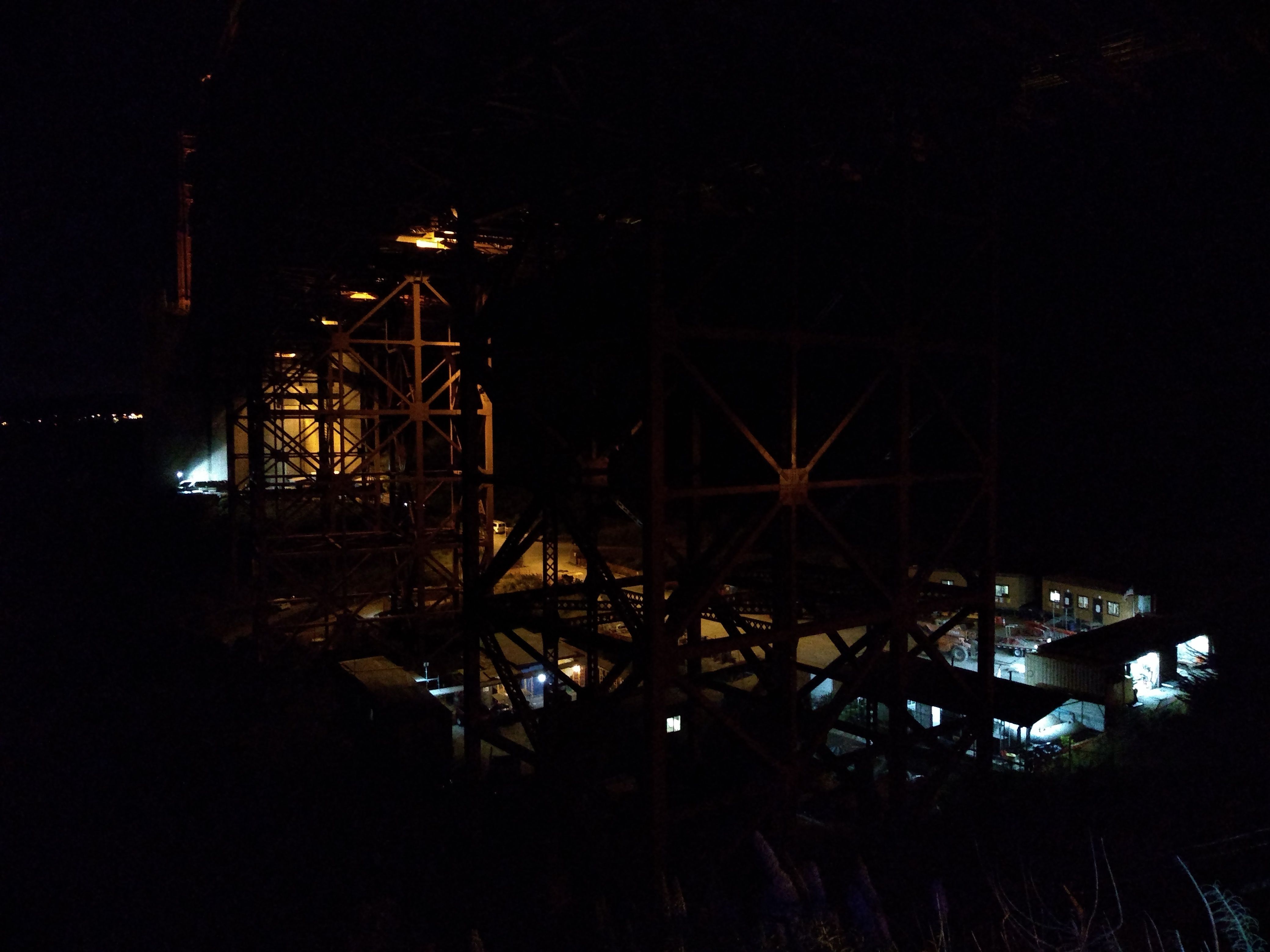
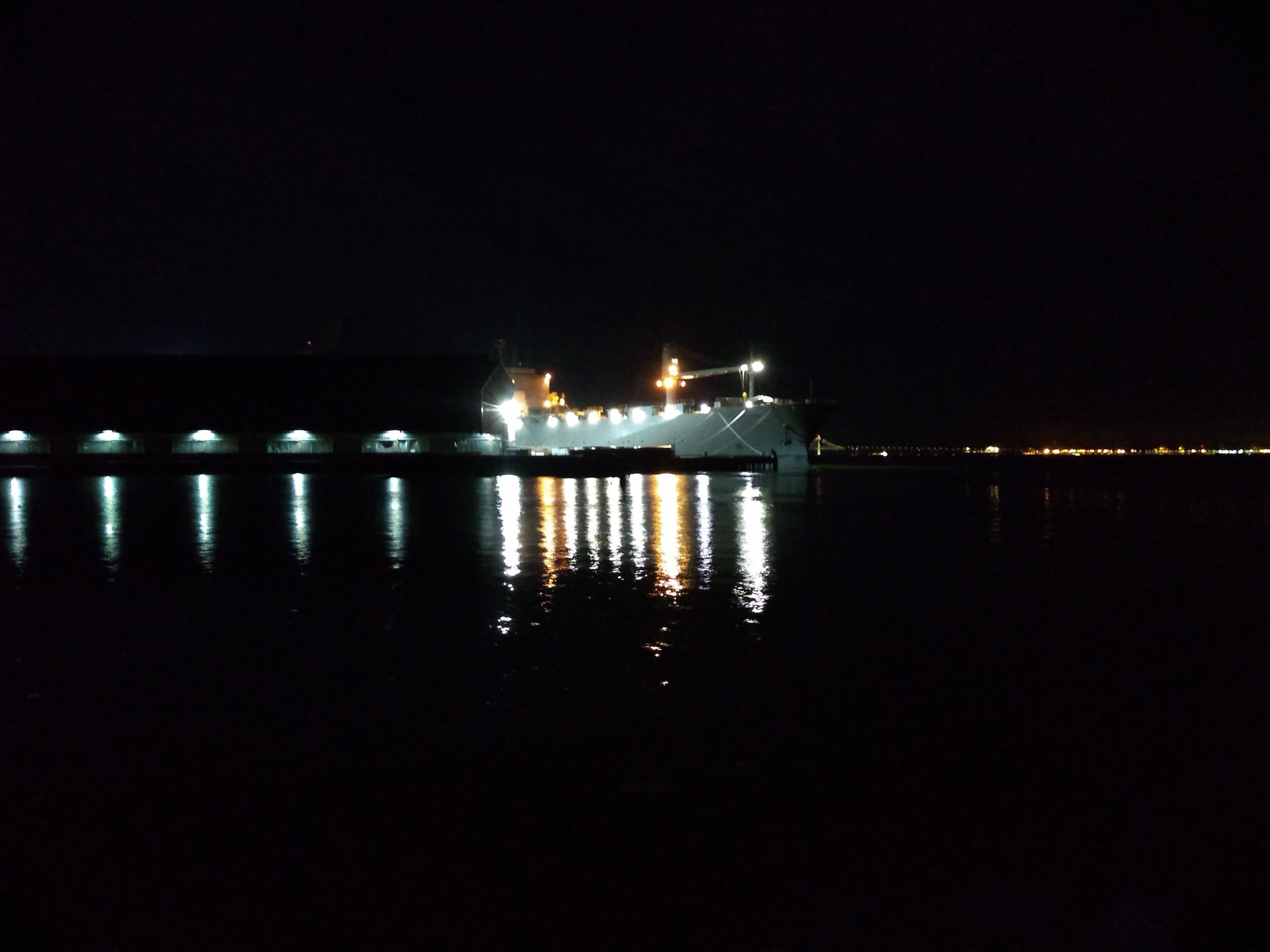
Port of Oakland
Oakland has a big
container shipping port
where huge cranes unload container ships.
The containers are transported by truck or rail to
Walmarts and Costcos all over the west.
On 12/21/20
I rode through it, and back on Adeline.
I also briefly explored
Middle Harbor Shoreline Park,
an odd park, on the bay, in the middle of the port.
I went back again on
1/29/21.
This time I explored the south end of the Shoreline Park,
at which point you're just on the other side of a fence from an
enormous container crane and an ever more enormous ship.
There's also a curious structure - the
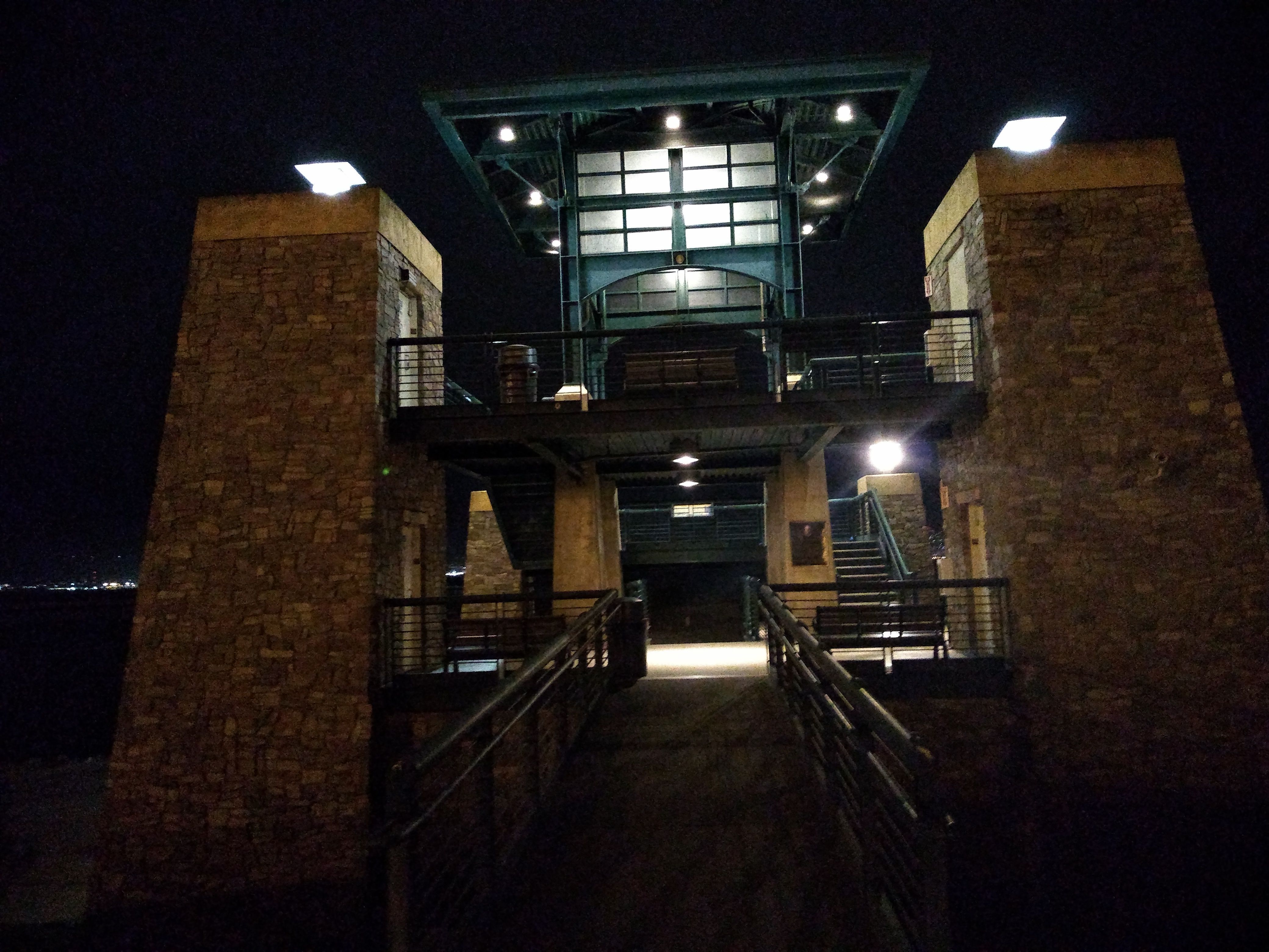
Chappell R. Hayes Memorial Observation Tower -
that looks like something out of Myst.
I went back again on
2/2/21,
this time with my phone to take some pictures.
But a security guard in a pickup truck chased after me
with his spotlight, and told me the park was closed and I had to leave.
I did, but later considered white lies like saying I just wanted
to take some pictures for my sick mother, etc.
Of course a security guard wasn't going to stop me for long.
On 2/8/21
I returned and avoided the security guard -
actually I don't think he was even there.
I got my pictures.
The Chappell R. Hayes Memorial Observation Tower
Wood St.
On 1/10/21,
having ridden through West Oakland on Mandela Parkway a number of times,
I looked at the map to see what else was around there,
and I noticed Wood St., a block or two to the west,
To get there, you go behind the Emeryville Target.
There's a stretch of 8 blocks or so where
RVs and campers are parked along the street
and in the vacant lots to the west of it.
Everything is ringed with junk and trash,
which seems to serve as a protective buffer.
Fires burn here and there.
Gutted and burned-out cars are scattered about.
Continuing south, one passes the 16st St. Train Station,
an large impressive classical structure,
unused for decades but somehow still there.
I'd love to explore it but it's surrounded by major barbed wire.
Then - just like that - the street is lined with
brand-new condos and late-model SUVs.
My first ride down Wood St. left me stunned.
Of course the East Bay has homeless encampments,
but they move around;
Wood St. seems more permanent, like a Brazilian Favela.
I guess the Oakland police have decided that Wood St.
is a place regular people never see,
so it's OK to let a permanent colony develop there.
UPDATE (6/21): the police seem to be removing some of the encampments.
It's easy for me to imagine twists of fate that would have led
to me living in a camper on Wood St.,
so I feel a connection to the people there.
I wish I knew more about them,
how they ended up there, and what they aspire to.
Someone (me?) should make a documentary about them.
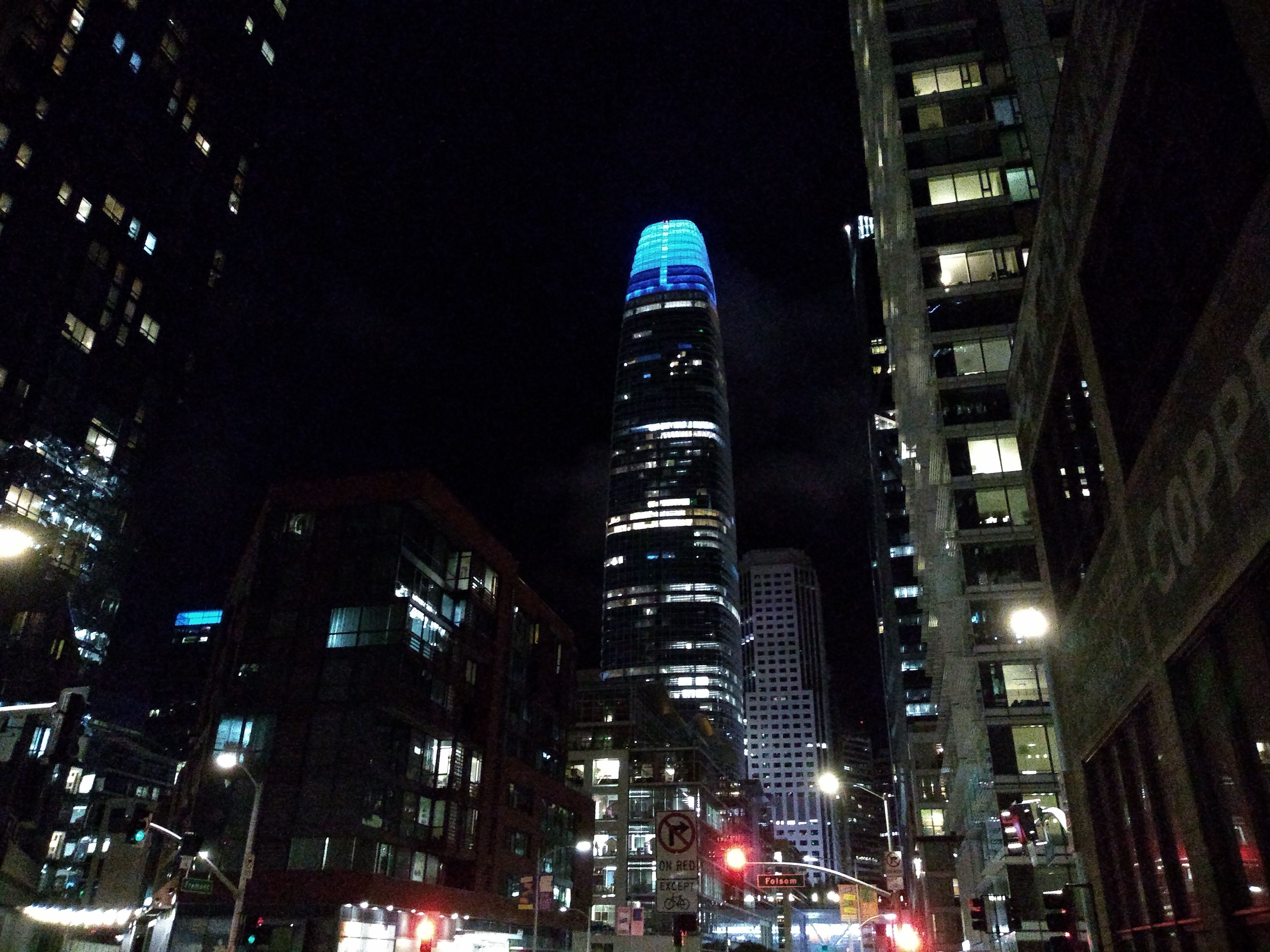
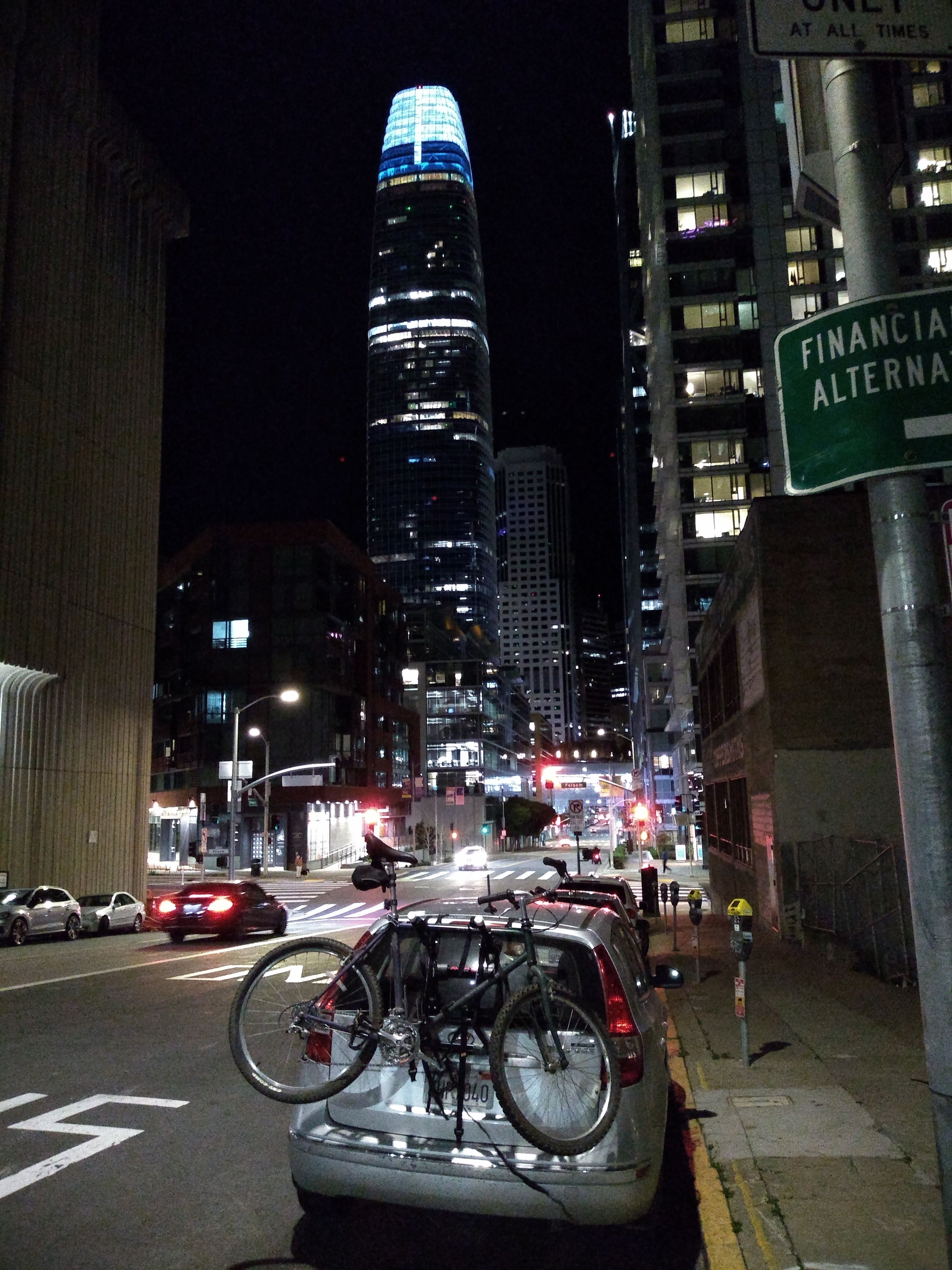
San Francisco
In October I expanded my horizons by riding in San Francisco.
I'd put my bike on the bike rack, drive across the bridge,
and park near the base of the bridge,
usually around Harrison and Main.
Ocean Beach
The first order of business was to ride across the city to Ocean Beach.
I did this on 10/10/20,
by an ambitious route that took me through Fisherman's Wharf
and the Presidio, then out to the beach on Clement,
and back via Golden Gate Park.
As I approached the ocean there was a heavy fog that
turned to mist and then to rain, so I got soaked.
But that was fine - remember, adventure is the goal of these rides.
This became my go-to ride and I've dont it many times since then.
On 11/28/20
I did it the other direction (clockwise),
going up the fairly steep 17th St.
On 12/26/20
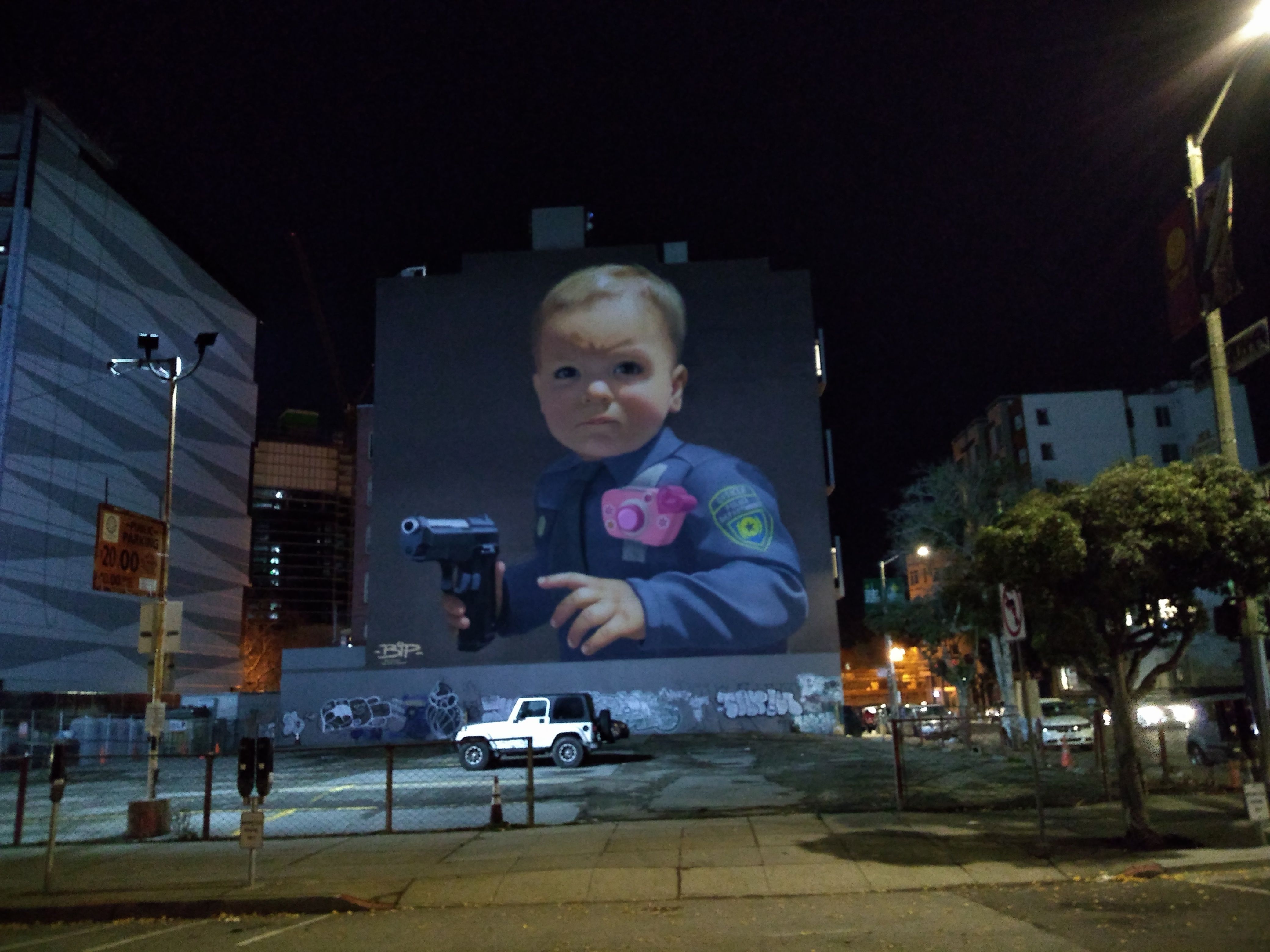
I explored the southern part of SF, going out Market, Portola, and Sloat.
I planned to go to the beach but ended up going up Sunset.
I stopped to take a picture of the disturbing mural across from the Conservatory.
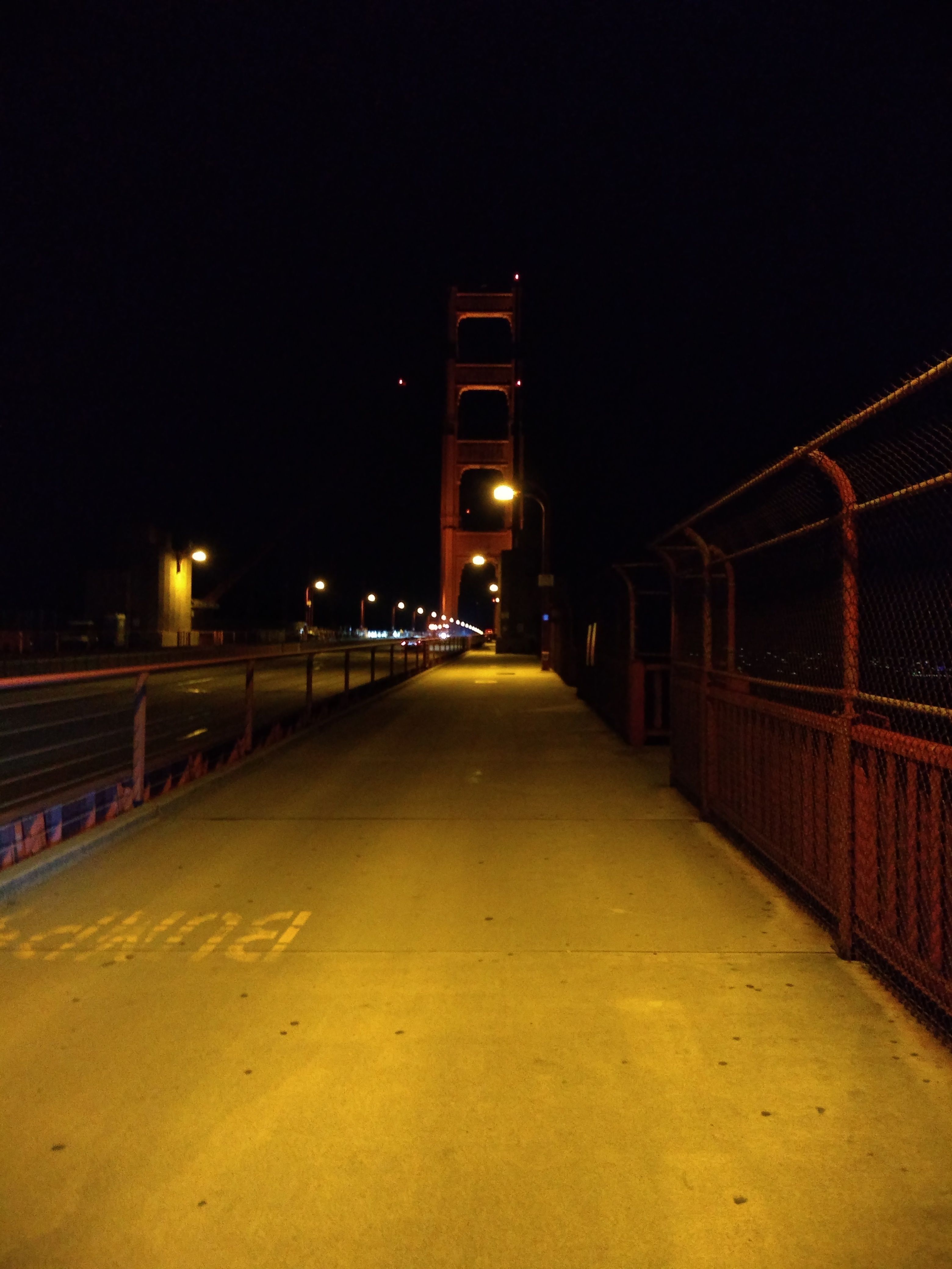
Golden Gate Bridge
The bridge - though closed to pedestrians after dusk -
is open to bikes 24/7;
I guess there are some Marin County bike commuters that raised
a fuss about this.
On 12/17/20
I rode out past Crissy Field to the bridge.
They buzz you in an electric gate.
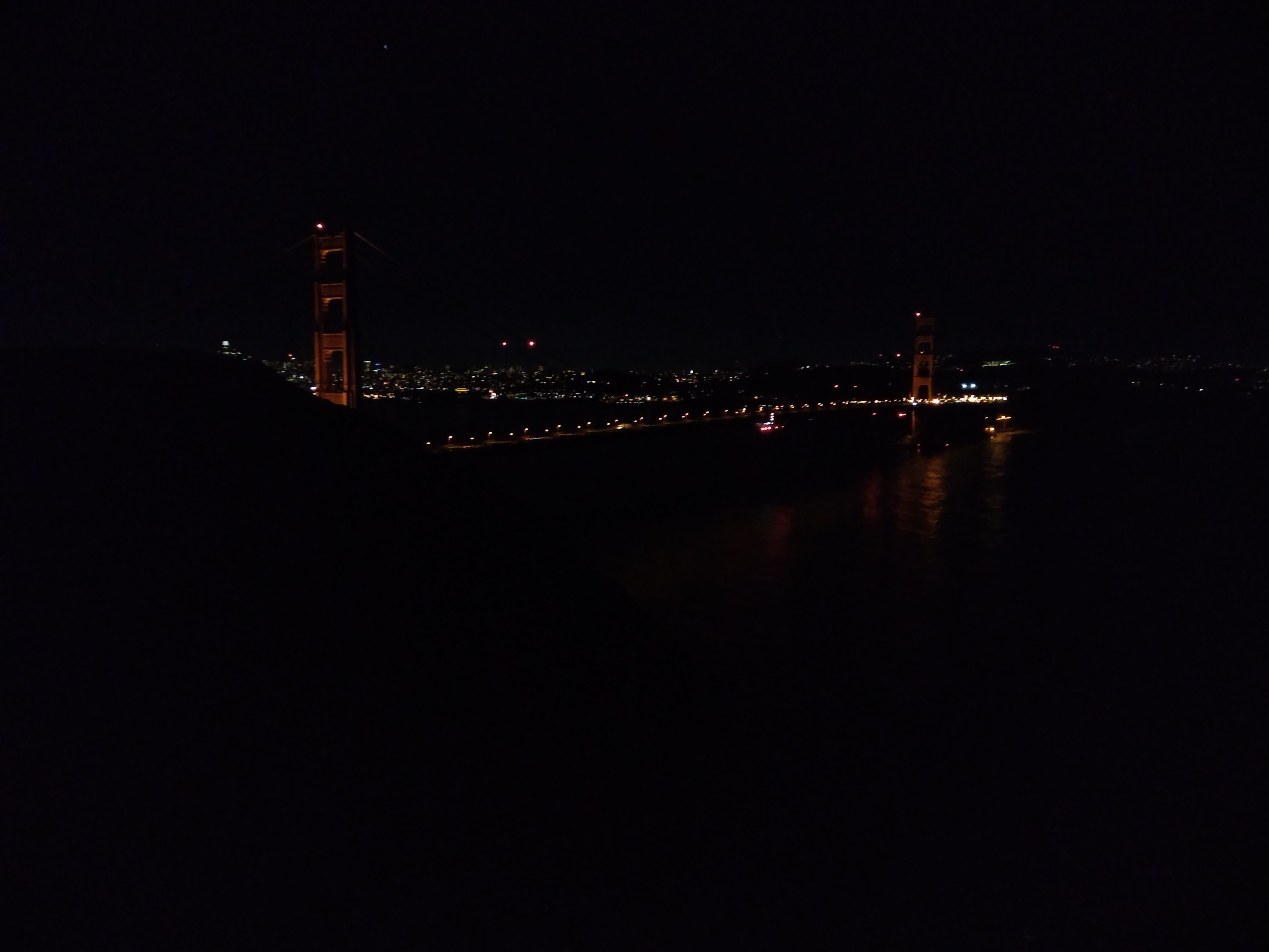
On the far side, I rode up to the Marin Headlands view point,
then down the far side and back through the tunnel on Bunker Rd.
Then to top things I off I rode back through the Presidio
and the Palace of Fine Arts, both of which were illuminated and spectacular.
SF from the Marin Headlands overlook
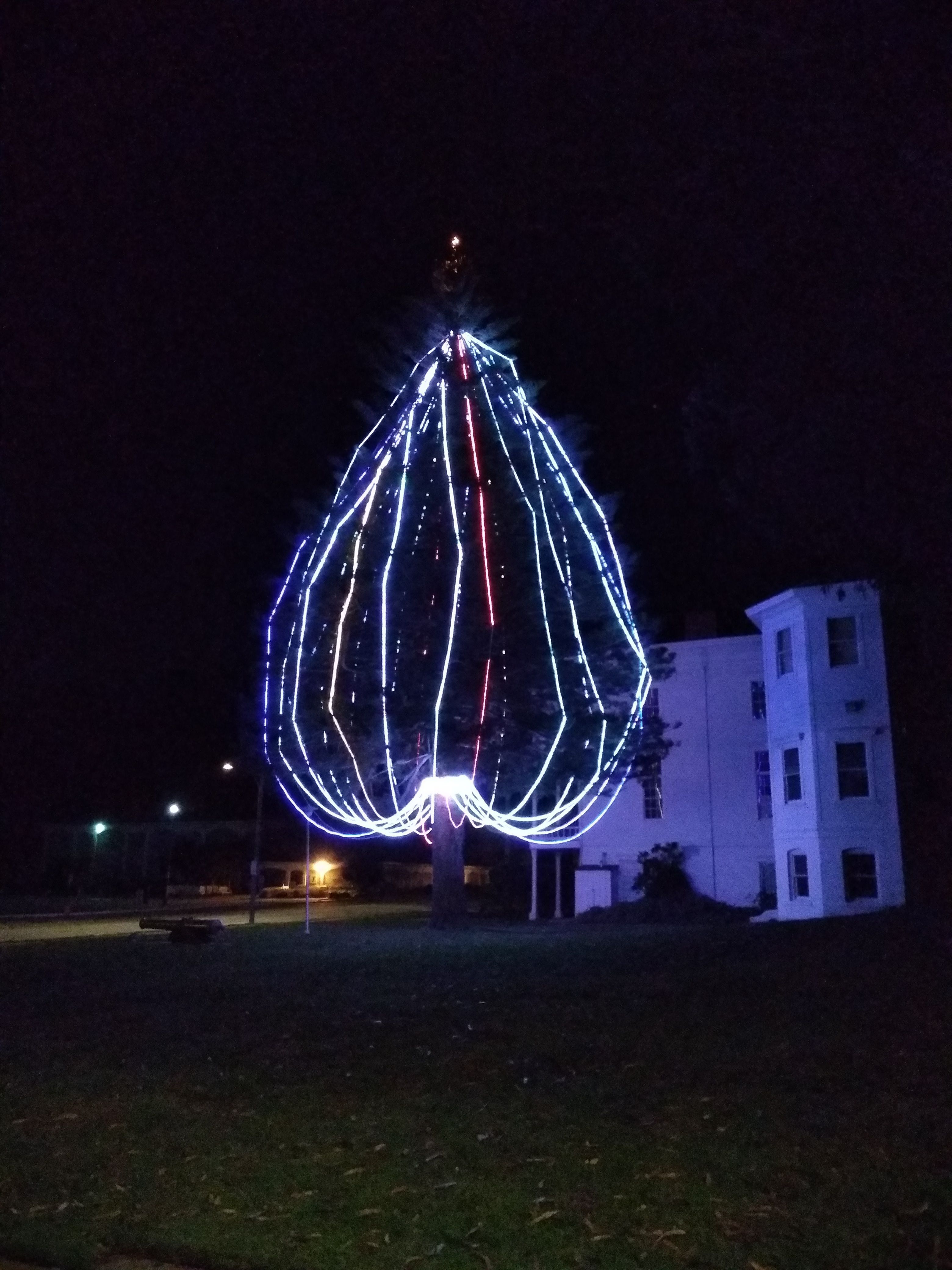
Xmas tree in the Presidio
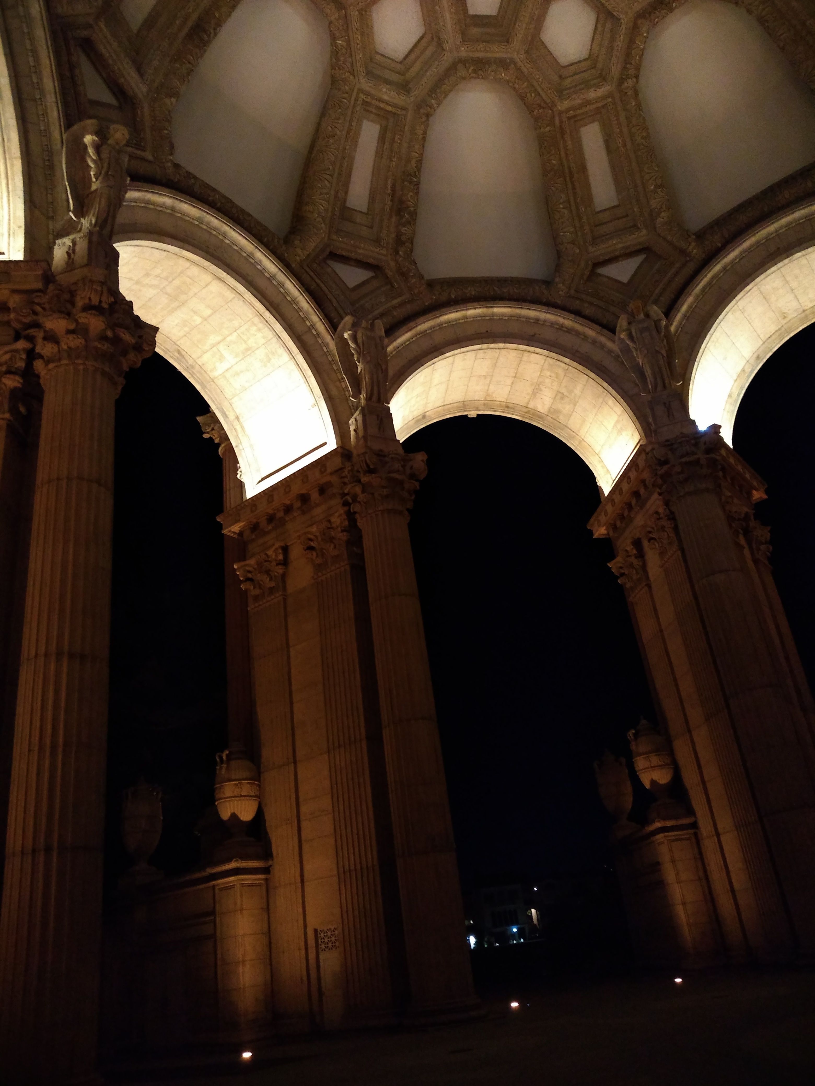
The Palace of Fine Arts
This was one of my favorite rides.
I felt like the whole city was a display case of attractions,
and I was the only viewer.
On 3/22/21
I went back, with the goal of riding down to the base of
the bridge on the Marin side and getting a dramatic photo.
I went down a groovy dirt road just past the parking lot,
and it afforded an amazing view of the trestle holding up the bridge,
but there was a security gate keeping me from going all the way down.
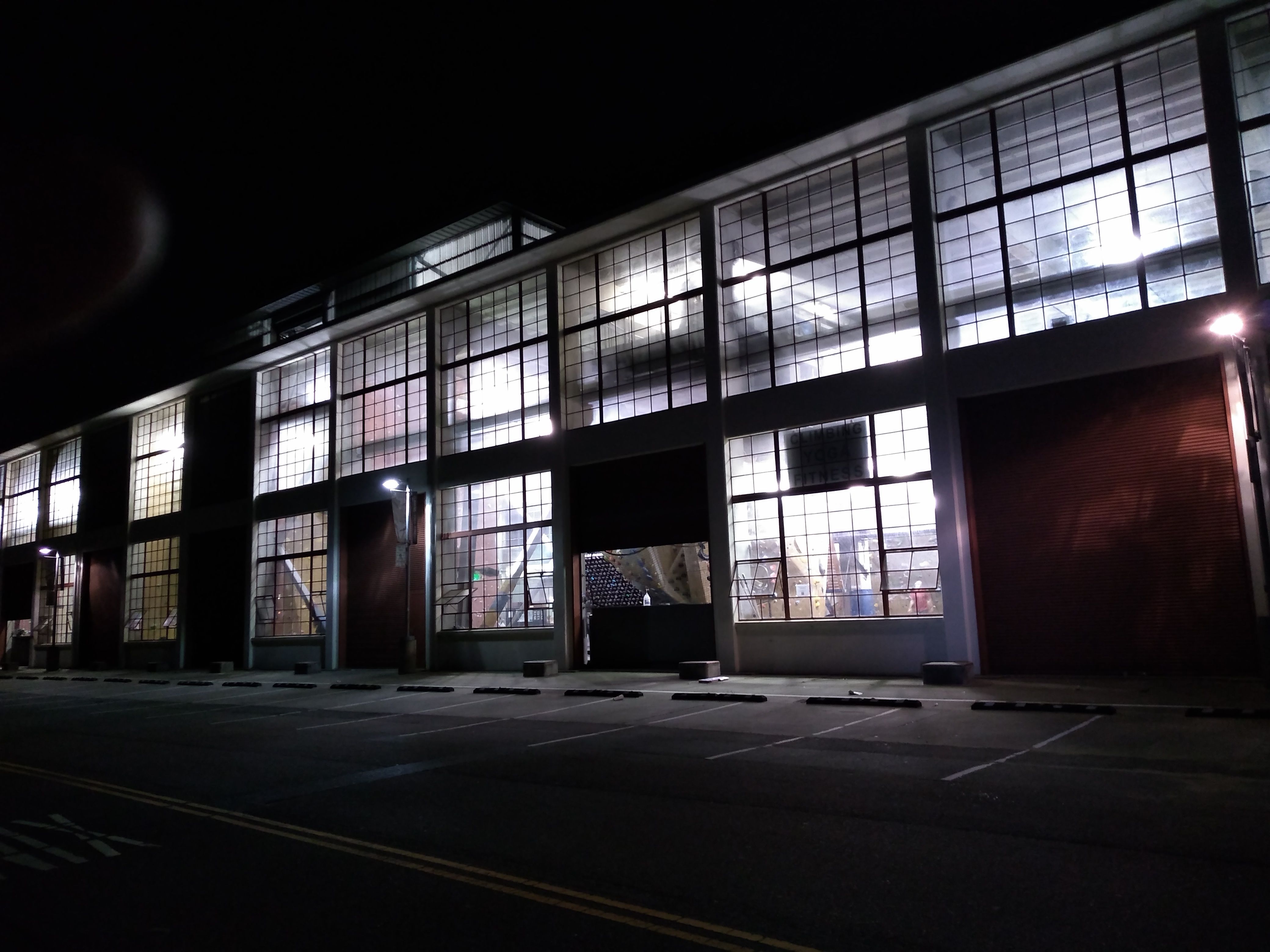
Planet Granite, a climbing gym at Crissy Field near the GG bridge
Trestles under the N end of GG bridge
Same pic, edited
I was headed back on
4/5/21
but got a flat tire at Crissy Field.
Fortunately I was able to repair it using my spare tube.
It was getting late so I decided to turn around.
The very next day,
4/6/21,
I went back and crossed the bridge.
I looped around past the Discovery Museum.
This indeed leads to a road along the water
that goes to the base of the bridge,
but it was closed off by another serious security gate.
I guess they're worried about terrorists.
I rode through the construction yard area and back across the bridge.
The Seven Hills of San Francisco
SF is known for hills, and I became interested in doing
a ride that would visit the tops of the well-known ones.
It turns out that seven hills had been given names when SF was incorporated.
Four of them are near downtown (Rincon, Nob, Russian, Telegraph)
and the other three are farther west
(Mt. Davidson, Twin Peaks, Mt. Sutro).
My first try at a Seven Hills ride was on
1/4/21.
I ran into trouble on Mt. Davidson.
Google Maps had me going up what turned out to be a hiking trail.
It had rained recently and the trail was muddy.
I tried riding but it was too slippery and steep.
I got off and pushed for a bit.
Then I left the bike by the trail and continued on foot,
but turned around before the top.
Mt. Sutro also involved paths, so I skipped it, and did the other 5.
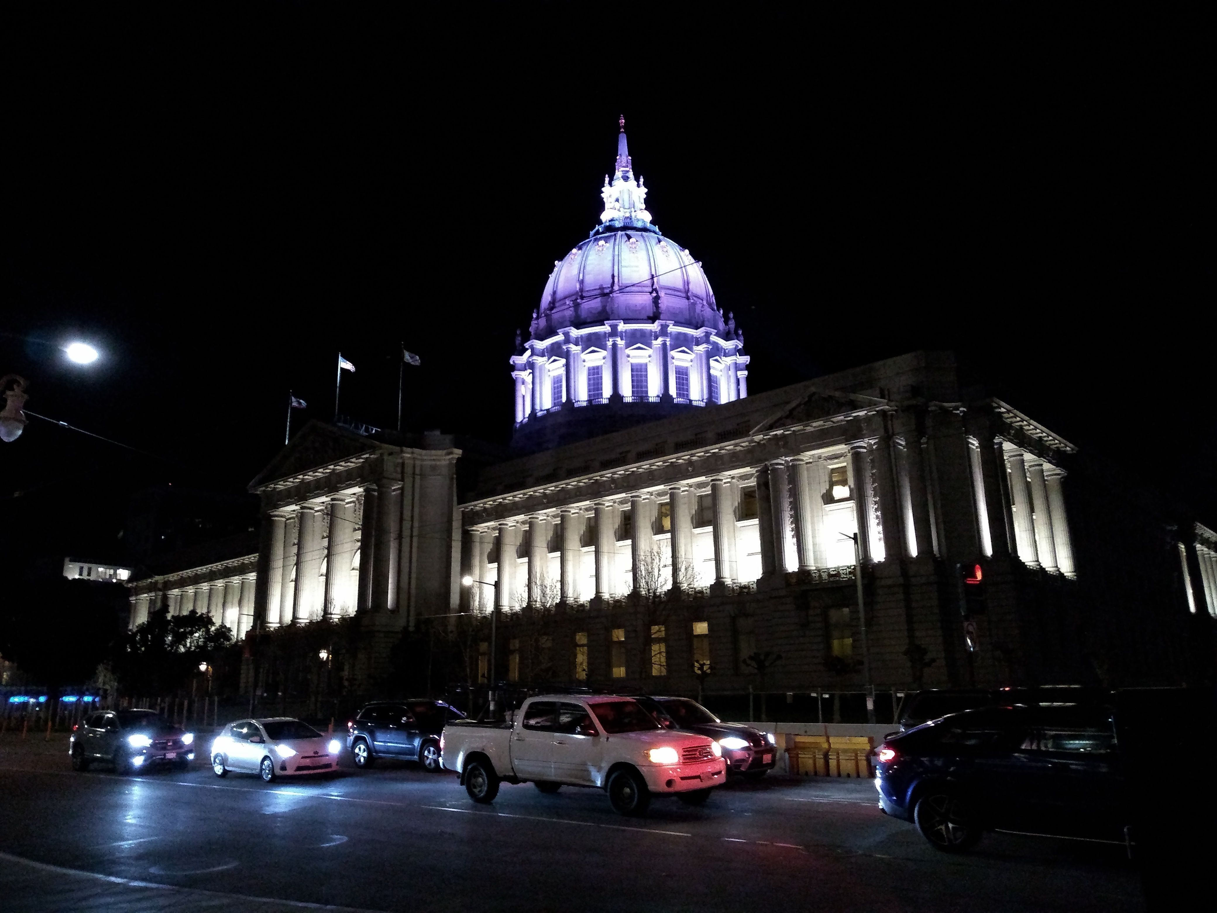
SF City Hall, with homeless sleeping on sidewalk
The Bay Bridge from Telegraph Hill
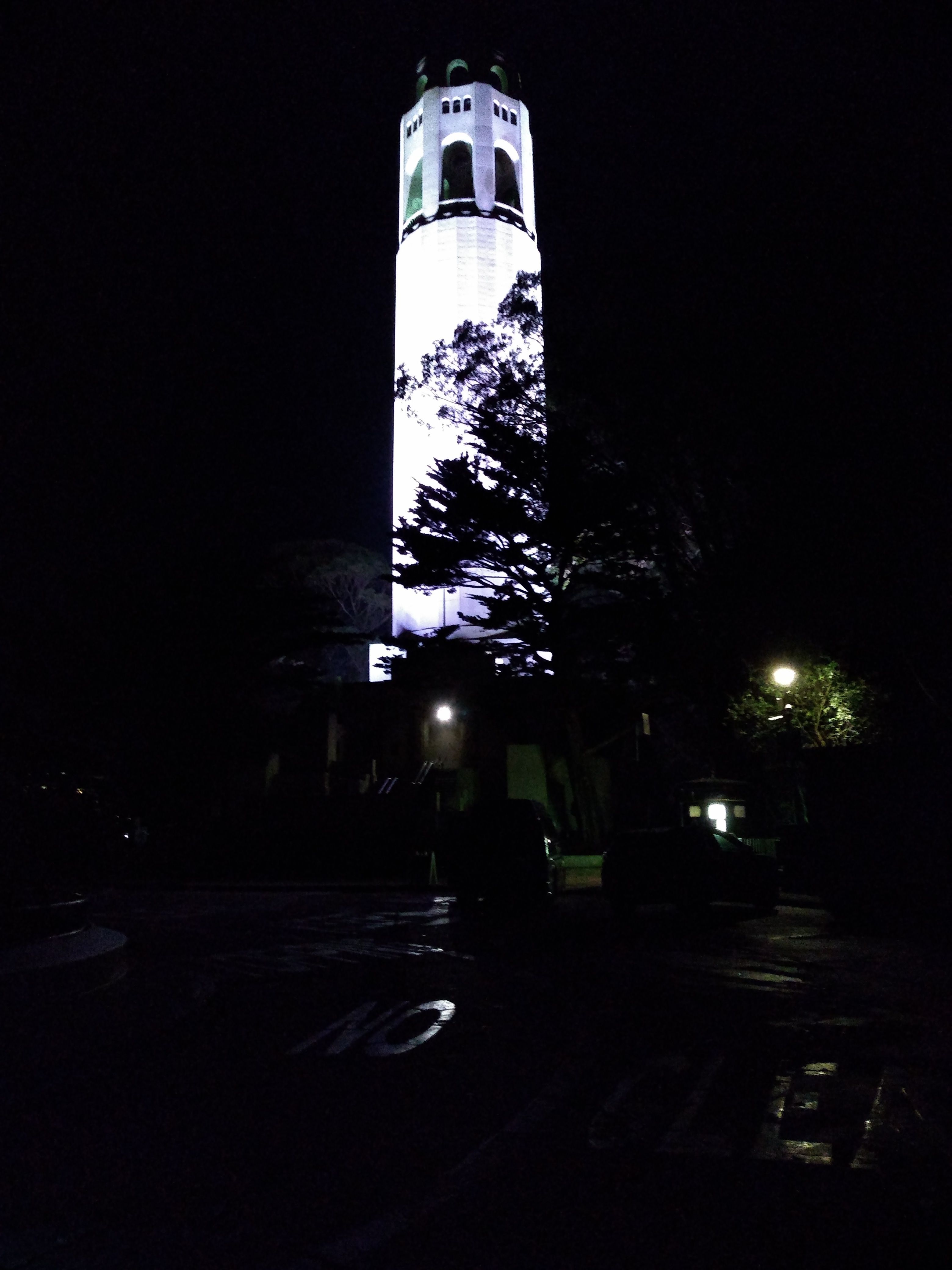
Coit Tower
I knew there must be a way to bike to the top of Mt. Davidson.
Satellite photos on Google Maps showed what
looked like a direct dirt road.
I went back on
2/10/21
and tried this.
But it was actually an impossibly steep trail.
I left my bike at the bottom,
hiked up, and did some business on the giant cross at the top.
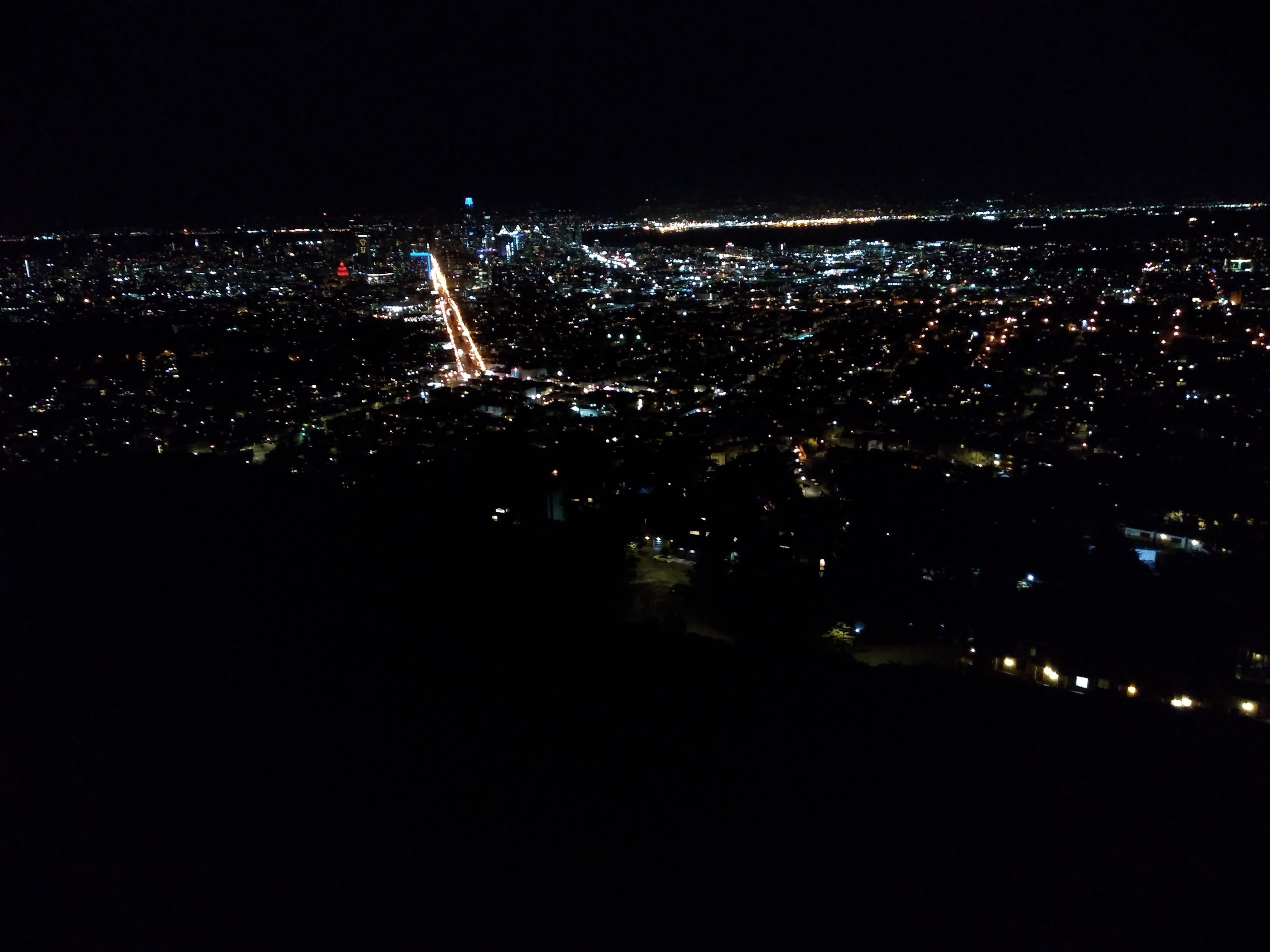
The Salesforce tower in SF
View from Mt. Davidson. You can see the Salesforce tower
I rode back through Bernal Heights.
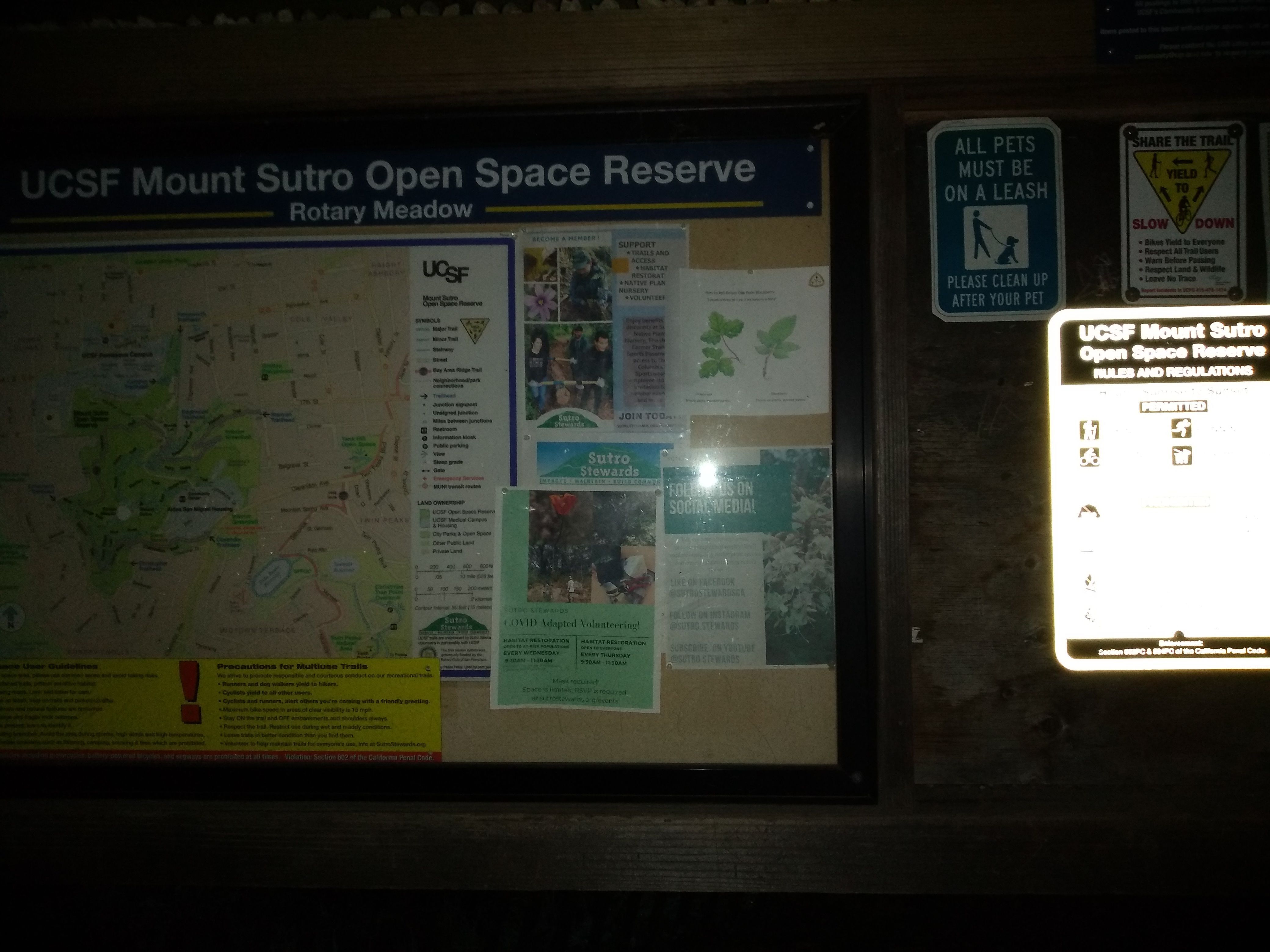
I wanted to make sure Mt. Sutro wouldn't pose similar difficulties,
so on 2/15/21
I did a recon ride there.
Nike Rd. is paved and goes to the top
(there was once a Nike missile radar installation there).
I came down East Ridge Trail, then down Medical Rd. behind UCSF.
I could use some Regeneration Medicine
Finally I located a map that showed how to bike to the top.
On
2/24/212/24/21
I went back, but made a navigational error and ended up on
yet another unrideable hiking trail!
What a maroon!
My car and bike!
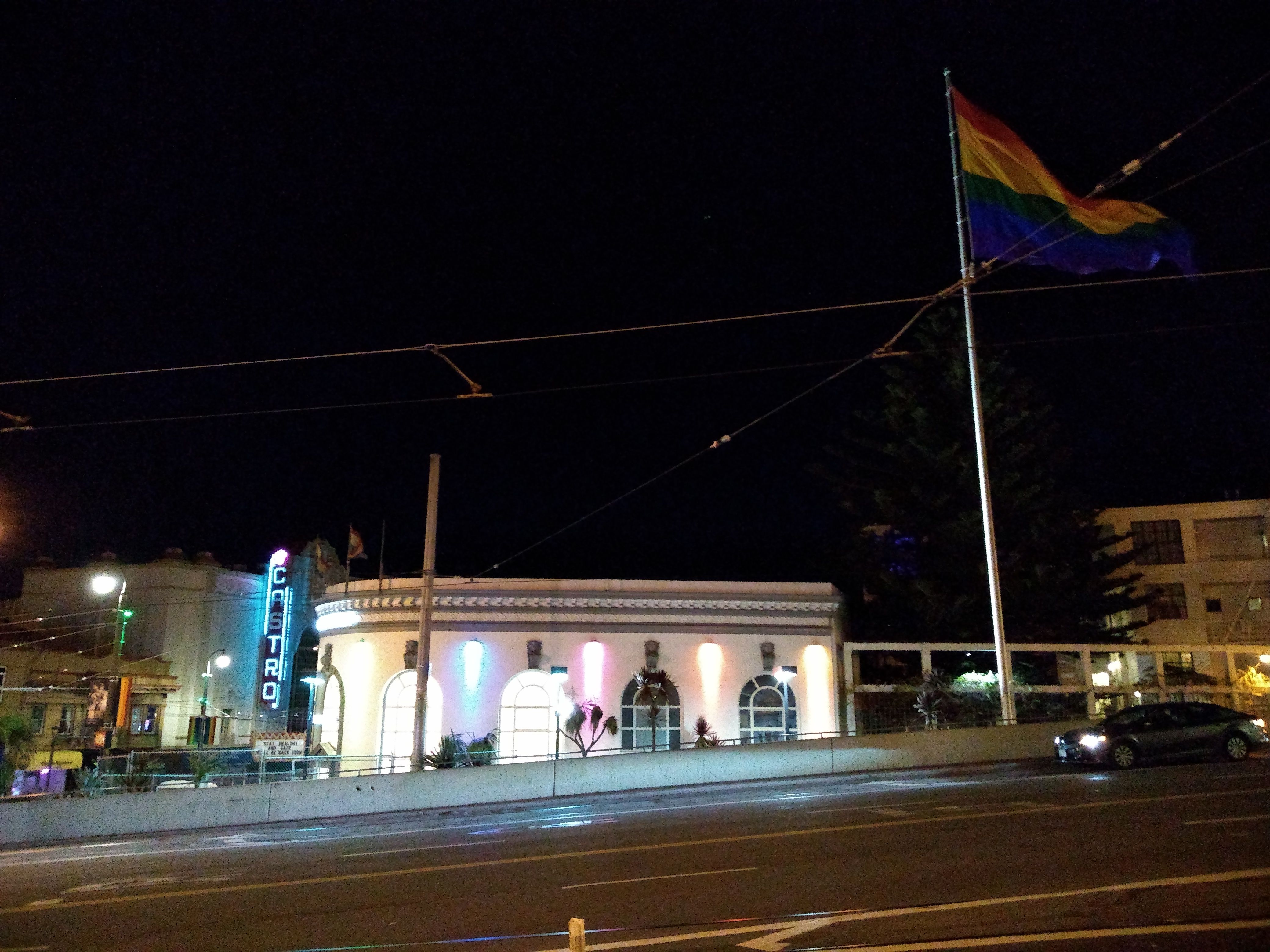
The Castro Theater from Market St.
A few days later, on
2/4/21,
I returned and FINALLY made it all the way to the top.
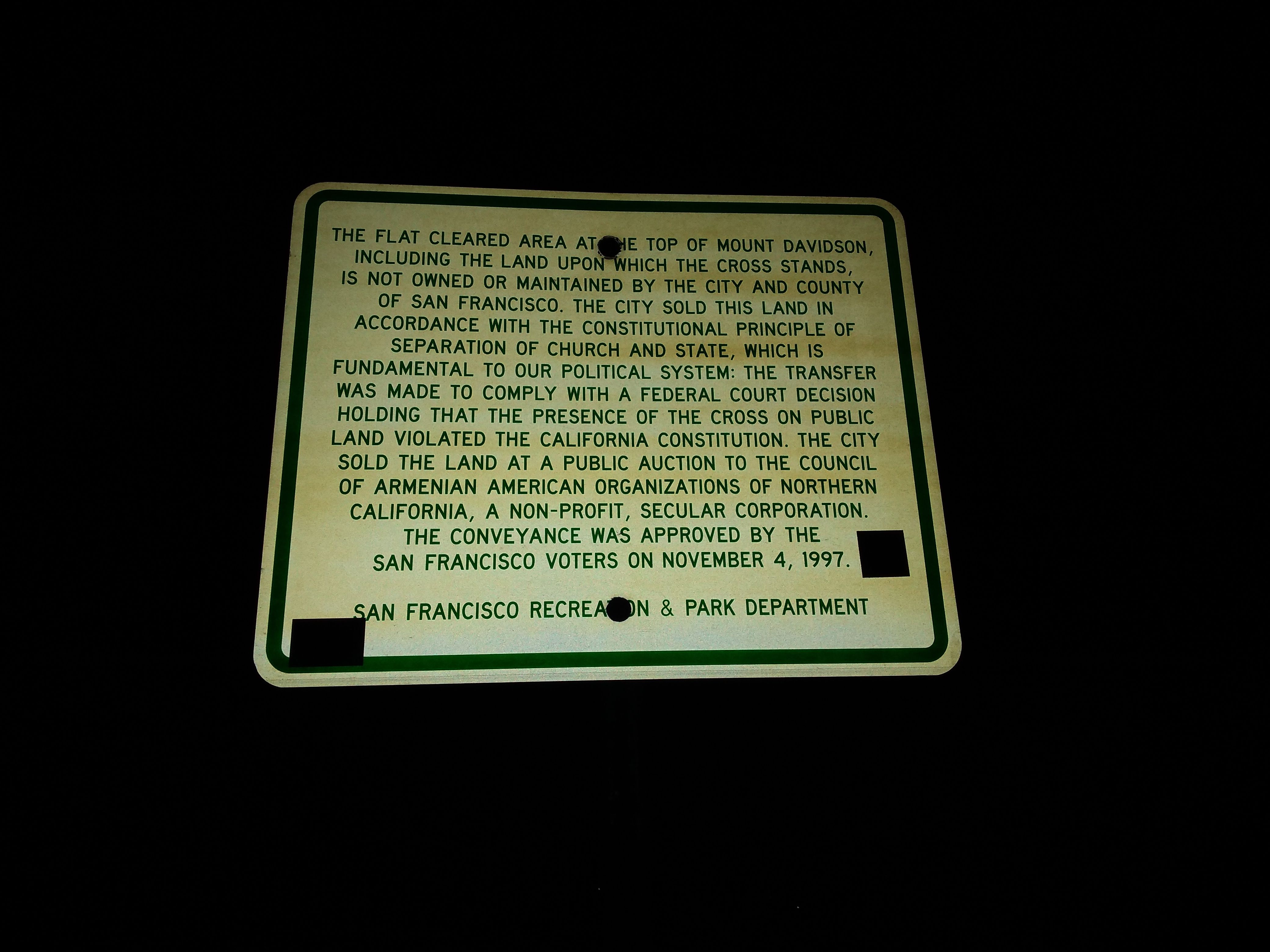
Sort of an apology for the giant cross atop Mt. Davidson, which I desecrated several times
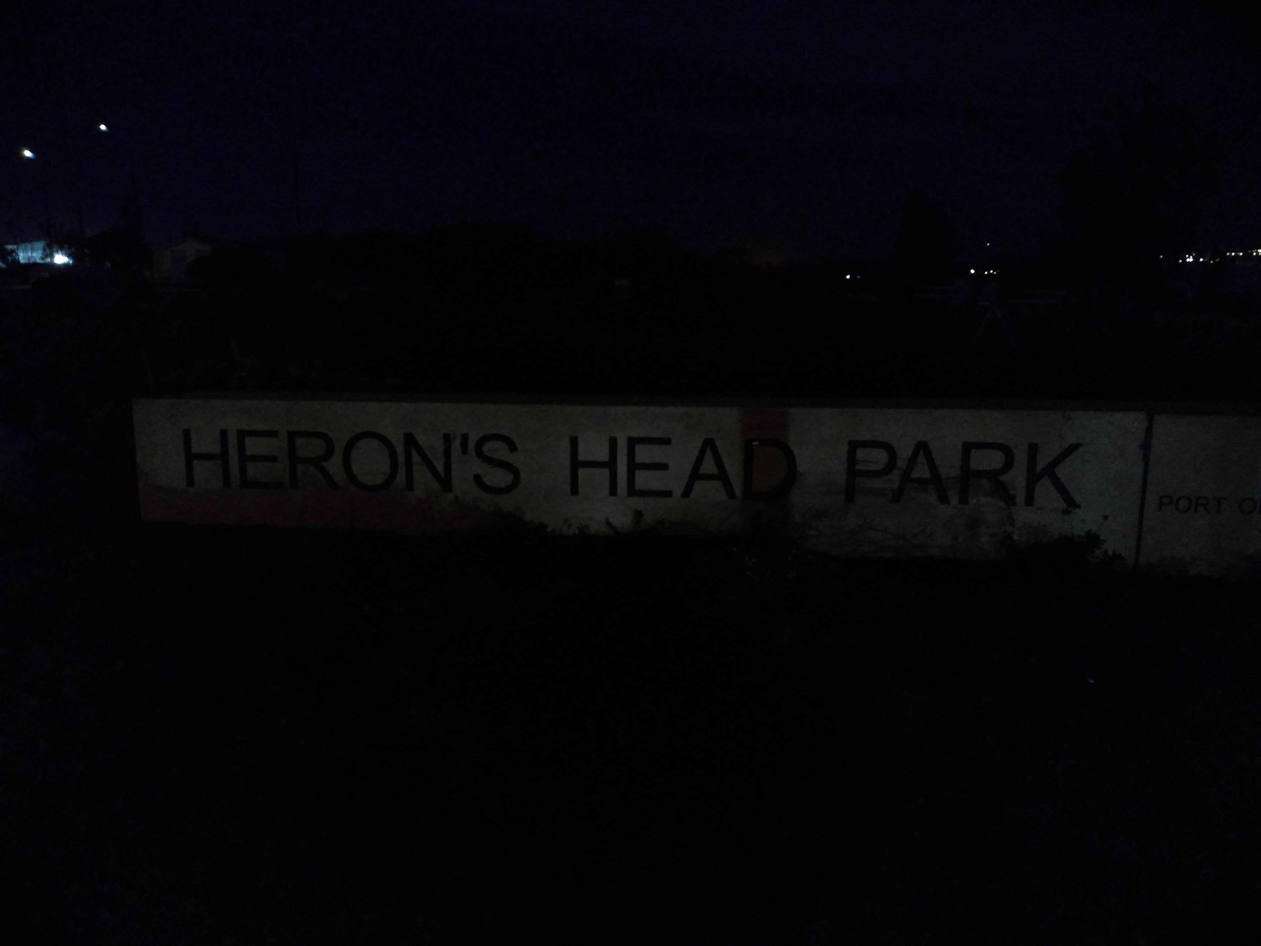
Someone told me about
Heron's Head Park,
a landfill jetty originally intended as a pier or footing for a 2nd Bay Bridge,
later converted to bird-friendly wetlands.
I rode there on 12/29/20.
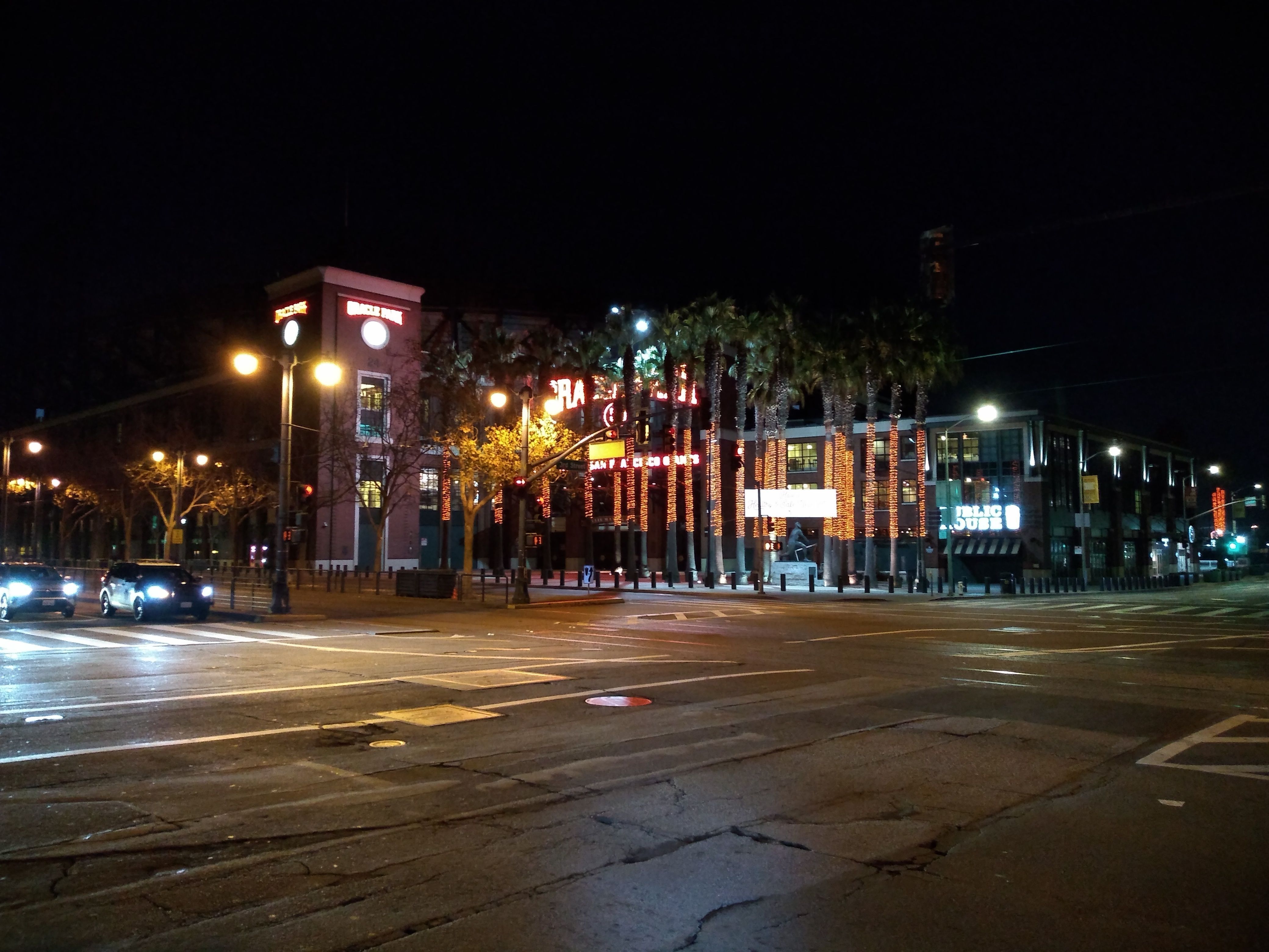
Oracle Park (Giants)
Chase Center (Warriors)
Odd buildings farther out 3rd St.
End of Heron's Head. The lights are container ships anchored in the bay
I went out 3rd St., passing by the new Chase Center where the
Warriors play, which is next to Uber headquarters.
These temples of wealth and greed pissed me off,
and the park was a nice contrast.
I rode back through the Mission.
Candlestick point
Candlestick hill is along 101, next to the old Candlestick Park.
On 4/14/21
I rode there, to round out my portfolio of SF hills.
The last block was so steep I had to get off and push.
I rode back via Mansell, which is also steep,
and I started to get cramps in my R calf.
My body craved electrolytes.
Eventually I got to Mission and there was a laundromat with
a soda vending machine.
It was closed, but the kindly owner let me in.
The orange soda was sickeningly sweet but cured the cramp.
Laundromat soda
Later, on 12/14/2022,
I did more or less the same ride again.
This time I was prepared for the steep part,
and made it up without dismounting.
Mt. San Bruno
This is a long, narrow mountain overlooking SFO and the mid peninsula.
On 3/15/21
I drove there.
A paved road goes to a cluster of radio towers,
then a dirt/rock road, with occasional steep bits,
goes to the southern end.
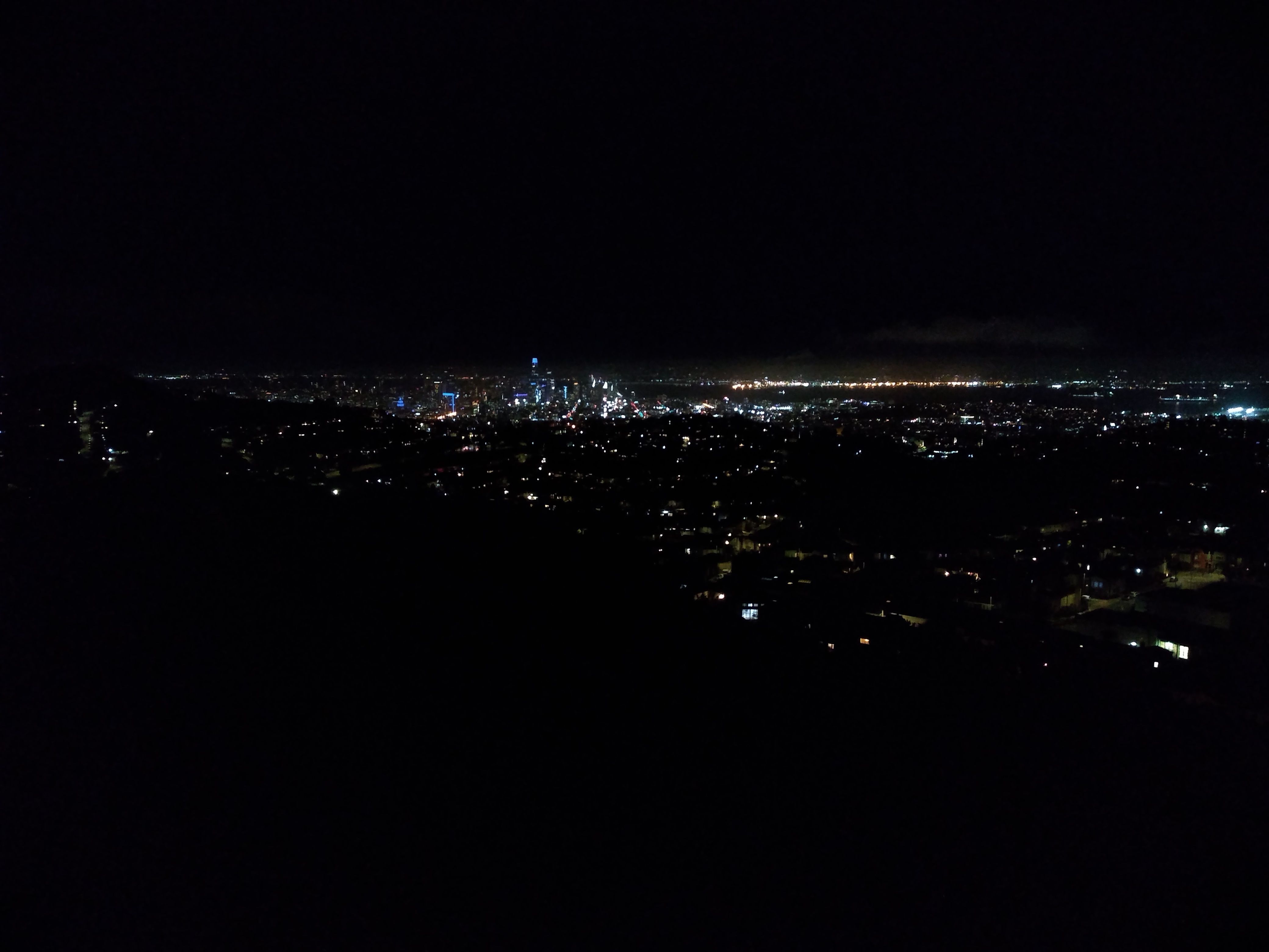
Spectacular nighttime views in all directions.
View from the S end of Mt. San Bruno. SFO is there somewhere.
This ride was scary, eerie, and beautiful.
Desolate and remote, but city lights everywhere.
I'm pretty sure no one EVER rides there at night (except me).
I was very aware of the consequences of - say -
falling and breaking a bone.
Later (Feb 2023) I got interested in doing this ride starting from the Bay Bridge.
I did some reconnaisance
to see how to get from outer Mission to that mountain,
and the next night did the
whole thing.
This was my longest ride - almost 30 miles, including a
navigational error that added a couple of miles.
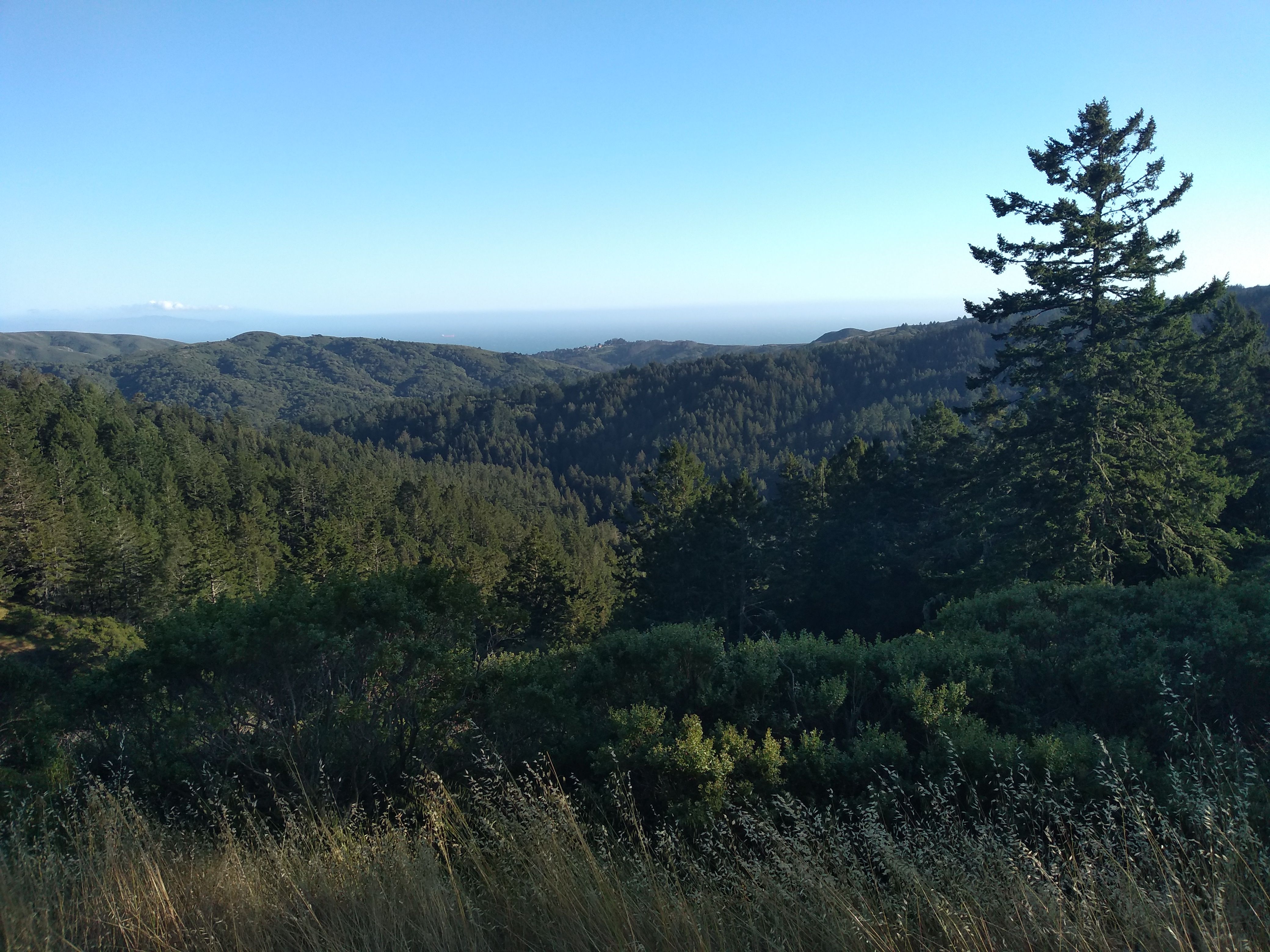
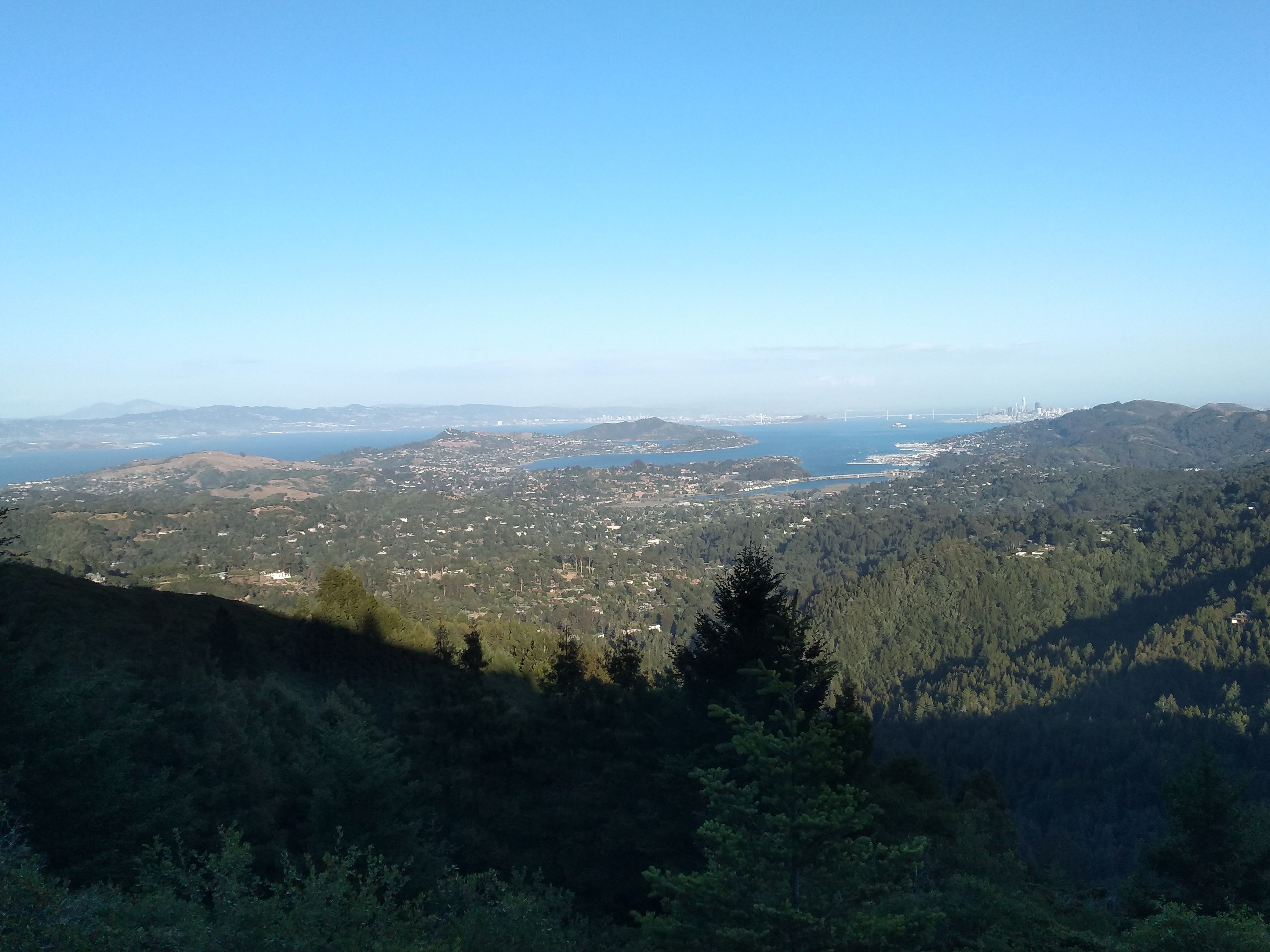
Marin County
It wasn't a night ride, but on
5/20/21
I rode up Mt. Tamalpais on Gravity Car Rd. and Old Railroad Grade.
Mt. Diablo visible at left.
Drop of thin mucus on nose; it was cold.
Steep hills
Marin St. goes straight up the Berkeley hills,
topping out at around 25% grade in the last 3 blocks.
On 7/8/20 I rode up it,
not getting off the bike but turning
off onto side streets to catch my breath
and let the lactic acid in my quads subside.
The last few blocks were tough.
After that I went to Tilden and rode up the last half of South Park.
On
11/7/20
I went to El Cerrito and up Potrero,
which is like Moeser but farther north.
It was tough. Then you still have to go up some of The Arlington.
SF has a few hills in the 25% grade range, with staircases for sidewalks.
A friend told me that the last block of Stanyan was one of the steepest.
So I
went there on 3/29/21.
It was steep but short - no problem.