Dana Couloir
August 19-21, 2000 |
random trip report |
[Click images for large version and again for full resolution]
BACKGROUND
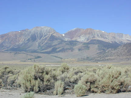
To the west, the Sierra Nevada range slopes gradually down to the Central Valley. In contrast, to the east the mountains plummet abruptly and dramatically to the desert plains of Nevada.
Mt. Dana is a 13,000' peak in the eastern Sierras, and its east-facing slope is a thousand-foot cliff, at the base of which is a beautiful mountain lake. Punctuating this cliff are two gullies (or couloirs) which are filled year-round with snow. The couloirs are quite steep: their angle is about 45 degrees, about the same as the roof of an A-frame house. One of them has a small glacier at its base.
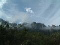
Mt. Dana. The couloir we climbed leads to the notch just below the summit.
Mike O'Brien and I climbed Mt. Dana last summer, and we peered (with considerable trepidation) down one of these couloirs. At some point we started talking about climbing up it. This discussion was driven by several factors:
- We want some crampon/ice-axe experience prior to our upcoming trip to Mt. Shasta.
- Mike's friend Phoebe Couch had once attempted them. She was turned back by logistical difficulties.
- I own a rock-climbing video showing some daredevils skiing down the couloir.
With Mike and me, once something is proposed, it generally must be carried out. So we planned an assault on the couloirs. Mike proposed belaying ourselves using 'snow pickets' (aluminum stakes driven into the snow, from which ropes are attached to climbing harnesses). I spent many happy hours at Marmot Mountain Works buying climbing paraphernalia.
THE TRIP
We set out on Friday afternoon, with Lynne Rutter, in her comfy Passat wagon. I've made a reservation at the Groveland Motel. We pick up Mike at his work in Pleasanton and sit in rush-hour traffic for a while.
Lynne has arranged to deliver a large tree fern to her ex-uncle-in-law Roy in Chowchilla, which turns out to be an hour out of our way. We head south on 99, stop in Modesto for a truly disastrous dinner (an hour wait for food) and get lost several times trying to find Roy's house. I get a bit tense. We manage to find a motel room in Mariposa, and have a drink at a bar that serves phony hard liquor.
On Saturday morning we get up at 6:45, are on the road at 7:30, and reach Tioga Pass around 10. The walk-in campground is full. We return to Tioga Lake, fiddle with equipment and packs for a while, and are on the trail at 10:45 -- later than I had hoped, but not too bad.
THE HIKE IN
The first part of the hike retraces my scouting expedition last month -- up a moderate slope of lupine and pine to the mouth of a narrow and exceptionally beautiful mountain valley separating Mt. Dana from Dana Plateau.
Above the lupine we reach a transverse trail, and this leads to an elevated clearing at the foot of the valley. There's a cairn in the form a dog (Lynne later adds some small rocks below its tail).
It's around noon. Mike and I are eager to get to the couloir quickly, and Lynne is fatigued and winded by the altitude. We test the 2-way radios, and Mike tries to use his cell phone.
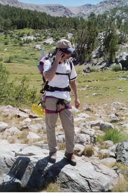
Then we split up, and Mike and I take off up the valley.
The lowest segment of the valley is lush and green, with a stand of trees at the top. We follow a use trail to the right of the trees.
The valley was formed by glaciers, most notably during the recent ice ages: 20, 60, and 100 thousand years ago. Each glacier, at its furthest point, created a 'terminal moraine', a wall of rocks resembling a man-made dam. The valley has three of these. Above each moraine is a lake; the largest is the highest one, Dana Lake, which is about 1000 by 200 feet.
Moraine is not fun to climb; it's large loose rocks, some of them tipping and teetering, others offering only an edge or a point as a footstep.
A terminal moraine (taken on the descent; note sun angle)
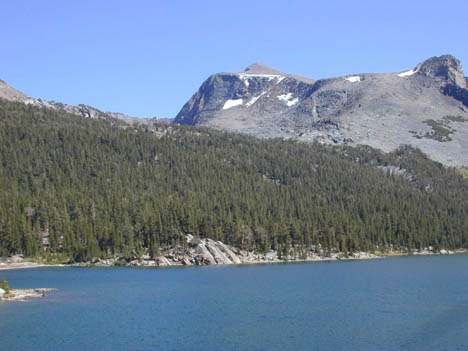
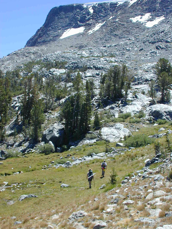
Mike and I move quickly up the valley, clear the last moraine slope, and arrive at Lake Dana around 2:00.
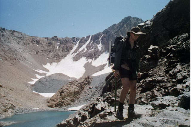
Lake Dana. The glacier is mostly hidden behind rocks at end of lake.
THE COULOIR
The summit is atop a giant cliff to the right of the lake. There are two couloirs, one on either side of the summit. The left one rises from a glacier at the end of the lake. There's a sizable bergschrund between the glacier and the couloir.

The south couloir (middle/top). Note bergschrund.
We decide to climb the right (northern) couloir, mostly because we're right there.
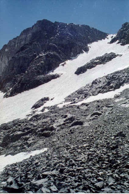
The north couloir. We made it to the buttress on the left, about 3/4 of the way up.
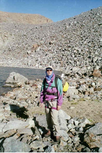
We stop at rocks at the base of the couloir, take off packs, eat some food (beef jerky, pretzel sticks) and put on our crampons and climbing helmets.
The slope is moderate (20 deg) at the bottom. There's a rock island about 100 feet up, and it's steeper after that (around 40 deg). A few hundred more feet up, and there's a large rock island. Above that is a long stretch, then more rocks and a final very steep bit, with a hint of cornice along the top edge.
Putting on equipment, I lose my balance and pitch forward, somehow taking the brunt of the fall on my index fingernail, which is wedged between my body and something sharp. The nail immediately turns blue; it started hurting in earnest later.
We venture out onto the snow. The crampons feel secure. It's as if my feet have grown a set of bear claws. I find that the ice axe provides a very secure anchor; in fact it's often a bit of work to get the pick end out of the snow.
After climbing for 50 feet, we decide not to use the snow pickets: it's too hard to pound them into the snow (a special hammer is needed, not just an ice axe) and the slope doesn't look that extreme. Instead, we rope together with a 40' length of rope (Mike coils up the extra in his back) and plan to climb side-by-side; if one person slips, he yells, and the other one digs in with ice axe and prepares for the load.

It got a lot steeper.
I leave my snow picket in the middle of the slope, and we start up. The snow is moderately sun-cupped, providing steps. Mike has brought only one glove - he has an extra sock which he uses for a left glove. We make good progress.

Note sock on left hand.
A patch of snow feels slushy - I look down and realize that my right crampon has fallen off; it's about 6 feet down. I retrieve it and strap it on tighter.
We reach the flanking rocks about halfway up. We stop and rest on the rocks. I realize I've reversed my right and left crampons, so they're toeing out instead of in. Mike tries to warm his numb hands.
We continue up, climbing straight into the sun, which sits directly over the ridge.

We turned around shortly after this.
It's a bit steeper now - maybe 45 deg. I shorten up on the ice axe and use my left hand for balance on the snow; it's kind of like climbing a really steep staircase, when you use all fours and basically crawl up. The altitude (about 12,500' by now) starts to get to me, in the form of a medium headache and loss of energy.
At 3:30 we reach the buttress about 3/4 of the way up. The sun is sinking; a shadow is forming on the right, and it will soon cover the whole couloir. After a brief discussion, we decide to turn back. We could definitely make it to the top, but we wouldn't have enough time or energy for the return trip.
We descend by down-climbing, facing the slope. Look down between your feet, locate a reasonable footplant, step down, and repeat ad nauseum. It's slower and more exhausting than the ascent. The slope beneath me, viewed upside-down, starts to look nearly vertical.
The wind picks up, gusting to 30-35 MPH. Now that the sun has set it's pretty cold, probably low 50's but the wind chill is around freezing.
My crampons keep slipping sideways off the toe of my boots. I restrap them once and then give up; they still work.
About halfway down, I decide to face away from the slope and side-step. In about two seconds I slip, slide about ten feet, do a hasty self-arrest, try to get up and slide some more. I totally forget about yelling; all orifices have become very tight. Mike, however, has been keeping an eye on me and is in arrest position, ready to catch me.
I return to downclimbing. Ten minutes later I try side-stepping again; once more I slip, again without shouting. This time I reach the length of the rope; once again, Mike has dug in and the rope stops my slide.
We get near the bottom and find my snow picket. I see my brown hat sitting on the rocks, go towards it and remove my crampons. Unfortunately, it's not my hat, just a brown rock. I have to descend another 40 feet along the rocks. When I reach the packs I realize I've dropped one of the crampons, but am too tired to go back for it.
THE HIKE OUT
It's now almost 5:00, and we're drained. A long hike lies ahead of us, but we need to rest and recharge a little. We grab our stuff and move about 100 feet to an area that still has sun. We recline and relax. Mike negotiates a sequence of snooze-button-style 20-second delays before getting up.
Finally we struggle to our feet and head down the top moraine. It's not too bad. Glacial melt rushes under the rocks - there's no stream, but we see a sinkhole in the rocks. Clearing the ridge, I establish radio contact with Lynne, who reports that she has had a 'problem', is getting cold, and wants us to hurry back.
The middle moraine is brutal - the sharp, wobbly rocks demand nimbleness, alertness, and energy, of which we have little left. Hurrying is not safe. I call Lynne a few more times.
Finally we reach the trees at the top of the grassy part of the valley. Lynne is there, and we all exchange lengthy hugs. Lynne's saga unfolds.
After we split up, Lynne is very eager to reach the base of the couloir and watch our climb. She heads up the valley, but can't negotiate the unstable rocks of the first moraine. Instead, she tries to skirt the moraine to the right, climbing to a band of solid red rock about 200' above the valley floor. She makes headway, but comes around a ridge and sees that not only are the couloirs still out of view, but that she would have to cross a steep snowfield to proceed. She attempts this (without crampons) and ends up slipping and falling about 20 feet, arresting her fall with a walking stick.
The gravity and hazard of her situation start to sink in, and an altitude headache throbs out of control. She gets sick twice and cries for 30 minutes. She sees another hiker pass by below, and deliberately conceals herself from him.
She eventually makes her way back down, and pulls out a watercolor sketchbook. The result is an altitude-distorted nightmare reminiscent of Munch's The Scream.
THE RETURN TRIP
Dusk is deepening as we reach the car at 7 PM. All of us are exhausted, almost in a state of shock. Mike lies down by the car, too tired to remove his pack. The question 'why in God's name did we do this?' is raised. Finally we stir and drive down the mountain to Lee Vining. We dine at Nicely's Pie Shop, making ample use of their facilities to wash off grime and sunscreen. We consider staying in a motel but there are no rooms, so we head for Mono Lake and end up in the exact same clearing where Mike and I stayed Nov. 99 during our Mt. Whitney trip. Even the firewood is the same; Mike builds a nice fire.
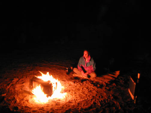
Mike, transfixed by flames. Note beer bottles.
We melt my remaining crampon, imbibe some beer and wine, enjoy the warm night air and a clear view of the Milky Way, and start feeling pretty good again.
The next morning is beautiful.
View from our campsite.
We enjoy a breakfast of oatmeal and grilled Italian sausage, then drive up the road looking for obsidian cliffs. We visit Mono Lake's South Tufa area (a tufa is a mineral deposit associated with underwater thermal vents).
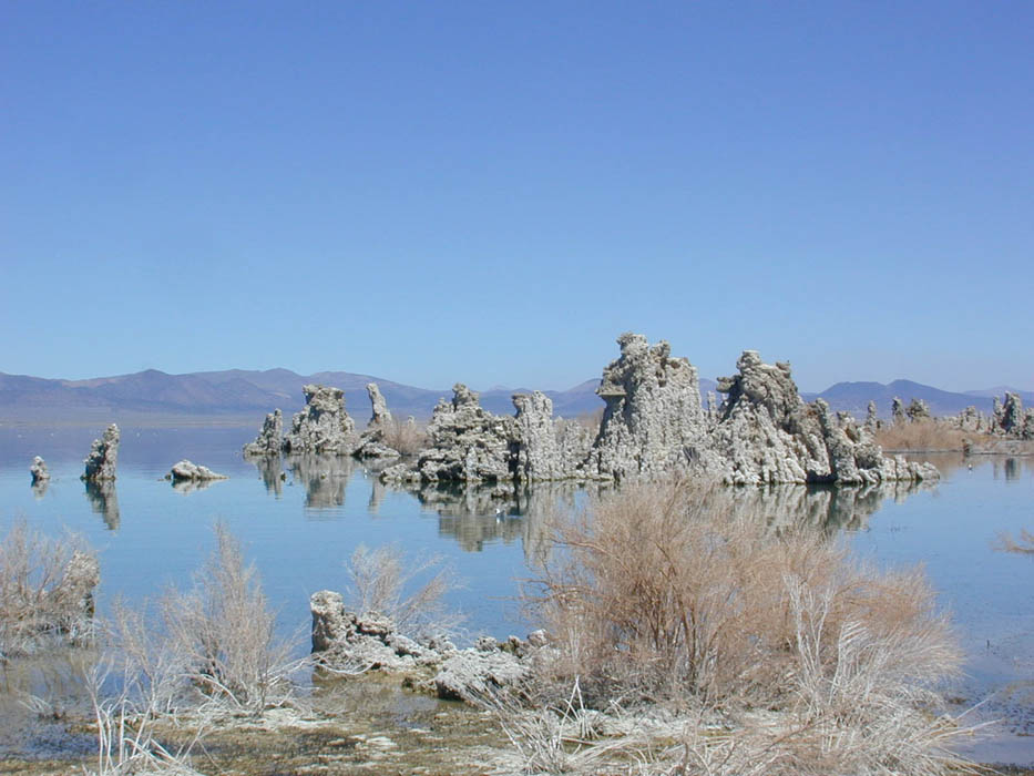
Tufas at Mono Lake.
The shore of the lake is a fascinating ecosystem of brine shrimp and tiny black flies who encase themselves in air bubbles and dive for algae.
After a tourist stop in Lee Vining, we drive back over Tioga Pass, pausing to scout Mammoth Peak (which we're too tired to climb today) from the road.

Mammoth Peak.
The phrase 'low-angle slab' is bandied about excessively. We stop at Lembert Dome, and climb its gradually steepening west face as high as we dare. A group is top-roping it above us.
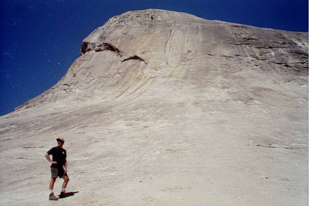
Lembert Dome.
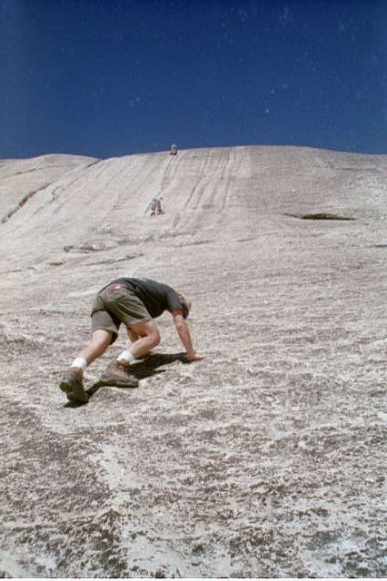
Down-climbing Lembert Dome (scary).
Finally, we stop at Tuolomne Grove on the way out and do the 1-mile tourist loop through the giant sequoias. A sign banning cone collection is variously misinterpreted.
Driving back, we stop at the giant log pile.
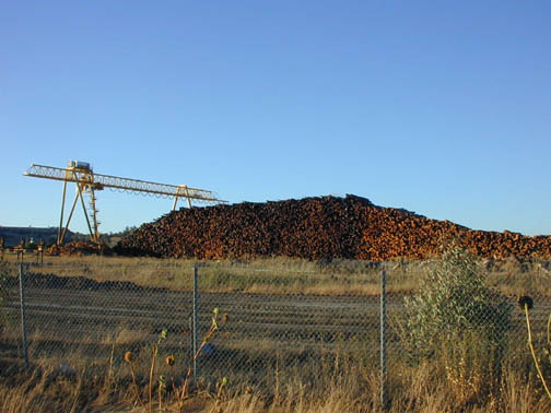
Part of the giant log pile. For scale, note stairscases on crane.
In Escalon, Missy's Espresso 'n Such is closed and locked.