Mt. Lassen
29 June - 1 July 2025 |
random trip report |
[Click images for large version and again for full resolution]
Sunday 29 June
I borrow Erica's car, pick up M and N, and we head up 80/505/5 to Redding, stopping at Granzella's in Williams for sandwiches.
We arrive around 2:30. We're staying in a house, found on booking.com (like Airbnb but fewer fees and right-wing donations). Checkin time is 5 so we drive W on 299 to the Crystal Creek trailhead near Whiskeytown. We drive 4 miles up a side road along a canyon, and eventually stop at a promising-looking trailhead. A trail leads down toward the creek at the bottom of the canyon.
It's 104 degrees outside, which is actually par for the course here. To me this feels comfortable (it's dry heat, and there's a breeze) but M and N seem to think it's certain death. I insist on a short hike. It's a short walk down to the bottom of the canyon, which is lushly vegetated and about 20 deg cooler. M and I dip our feet in the cool stream. We all walk a little up the other side of the canyon. Intriguing trail; wish we had time to explore further.
We drive to the rental, which is 3BR/2BA house in a quiet neighborhood. I have to call the agent to get the entry code, but this is easy. The house is big, clean, and well air-conditioned; it's perfect.
After a rest, we drive to a nearby CVS, where N gets a sleep mask and M buys a pair of thick-soled black sandals with glittery silver straps; a steal at $15. We eat at a taqueria next door, which is OK.
We drive to a 'family fun center' kind of place a few miles N of town, with a go-kart track etc. Noah and I play a round of mini-golf. The course is boring; no windmills, tunnels, loops etc., just carpet. There's an arcade inside. We play some air hockey, and N and M play skee-ball.
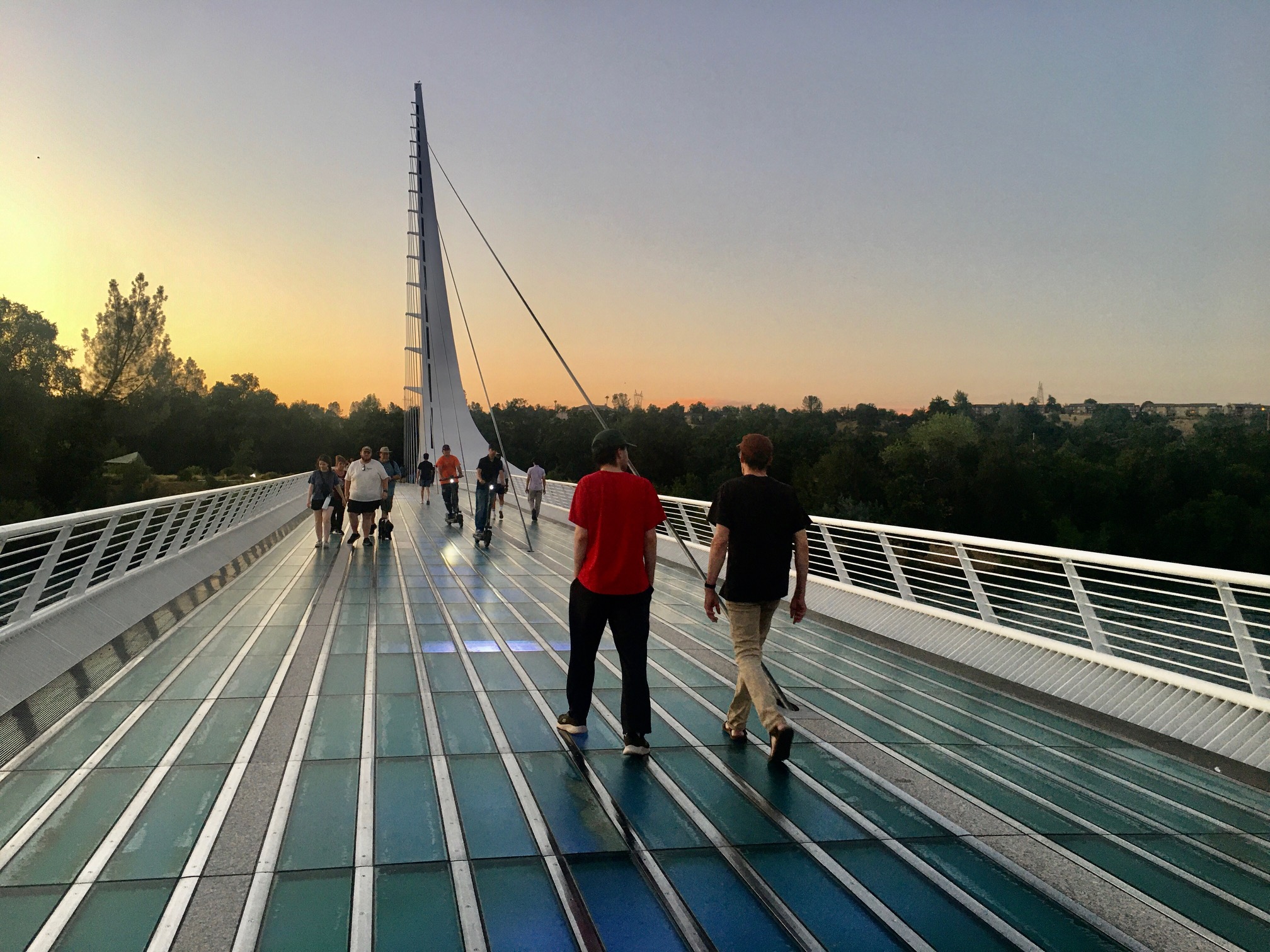
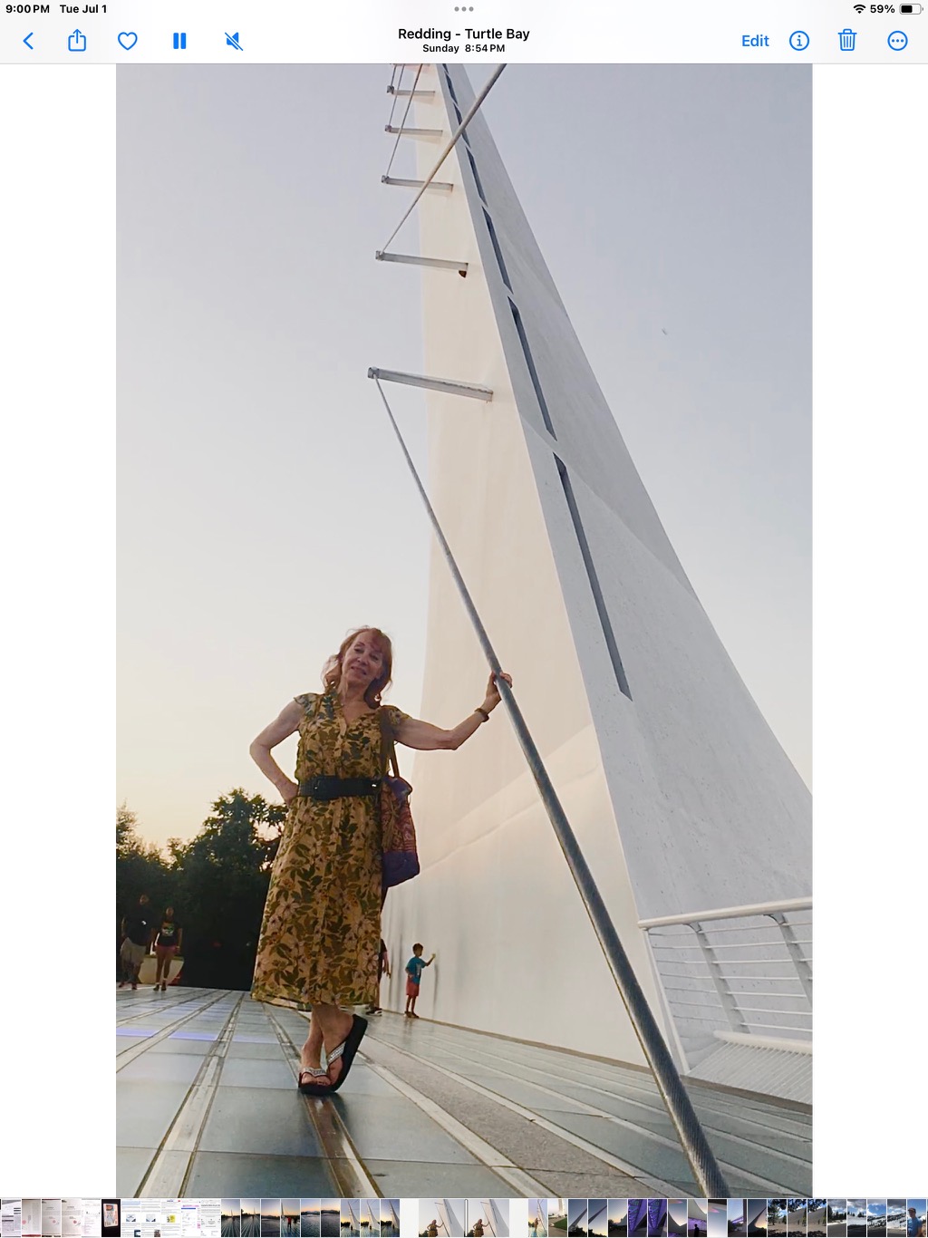
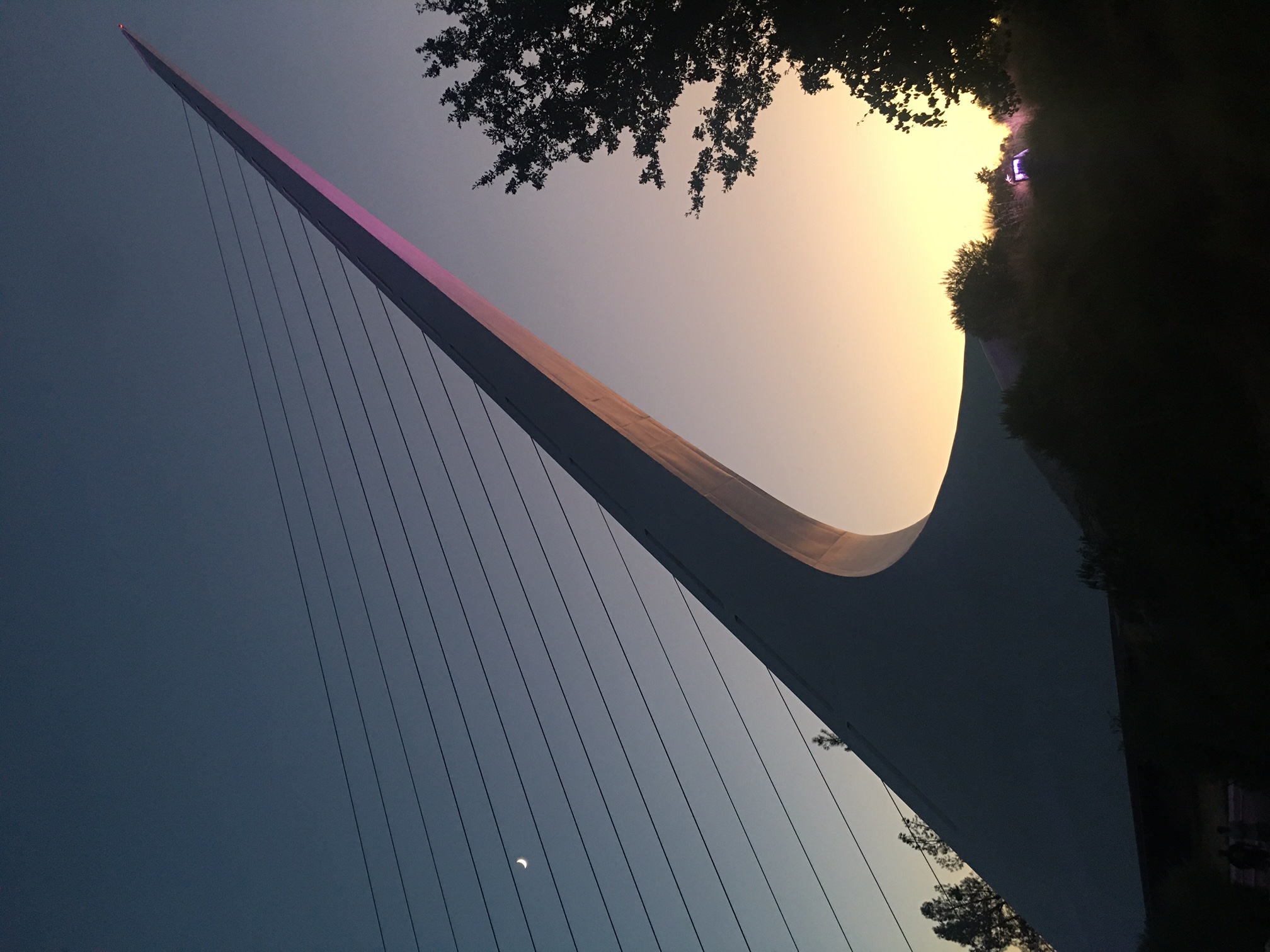
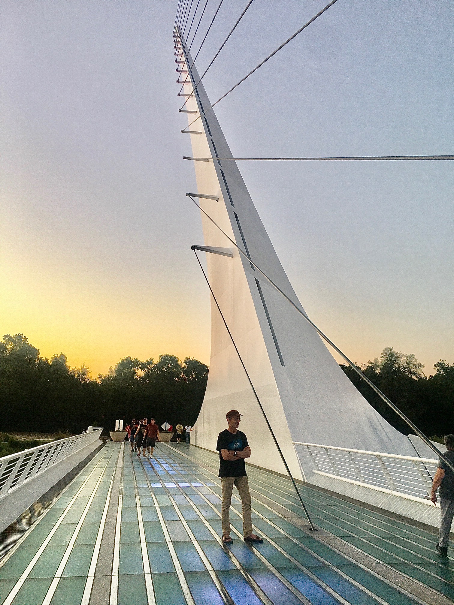
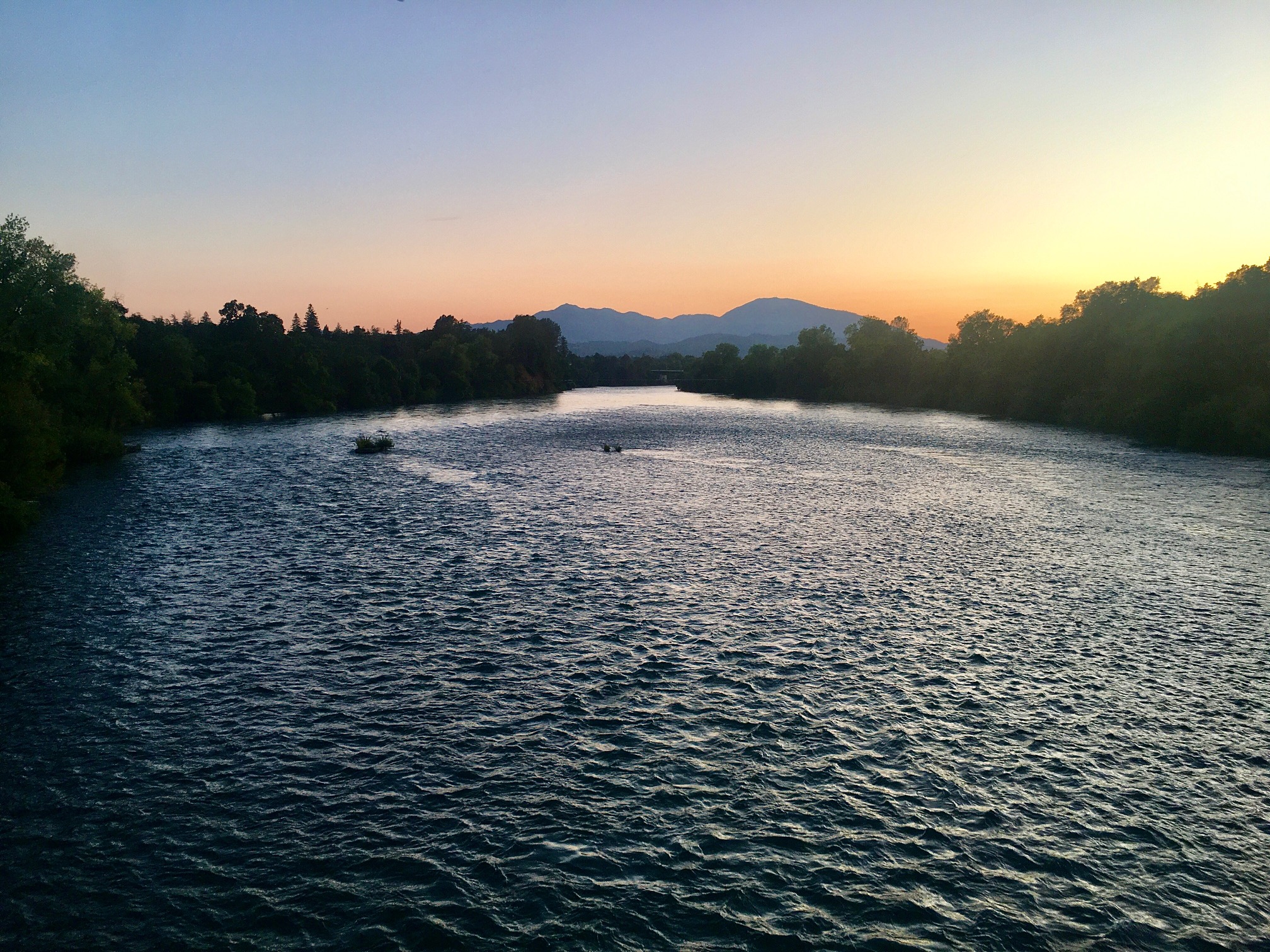
On the way back, I follow the signs for the 'Sundial Bridge'. This is a foot-bridge across the Sacramento River, with a unique suspension design that's kind of like a harp, and a glass walkway that's illuminated from underneath. The suspension tower is illuminated with purple-ish light. Its base is covered with white tile mosaic. At this time of day (post-sunset, fading light) the whole thing is fantastic and beautiful. We cross it and walk around a bit on the other side of the river.
On the way home we stop at the Holiday Market (in the same mall as the CVS) and buy various food for breakfast and lunch tomorrow.
Monday 30 June
We have eggs/sausage/toast/coffee for breakfast. We drive E on 44, across the valley, into the foothills, through Shingletown and Viola on the N side of Lassen. We have to stop for about 10 min for some rather dubious road work: they're moving some dirt around and this blocks a lane. At Old Station, 44 turns to the south, going down the east side of the park.
I program 'Cinder Cone' into Google Maps on my phone, but once we're out of cell range it forgets everything. (Note to self: use the car's nav instead). Looking for a sign for Cinder Cone, we drive past a sign for Butte Lake campground. About 10 miles later we stop at a rest area. I talk with a bicyclist, and learn that the Butte Lake road in fact goes to the Cinder Cone. Terrible signage.
We drive back up 44, then ~4 miles on the corrugated dirt road to the campground / trailhead, arriving maybe 12:30 (drive time: almost 2 hours). There's a nice-looking lake (Butte Lake) right there.
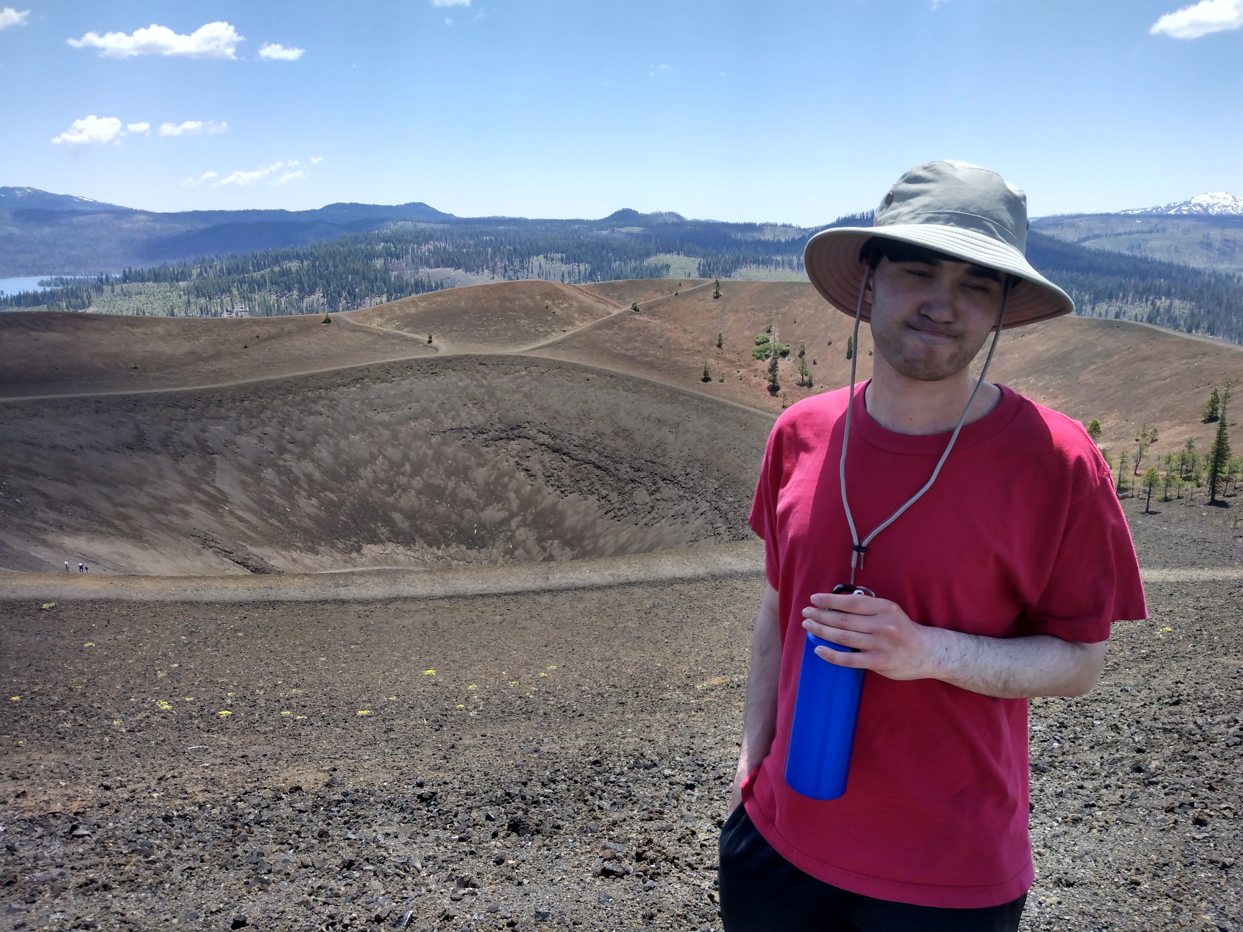
We're at about 4,000' so it's cooler than the valley, but still mid-80s. We walk a mile or so to the Cinder Cone.
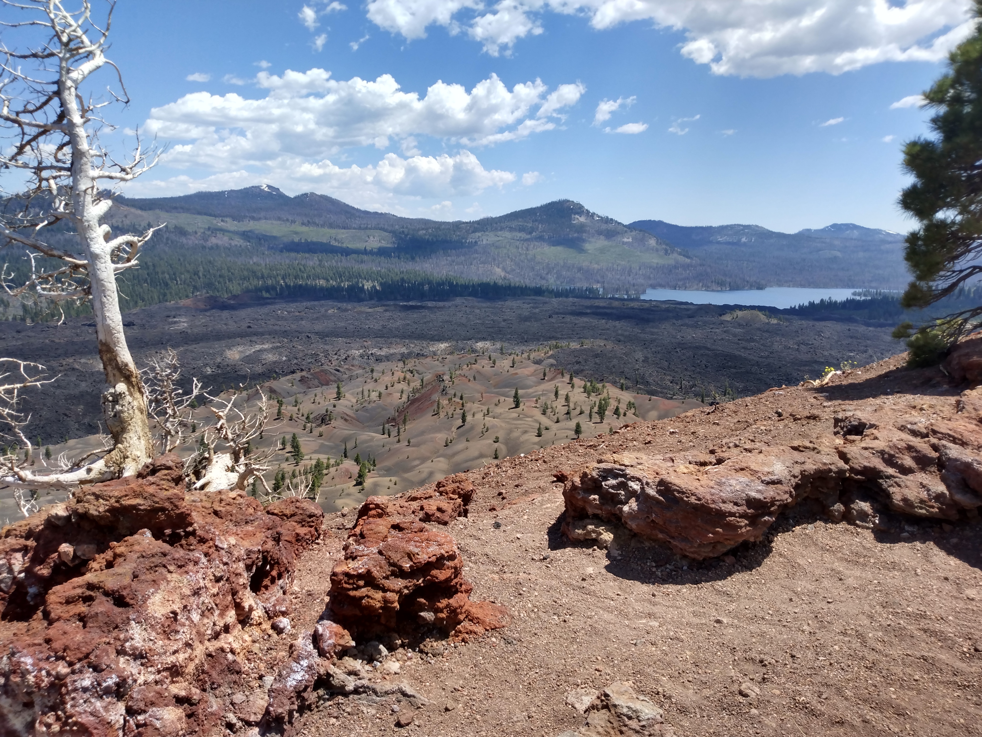
M elects to wait in the shade of some trees at the base of the cone, from which there's a view of the Painted Dunes and of course the Fantastic Lava Beds.
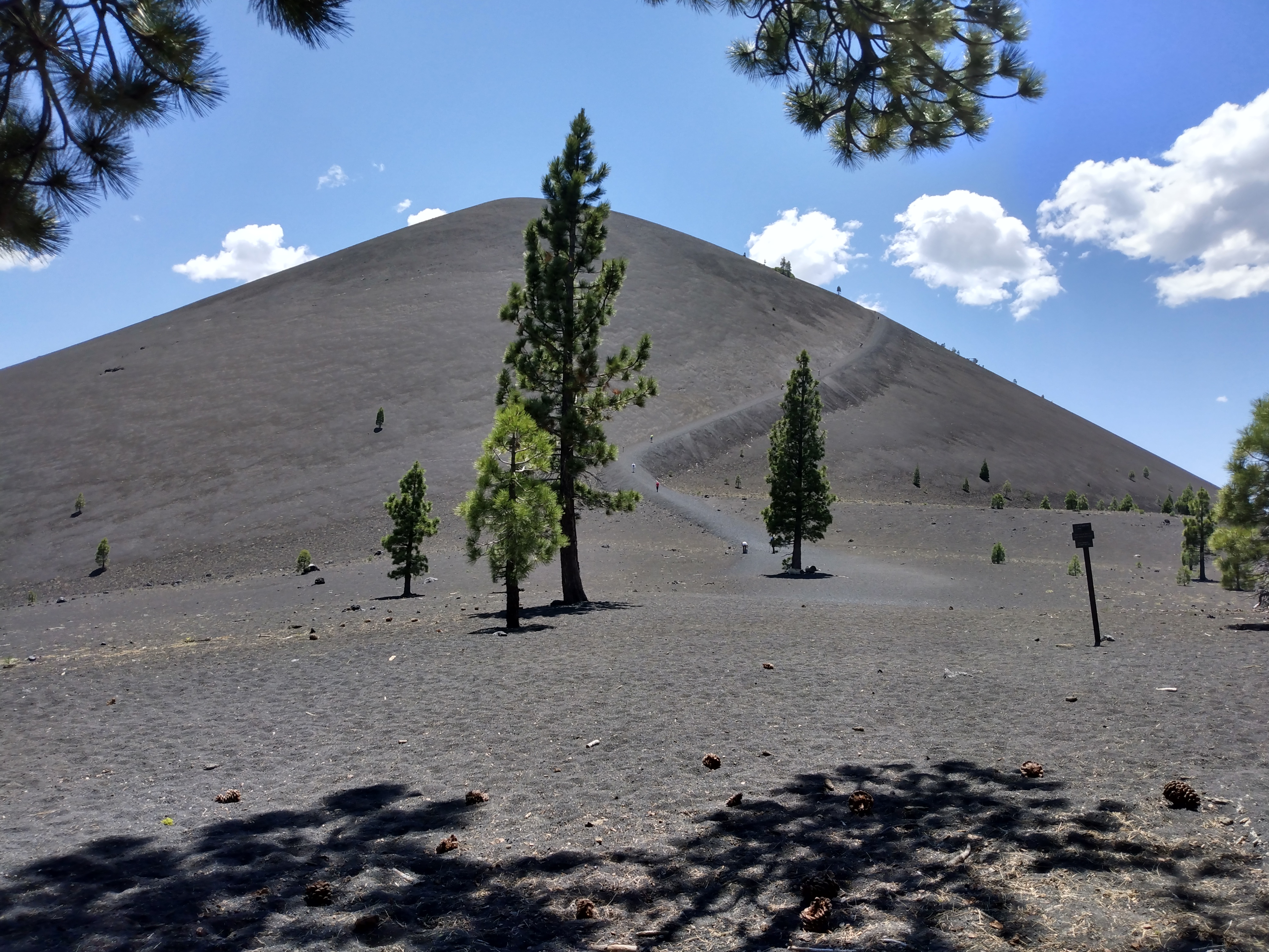
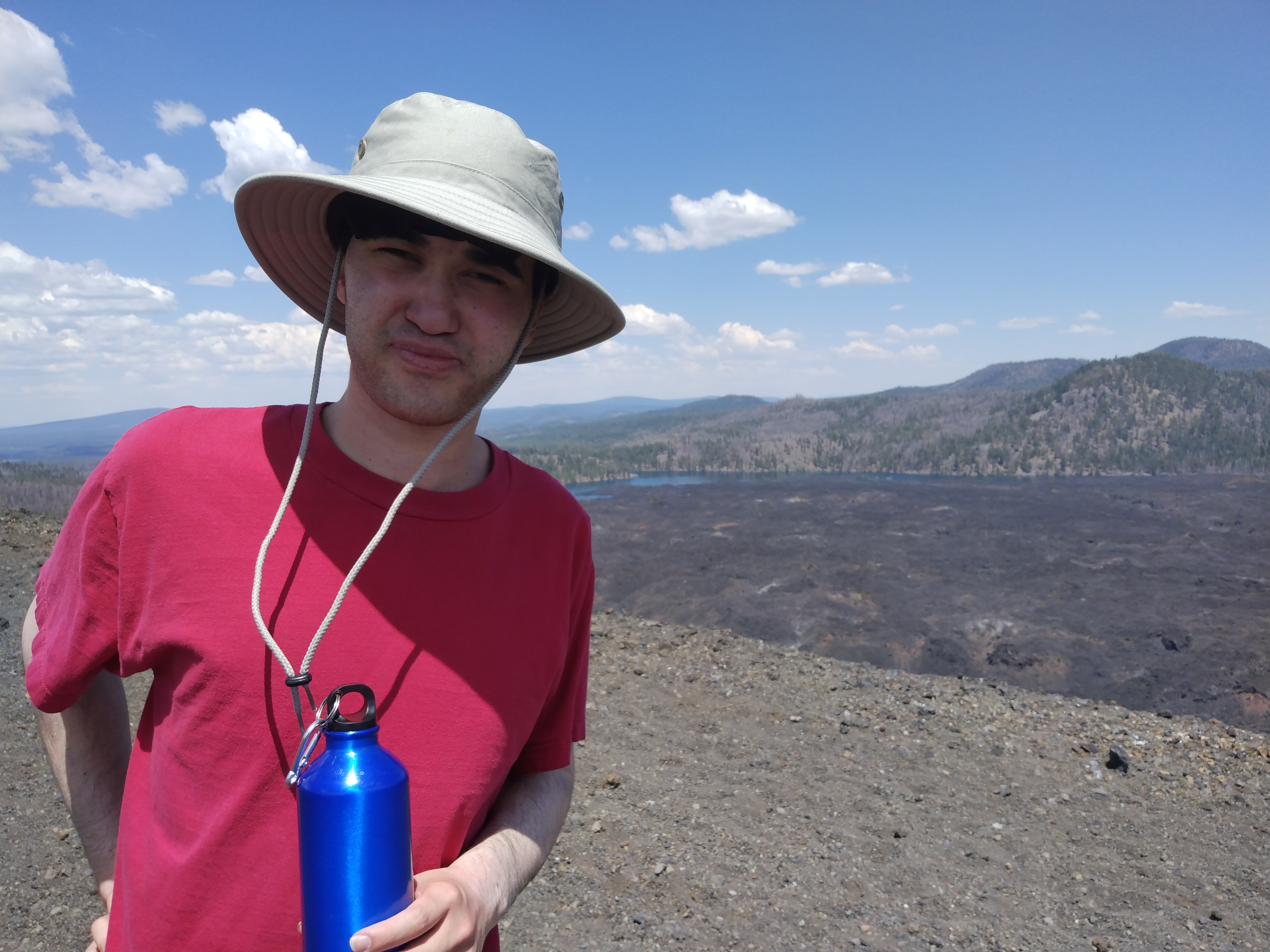
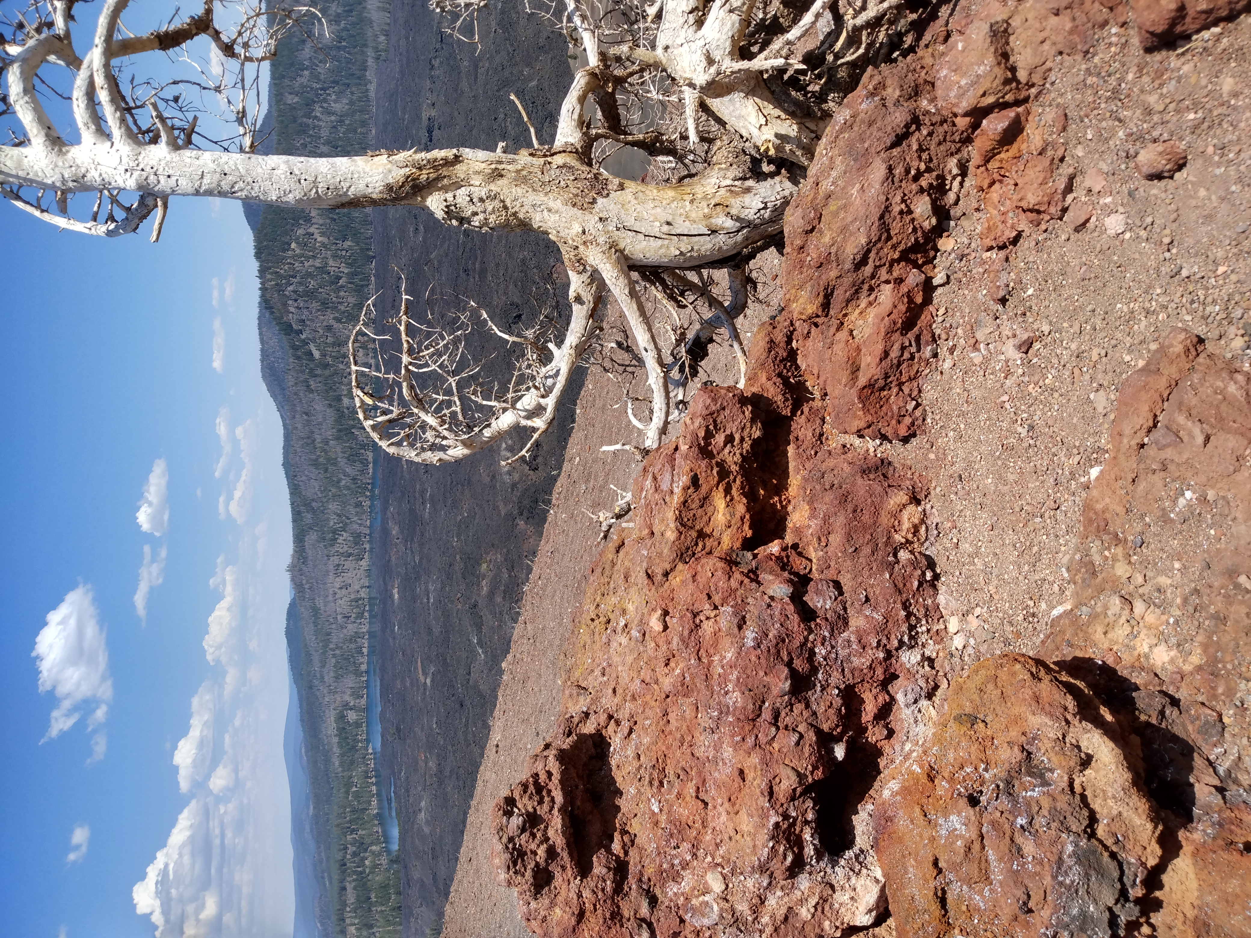
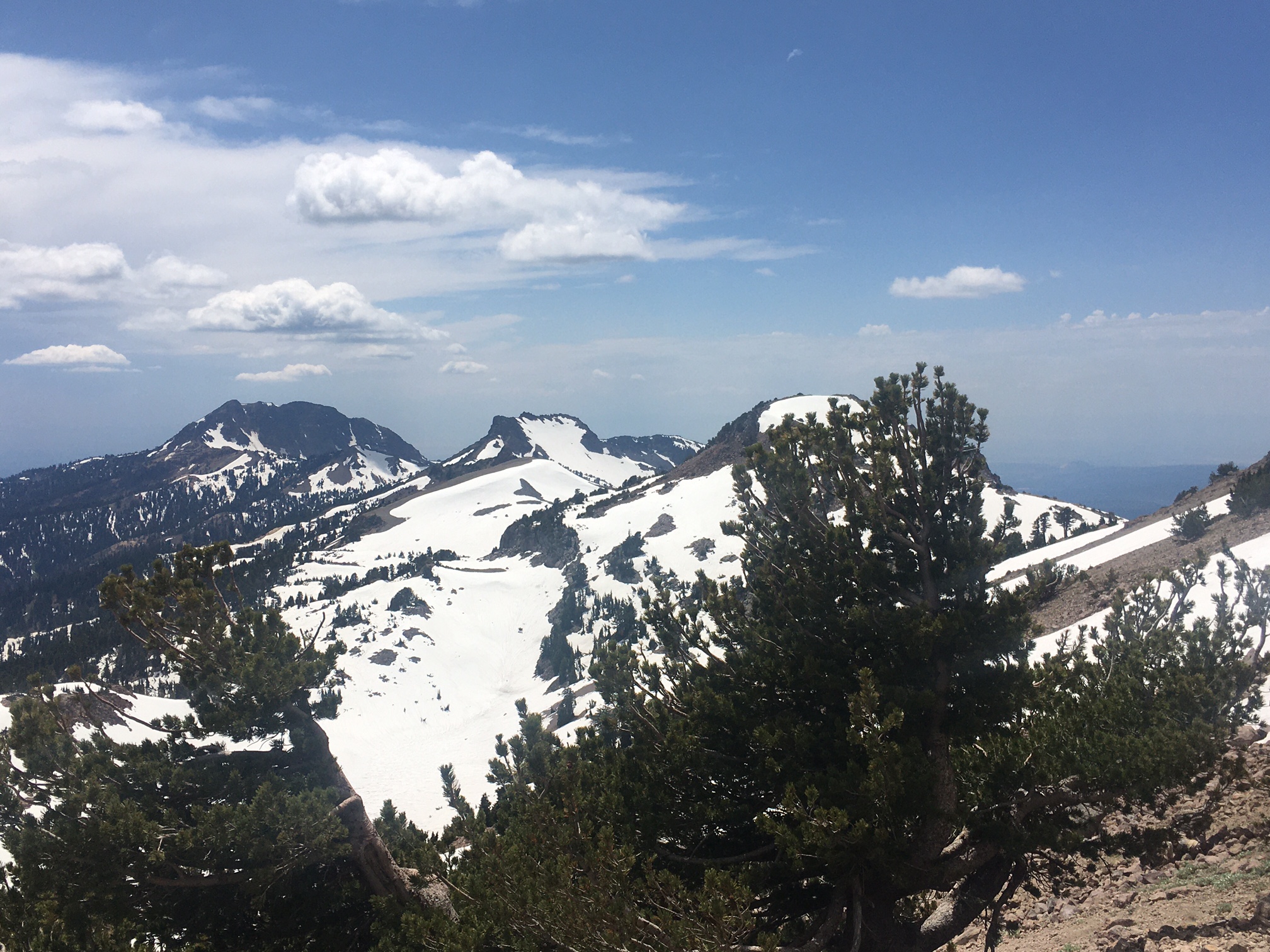
N and I climb up the cone, which is mildly steep and slippery volcanic ash. We walk halfway around the crater rim to a point where there's a lone tree and a great view of the dunes.
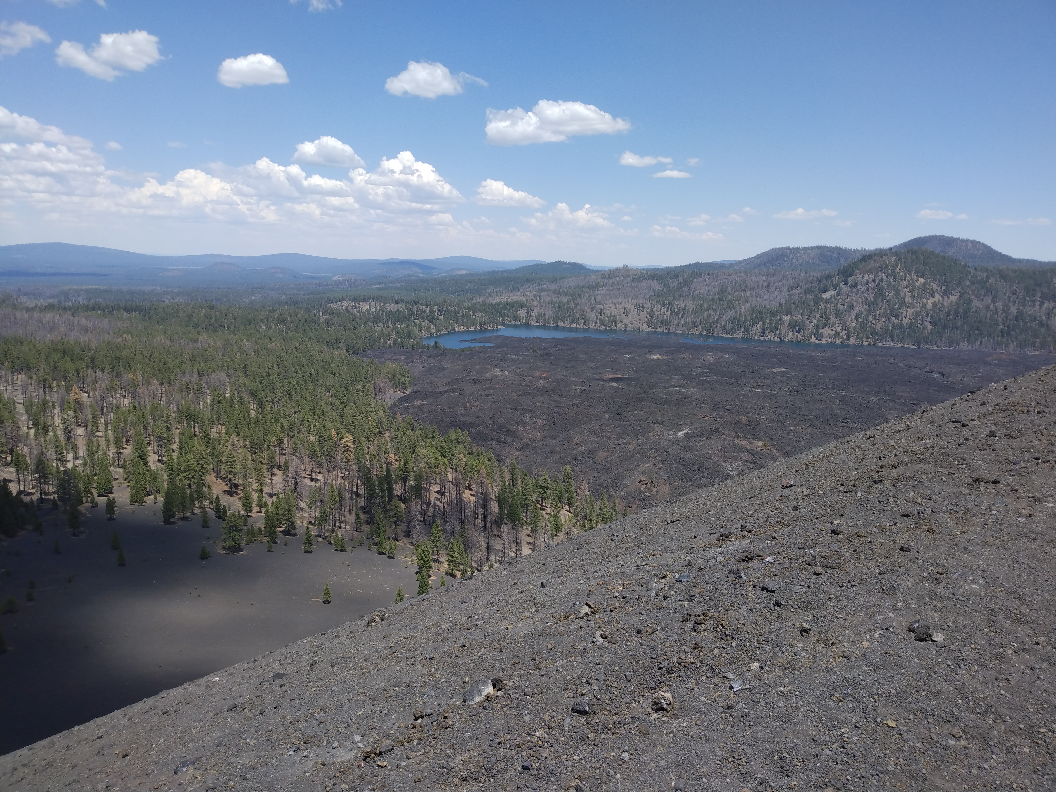
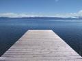
Butte Lake in the distance
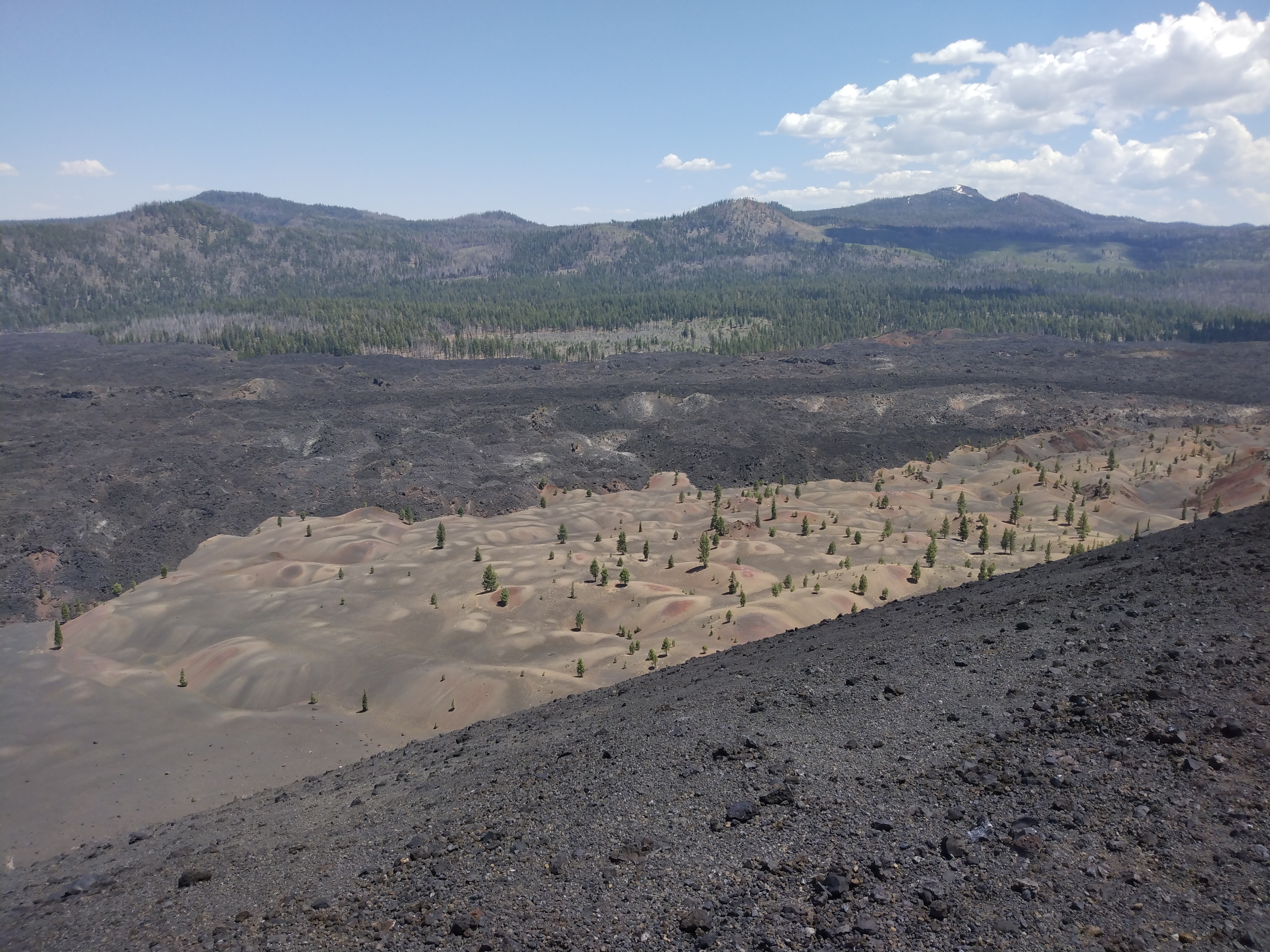
Fantastic Sand Dunes
We descend and enjoy our lunch (PB&J sandwiches) with M. Various people stop near us, including a young Russian woman with her 3 young kids (maybe 4/6/7) who it turns out not only climbed the cone but descended (150' or so) to the bottom of the crater.
I've noticed a few trail-runner types. One of them walks by and I chat with him. Apparently there's a bus with about 25 runners, doing various runs in the area, some of them going up the cone. He says its a good group but the smell on the bus is not always good.
There are a lot more people than the other times I've been here. Quite a few Asians.
We return to the car. M and I wade in the lake. The Russians are there, and also a Spanish-speaking family with young kids.
We drive back to Redding. N curiously pulls his cap visor down over his eyes, so he can't see anything, although not asleep. I stop for gas and splash some on my leg.
We decide to go out to dinner, and drive downtown. Our first choice (a brewpub type place) is inexplicably closed. But there's a similar and possibly better place nearby. M and I split an Ahi salad and giant (oily) onion rings. I giant TV above us shows golf; it's mis-configured so that everyone looks fat.
N suggests bowling but we decide against it.
Tuesday 1 July
We pack up, and stop at the CVS for a cooler bag (for leftover food) and at the Holiday Market for sandwiches.
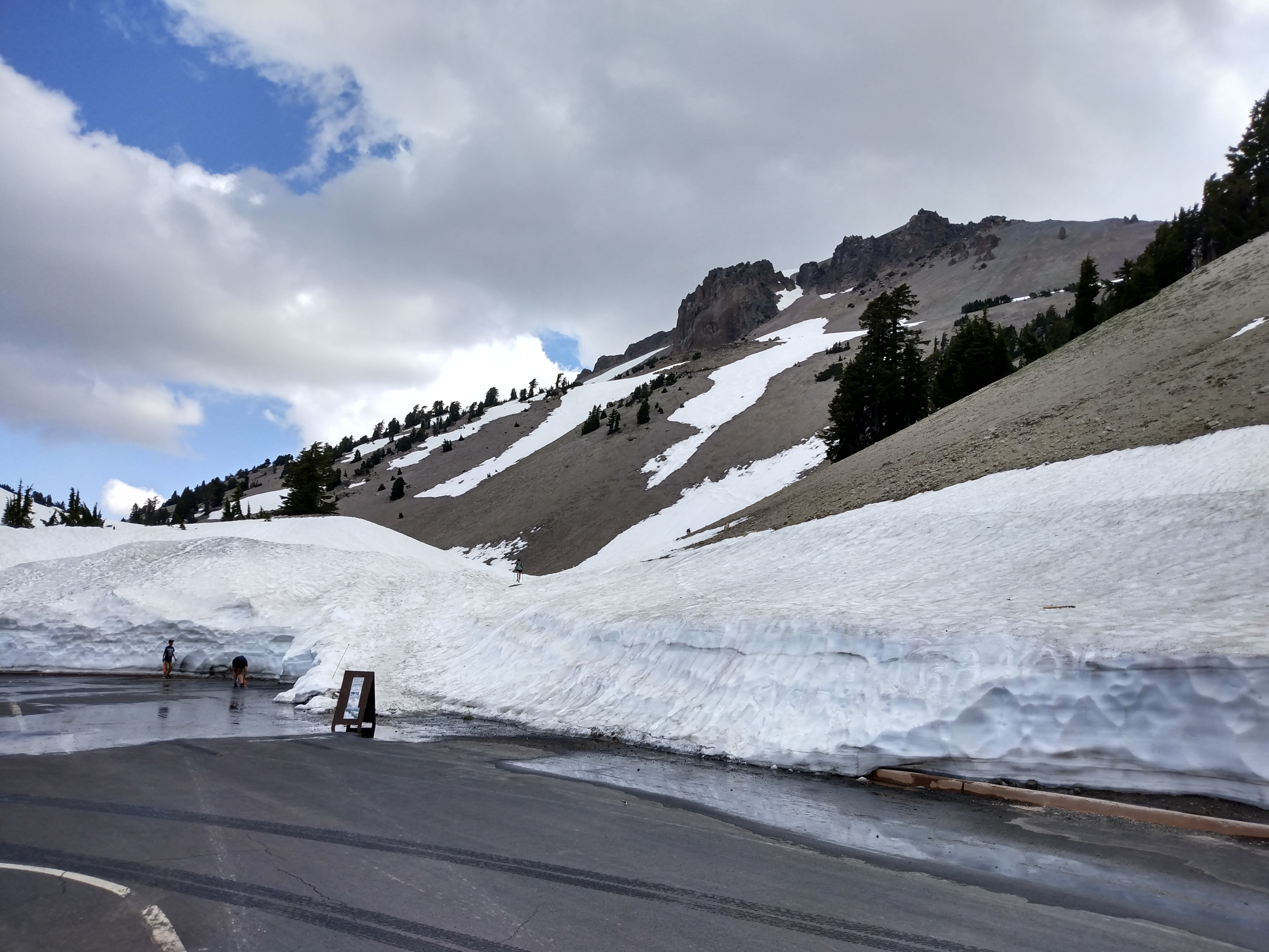
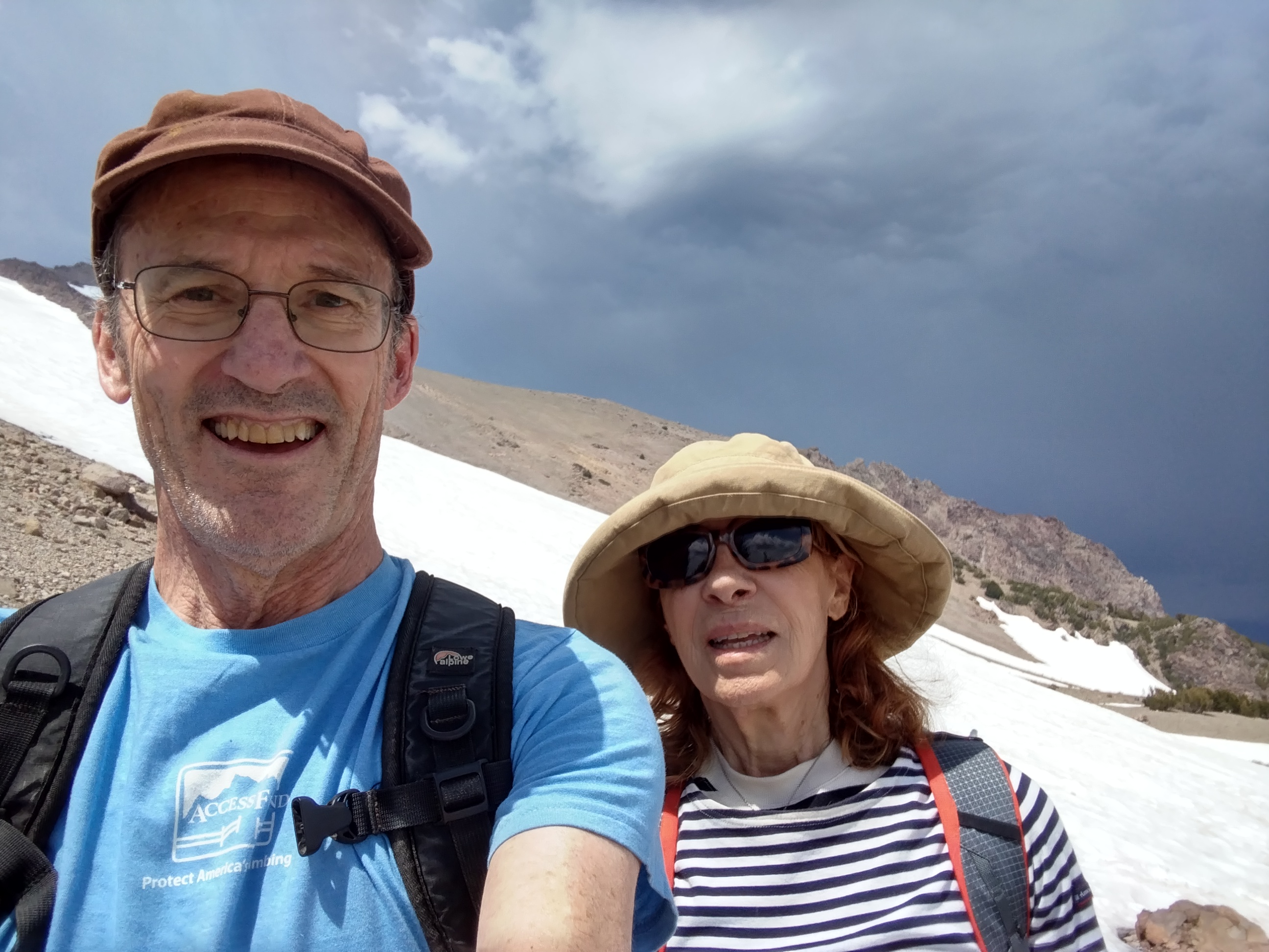
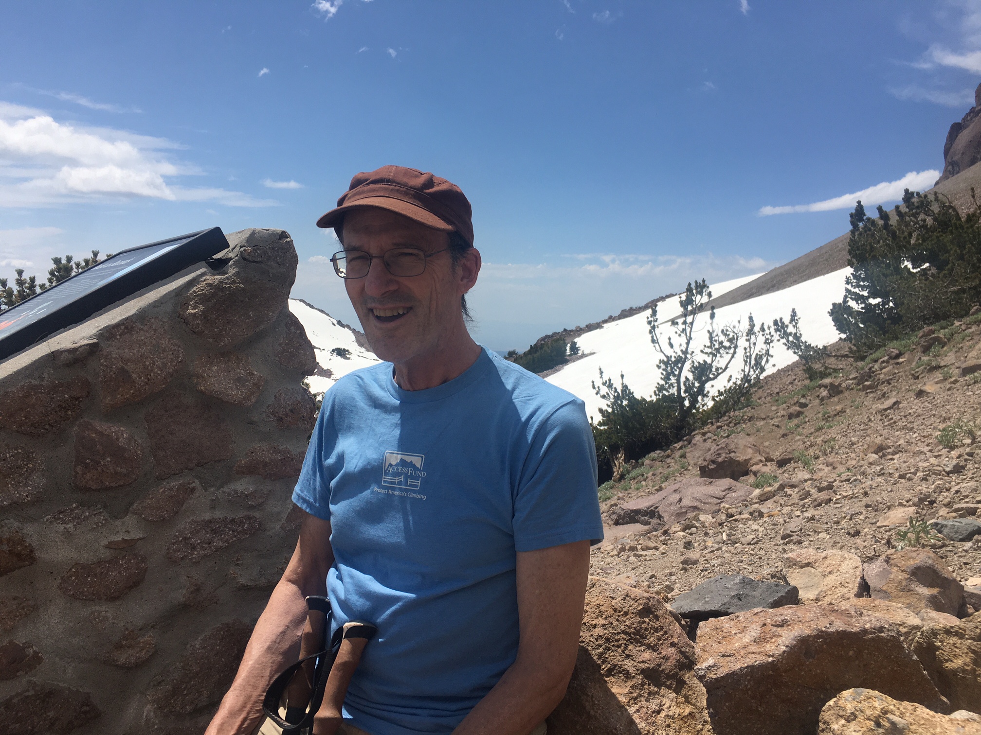
We drive E on 44 like yesterday, but this time we turn S on 89 to enter the park. We drive to the Lassen summit trailhead. The mountain still has big vertical bands of snow, and the parking lot is surrounded by walls of snow.
Trail starts behind sign
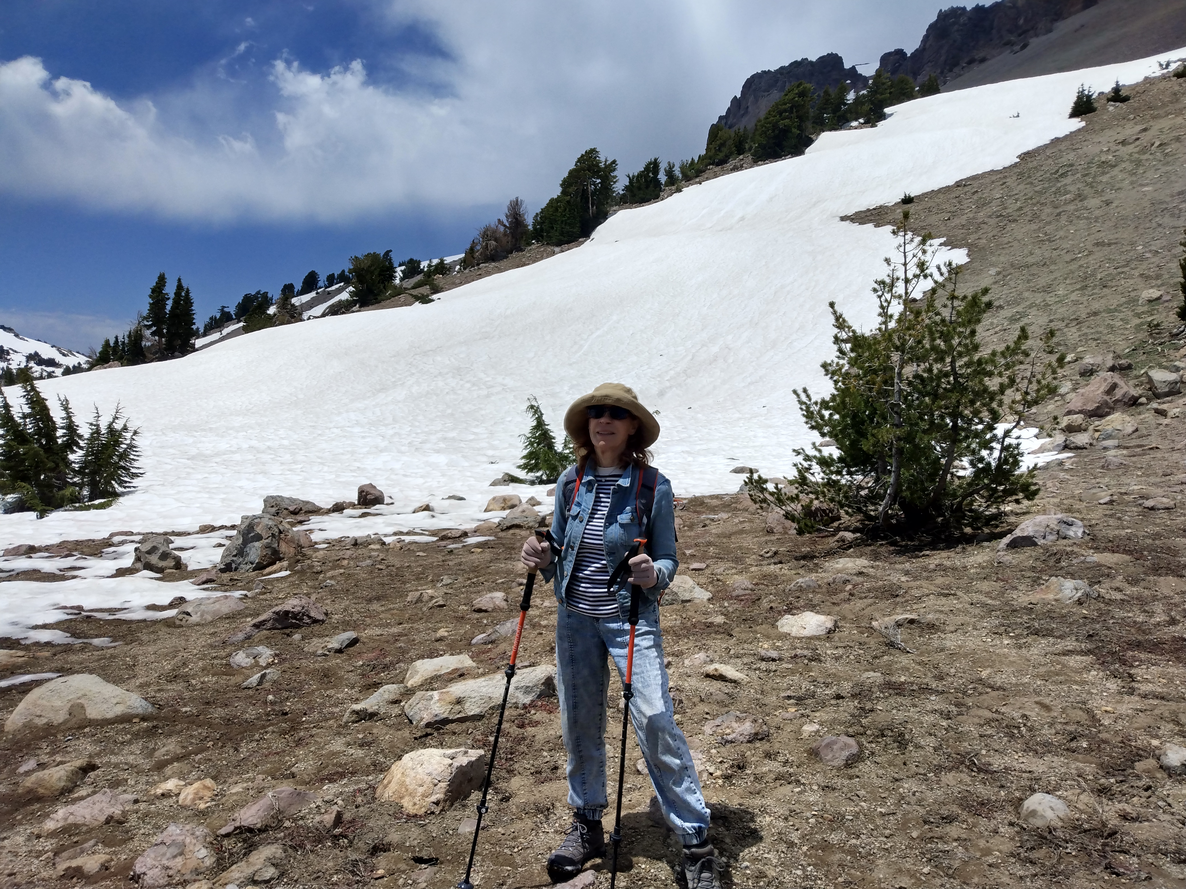
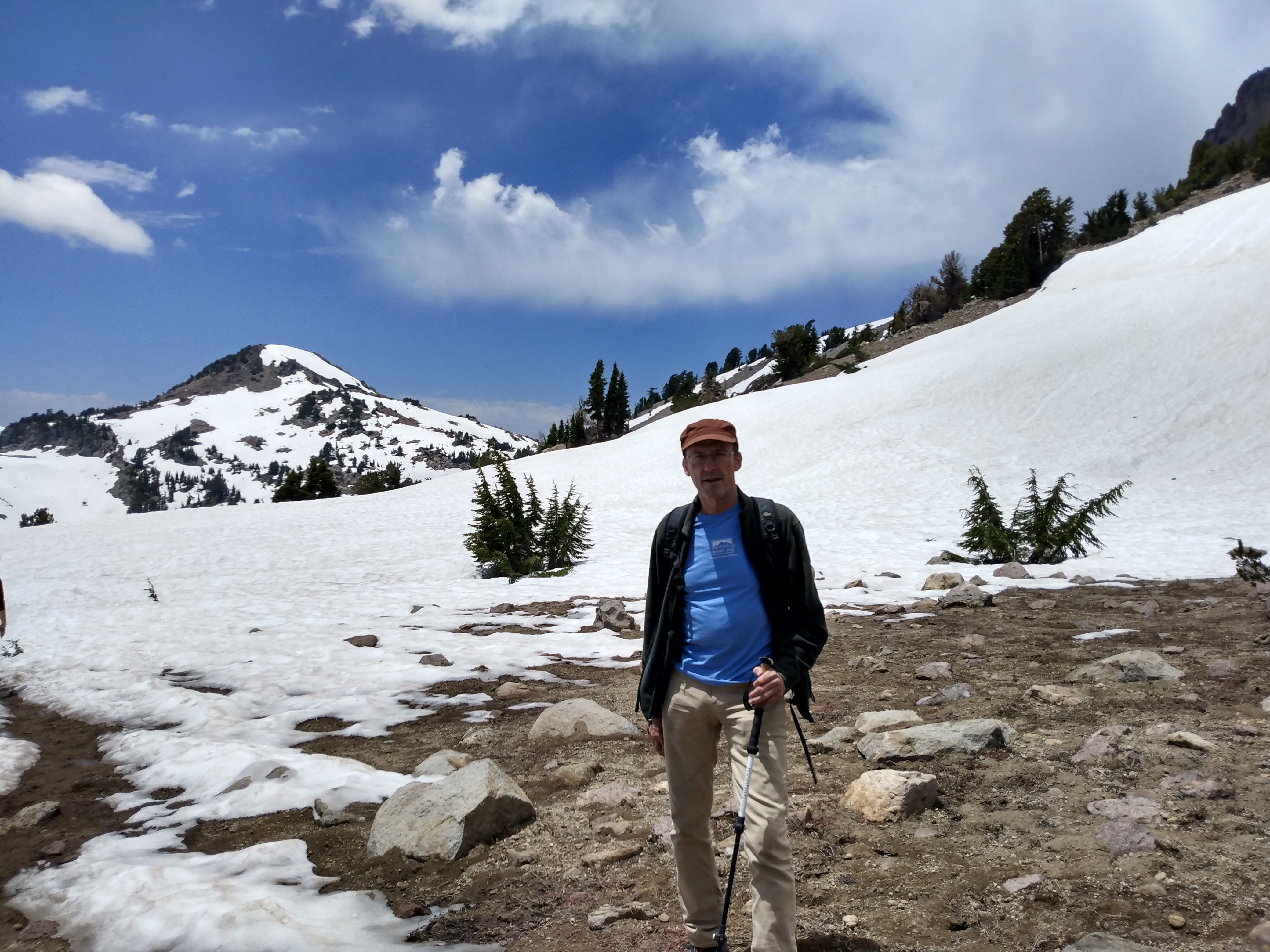
I'm skeptical about our ability to get very far. But we start up, mostly on snow but with occasional stretches of ash.
A descending couple tells us that they reached the summit, and that the snow is only sporadic. That's encouraging.
After about 10 minutes we hear thunder in the distance. The sky to the N (toward the summit) is dark and ominous. It briefly starts to rain. But to the S and W the weather is good (high patchy clouds) and the wind is coming from that direction. We decide to wait under a tree and see what happens.
We can see a lot of people on the ridge near the summit. Thunder continues, though we never see lightning. We see what looks like heavy rain at the summit (turns out it's hail).
N paces nearby, then decides to return to the car. M and I watch a group of teenagers descend, wearing sneakers and slipping wildly in the snow. A girl freaks out and hyperventilates noisily.
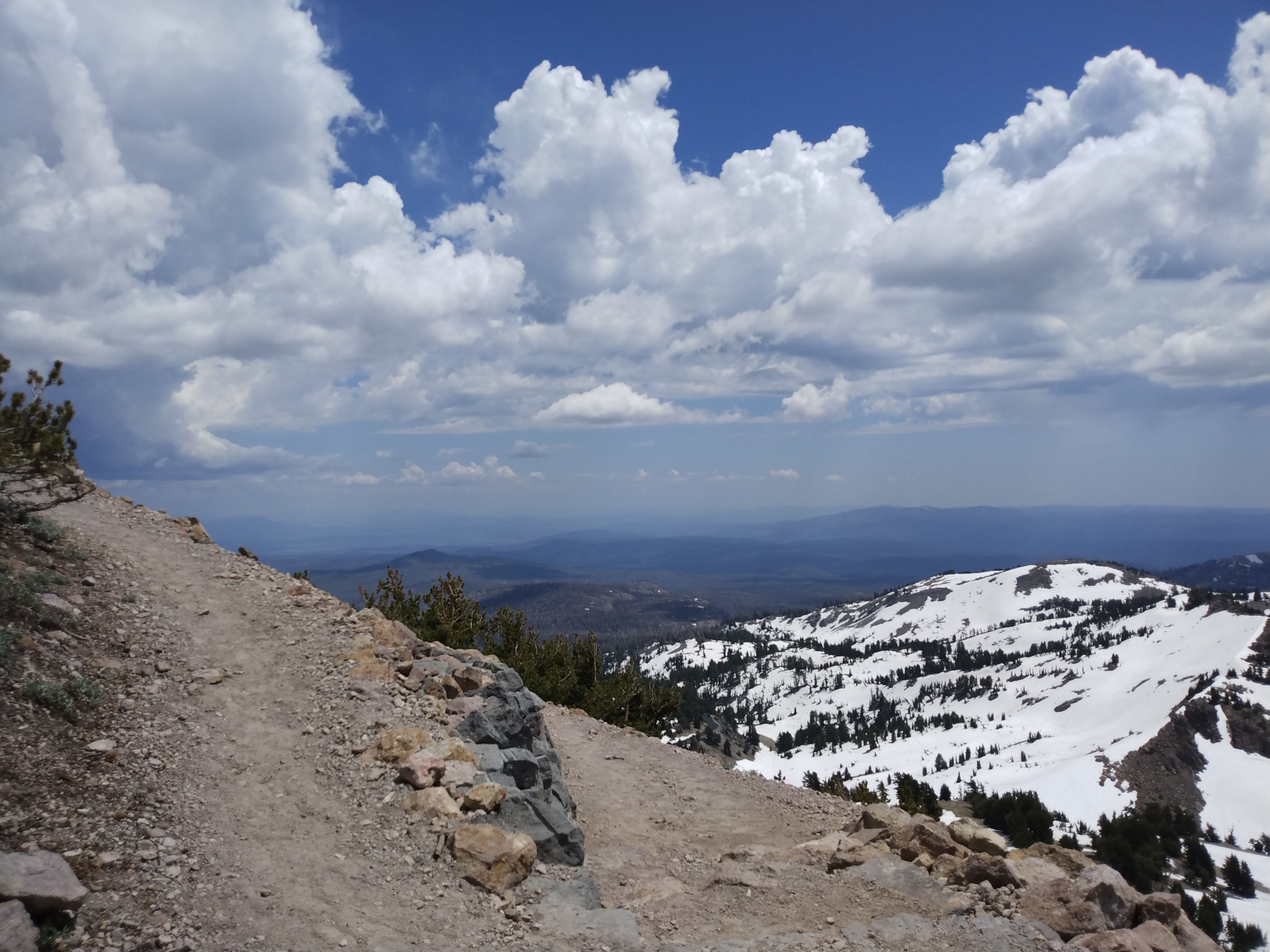
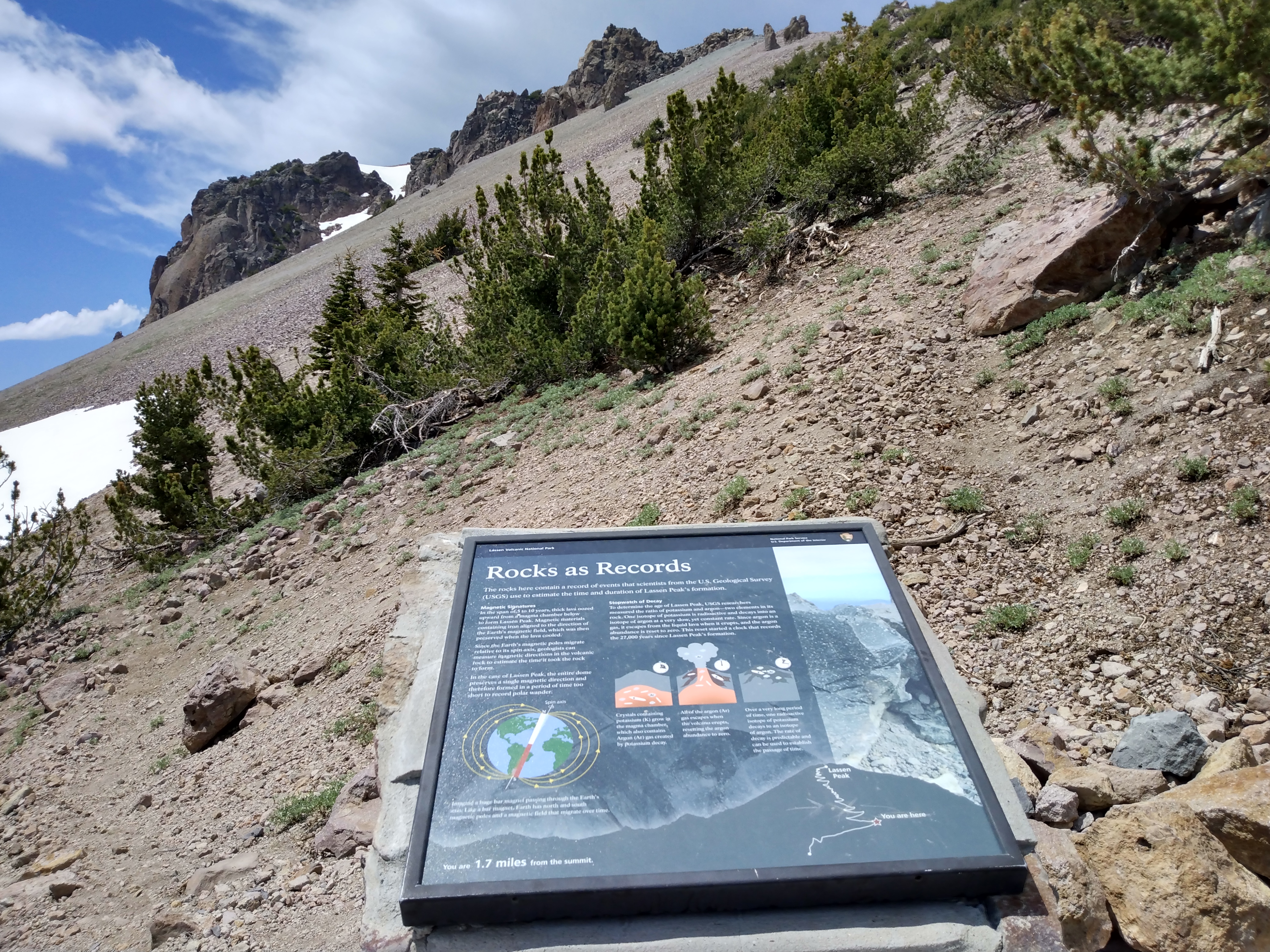
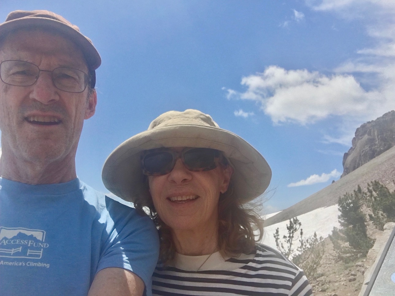
The sun comes out again, though it's still dark to the N. We continue, crossing about 200' of snow before rejoining the trail. We keep going for about a half mile, crossing occasional sections of snow. We turn around at a marker 1.7 miles from the summit, mostly because we don't want N to wait too long.
I feel great, and being on a large mountain like this puts my in an extremely good mood. I'd be happy even if we were drenched with icy rain.
We descend. The weather becomes slightly threatening again. M's knee has some twinges but it's manageable.
Near the bottom we chat with an Asian family (Bhutan? Nepal?) that has stopped, deciding what to do. I take their picture and encourage them to keep going and 'have an adventure'.
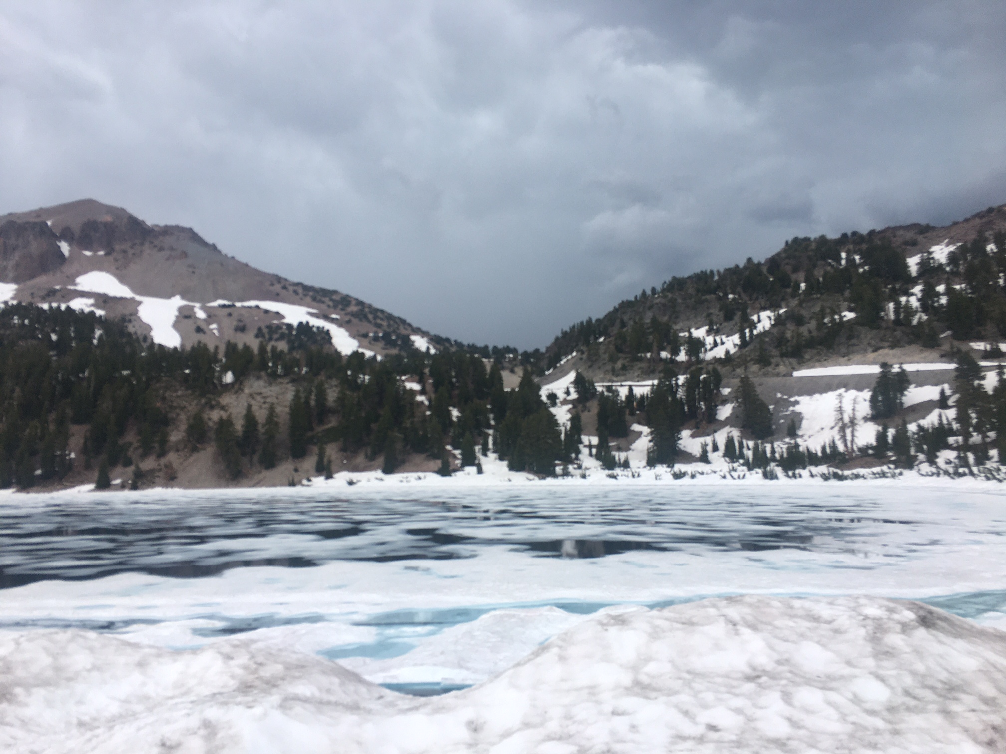
N has been waiting for a while and is a bit impatient. We start driving, stopping at half-frozen Helen Lake for M to take a picture.
We stop at an area of sulphurous fumaroles and admire a bubbling mud-pit. At least, M and I do. N just wants to keep moving.
We continue on 89 and then 36 to Red Bluff, then S on I-5. We stop at a rest area S of Williams. A tall woman (possibly trans) is wearing glittery silver-sequined pants and extremely high platform shoes.
The rest of the drive is pleasant, although N throws a minor fit when I say I'm going to hose off the car before returning it to Erica.