Matterhorn Peak
Aug 11 - Aug 13 2011 |
random trip report |
[Click images for large version and again for full resolution]
This winter's snowpack was exceptionally large. This concerns Dave, but the ranger assures him that there are steps kicked into the snow near the peak, and that we won't need crampons. He buys a wilderness permit in advance.
This climb, I know, is going to be hard; nearly 6,000' vertical over 7-8 miles, rough trail, medium pack. I have some health concerns: bad sciatic pain on the descent of my last big hike (Mt. Ralston and Lake Aloha), and a swollen left ankle from getting banged by a softball 3 weeks ago. I've done a few training hikes with 20-lb pack in Claremont Canyon. The ankle prevents me from wearing my hiking boots, so I take my old Garmont approach shoes instead.
I've also resurrected my back-stretching machine and enhanced it with a cinch based on a car-top tie-down; I've used this quite a bit.
Dave has been on a fitness jag, running and hiking 6 days a week. He offers to carry both our tent and the bear canister of food, so his pack is about 10 lbs more than mine. I feel guilty about this, but not guilty enough to change it.
Thursday 11 Aug 2011
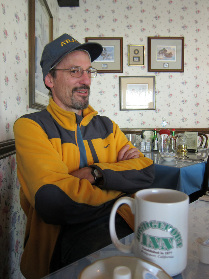
Dave's flight from Seattle to OAK is delayed, but I pick him up around 15:30 and we hit the road. We take hwy 108 and go over Sonora Pass (9,600') as the sun goes down behind us. The sky in the east turns a mystical pale lavender.We check into the Redwood Motel in Bridgeport (recommended), and head down the street to the Rhino diner/bar for dinner. A group of 6 local women, 35-ish, enter and sit at the next table, rowdy and boisterous, After a few minutes they chant, loudly and in unison:
The men who we love
Will never love us
So fuck all the men
And here's to us!
... and toss down double shots of booze. I warily borrow a pen from one of them to jot down these words on a napkin.
NOTE (6/8/2021): I now believe that this is based on a song called A Toest to Men by Willa Ford.
Friday 12 Aug 2011
Because of a technicality, the permit that Dave reserved is no good, so he gets up at 7:00 and heads to the ranger station to get one of the 4 walk-up permits. While there (shivering), he chats with a mountain guide who says that in fact there is steep snow near the peak, and that crampons and ice ax are required. He also warns us of mosquitos.
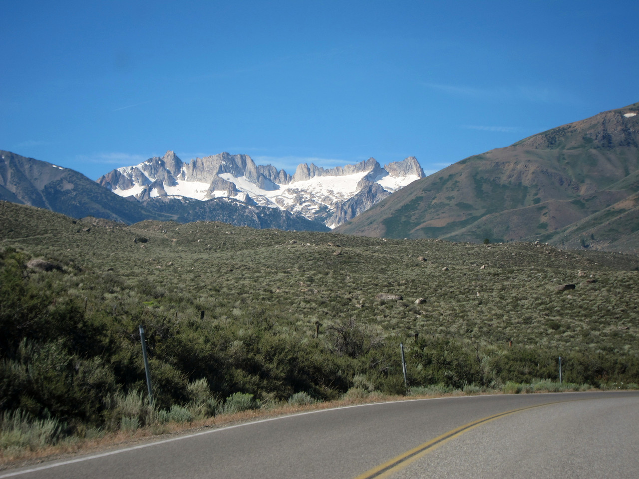
The Sawtooth Ridge, seen from Bridgeport
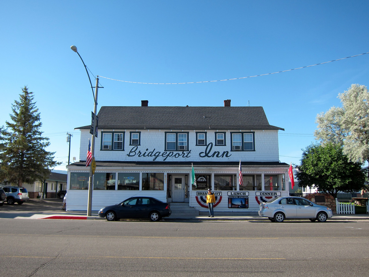
We have breakfast at the Bridgeport Inn, then pick up sandwiches and bug spray at the general store.
We drive to the fishing-oriented resort at Twin Lakes and pay $10 to park in the "backpacker's lot". Most of the campers are in enormous shiny RVs. We're on the trail around 10:30, Actually, we futz around for 10 minutes trying to locate the trail; there are no signs. Finally some local walkers pass through and show us where it is. They tell us there will be a horse race on the trail the next day.
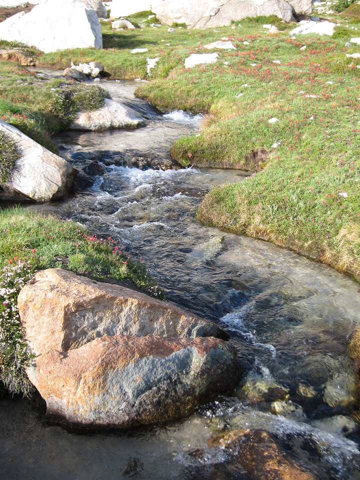
The trail goes up a slope on the east side of Horse Creek. The first mile or so is switchbacks, occasionally going near to the creek, which has a series of cascades going down the slope. The slope is partly covered with a mixed conifer forest, including some beautiful Ponderosa pines; I stop and sniff their sweet-smelling bark.
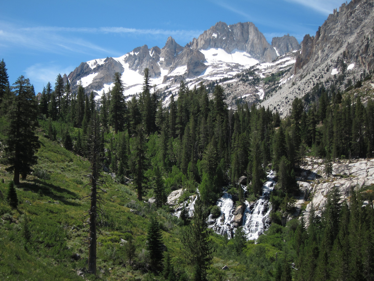
Note cascades
Then the trail levels out and follows a shallow valley with a lush meadow at its floor. There's an area in which beaver dam activity flooded the meadow and drowned a bunch of pine trees. Dave walks across a downed tree spanning Horse Creek. We see a group of 2 young deer.
At one point a rock slide covers the trail, and we have to navigate through huge boulders.
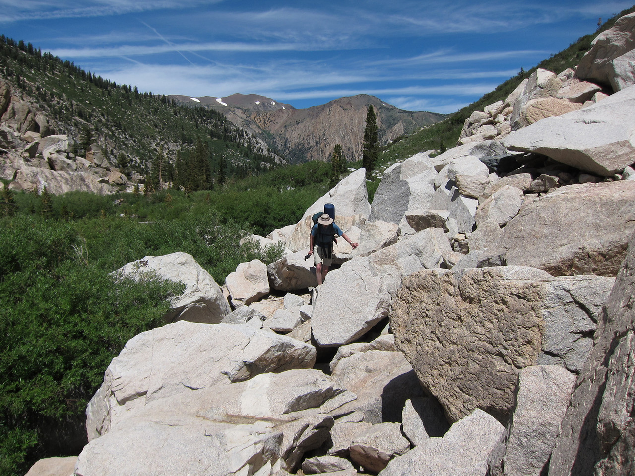
The rock slide
It's a warm day - maybe upper 70s - and we sweat. Occasionally a refreshing cool breeze rolls down from the snowy peaks above us. We pass 2 rock climbers, with the same destination as us, carrying ropes, climbing gear, and crampons.
I'm feeling fine, but I have an impending-doom feeling that one of my ailments will flare up, especially the sciatica. I try to suppress this and enjoy the moment.
The valley abruptly steepens into a large field of medium-size, unstable scree.
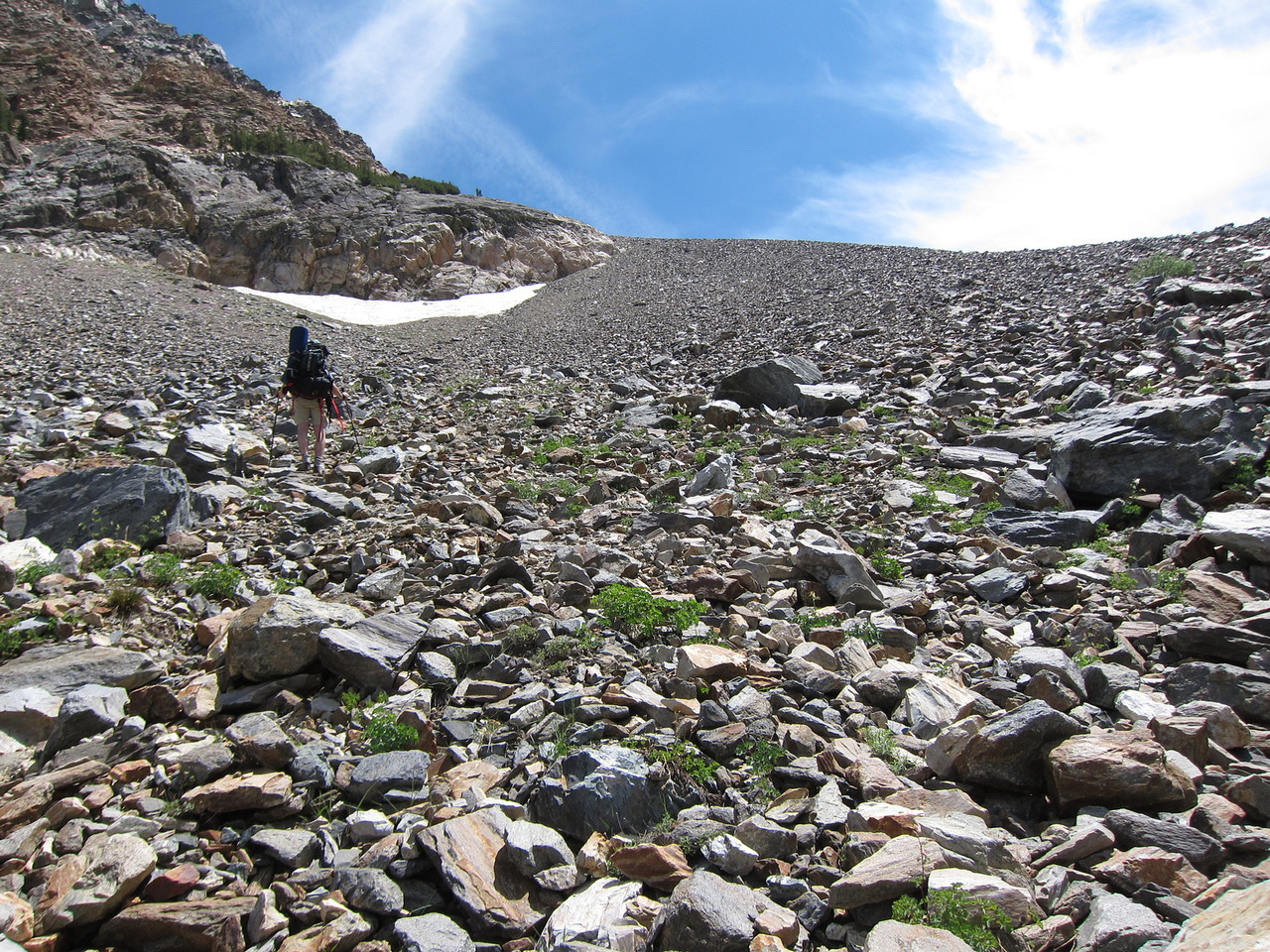
Scree
I follow the path up through the middle of this, but about 3/4 of the way up I realize that correct path goes up the right edge. So we traverse, nerve-wrackingly, occasionally triggering small rockfalls.
The trail is marked sporadically by cairns. However, the biggest cairns are in places where the trail is obvious, while at many crucial junctures there are none to be seen.
The trail continues, unrelentingly steep, up the ridge on the right. Eventually it tops out on small plateau with a grassy clearing; we decide to stop here for lunch and eat our sandwiches. It's 14:00. Dave takes out his guidebook, which vaguely describes the location of the Kerouac camp site. On a hunch, he wanders along the plateau a little. Lo and behold! The camp site is just around the corner. I wouldn't say the rock is the size of 2 houses - maybe 1/4 of a house - but it overhangs a good 6', and there is charred wood nearby; clearly this is the place. Dave writes some graffiti in charcoal.
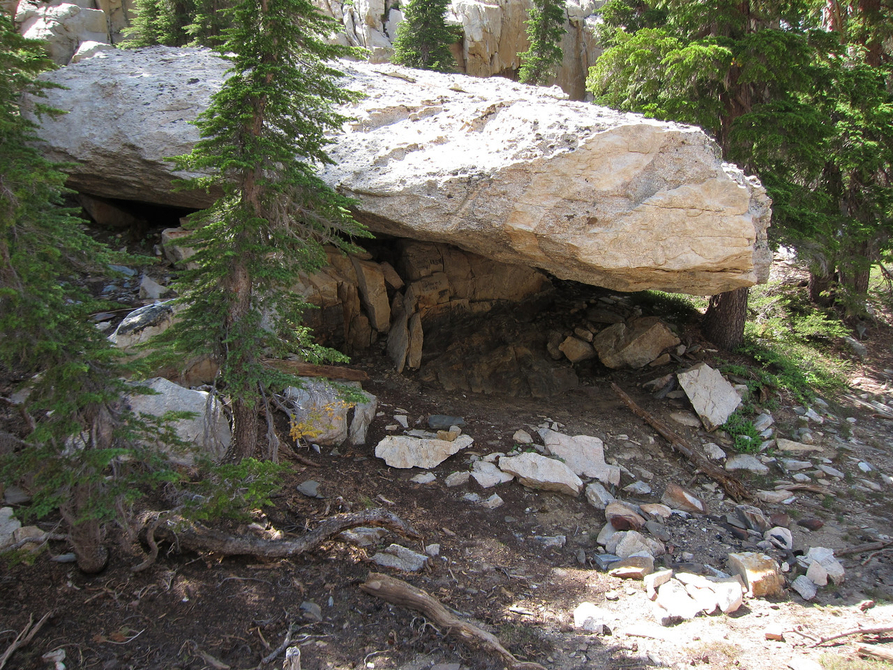
The Kerouac camp site
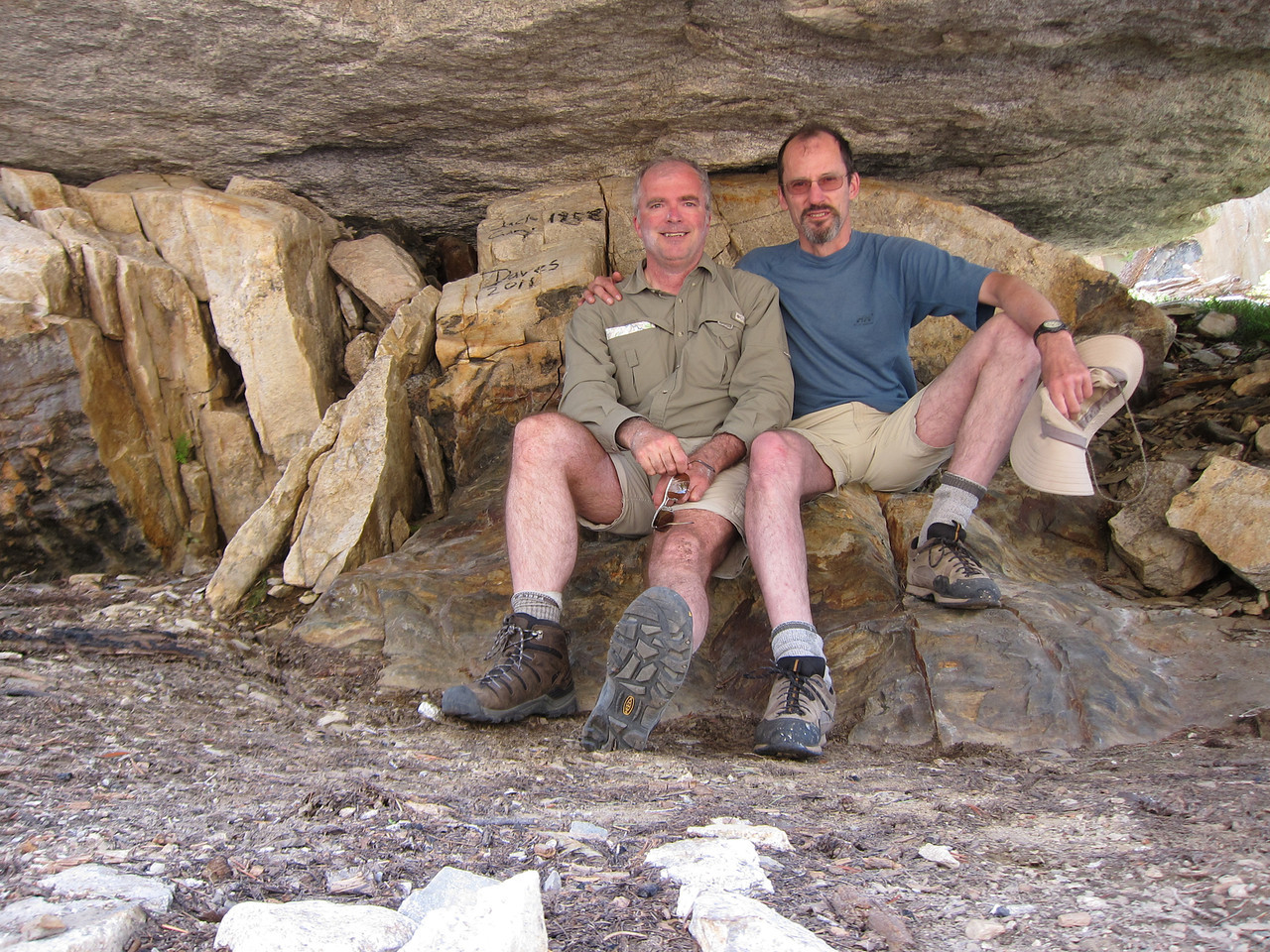
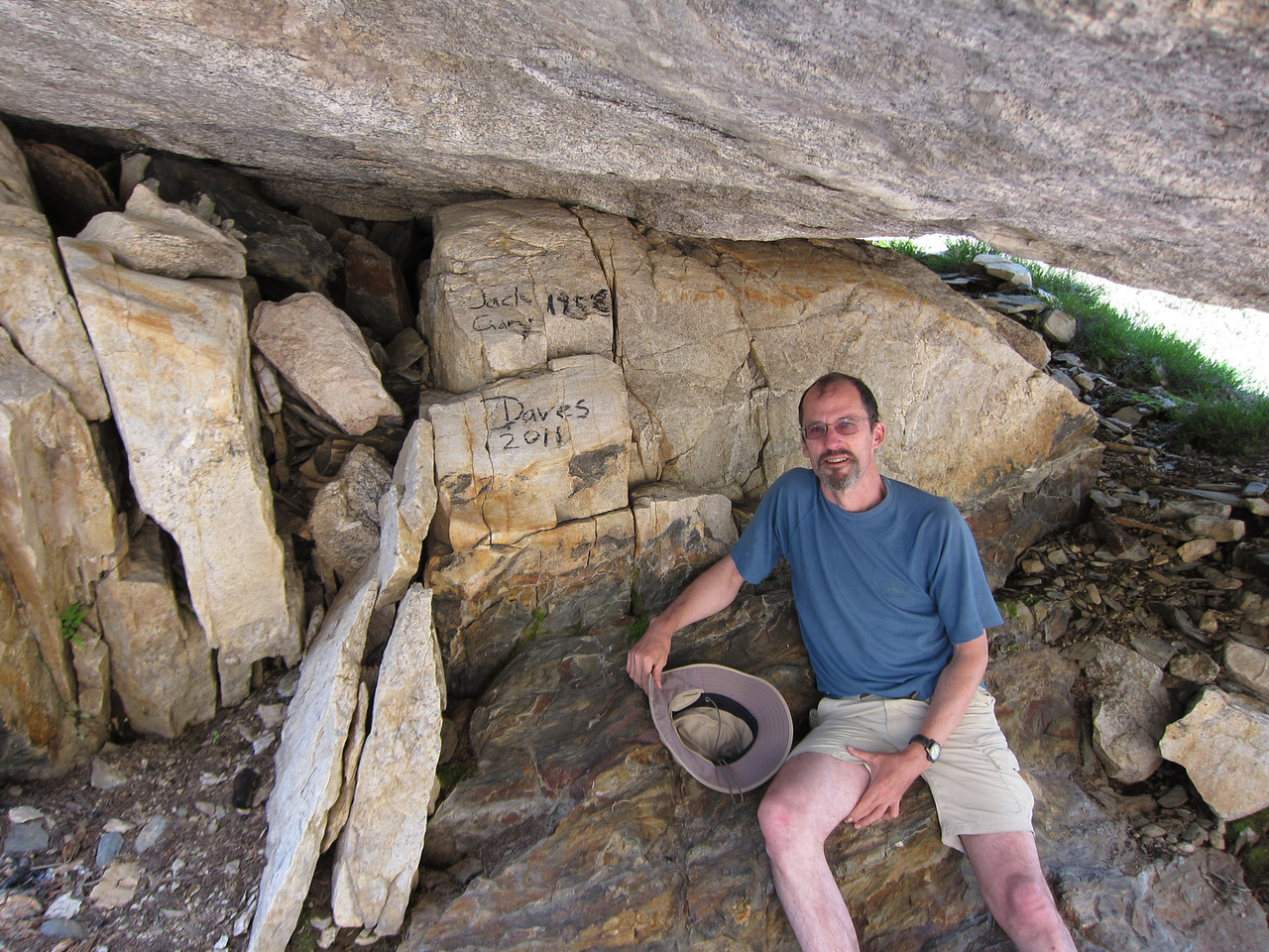
Note graffiti
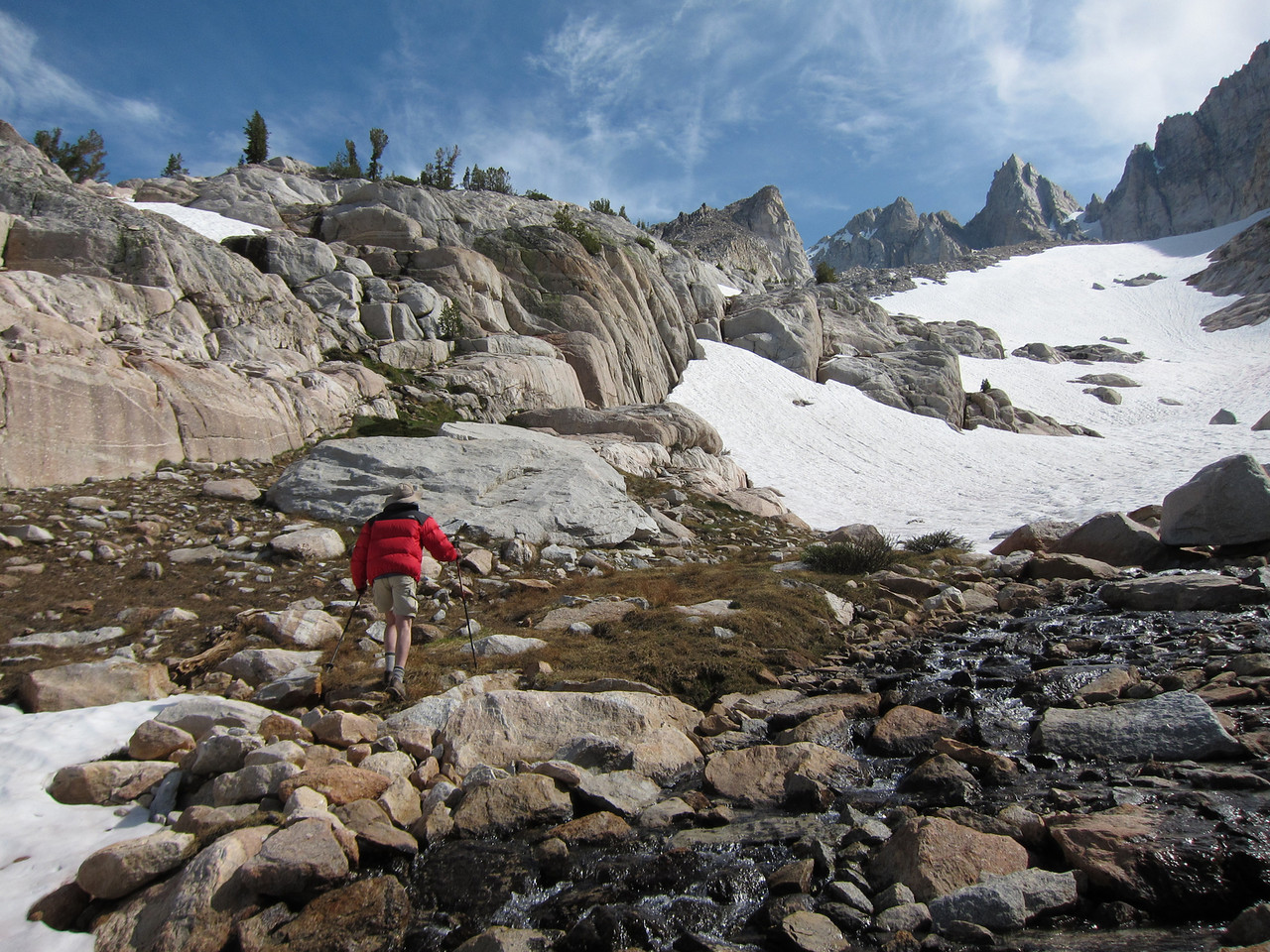
We continue up. The trail goes from steep to extremely steep, and finally there's a long slope where it turns into a web of alternatives, all of them consisting of loose dirt and rocks, similar to the last part before the Mt. Conness plateau, coming up from Alpine Lake.
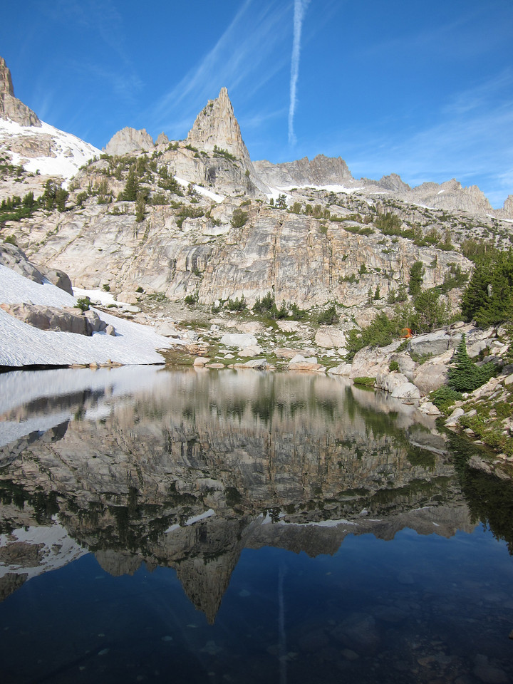
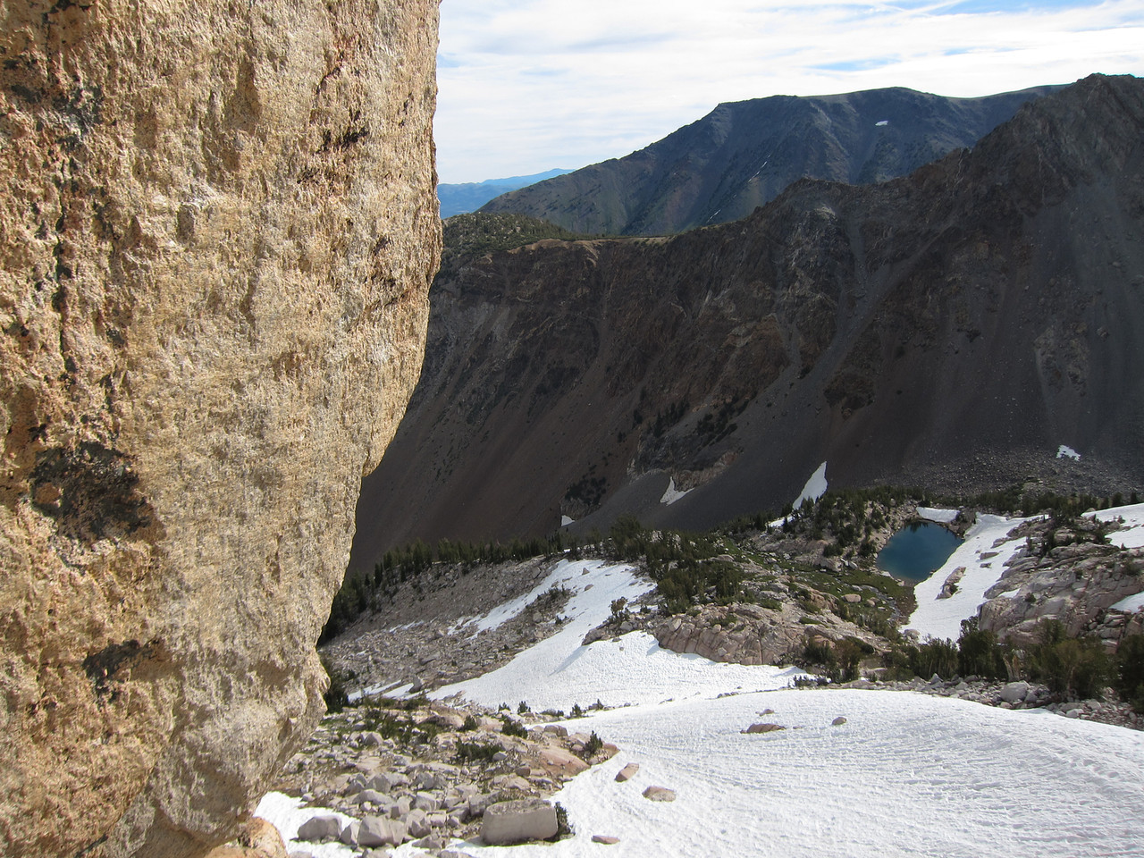
Topping out on this, we arrive at a small rectangular mountain lake, situated at the base of an immense snow field, reminiscent of Avalanche Gulch on Mt. Shasta, leading up to Matterhorn Peak.
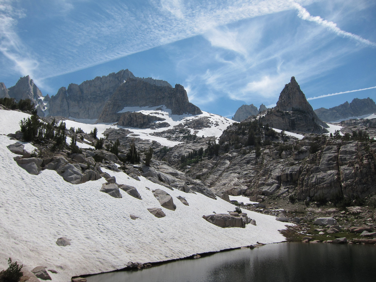
The tarn
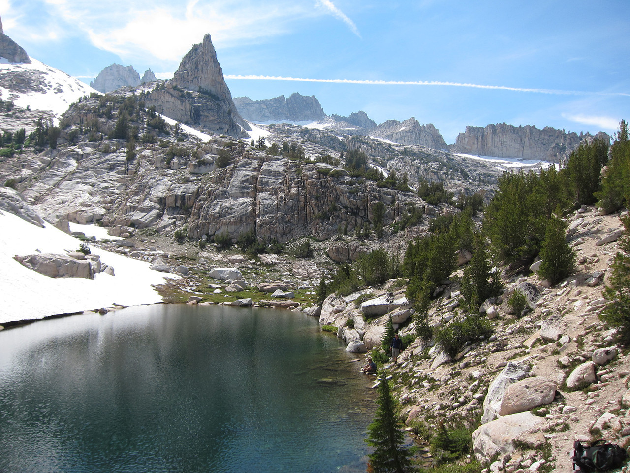
The Awl is at left, the Cleaver at right in the distance
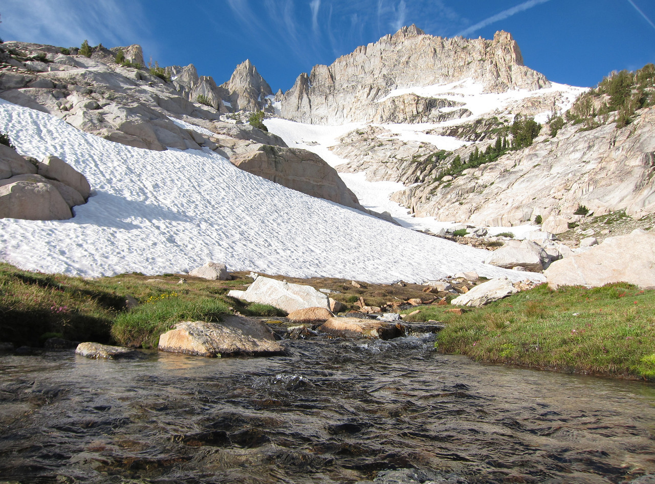
At the far end of the lake there's a rolling grassy area, through which a small but spirited stream runs.
We explore this, locate a fairly flat and dry area, and pitch our tent. The air is dense with mosquitos, but the bug repellent works very well.
The grassy area is lushly green and scattered with wildflowers, including a lot of scarlet Indian Paint Brush. The scenic gestalt is absurdly beautiful; Dave says it's among the best he's ever seen, and he's seen a lot.
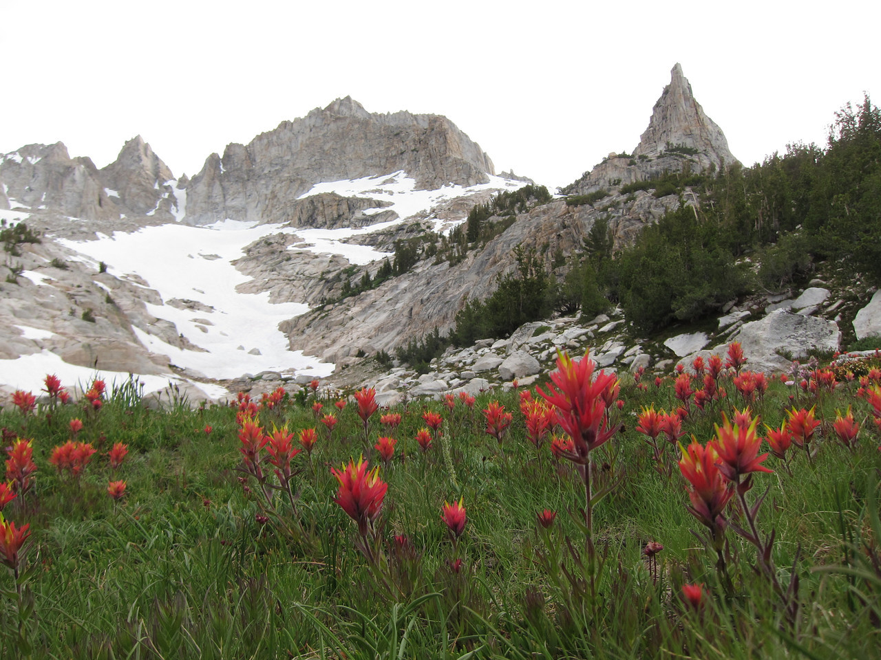
Indian paint brush
I'm parched and out of water. I filter a bottle from the babbling brook (probably not necessary, since it's melt from the adjacent snow). It's cold and delicious. I drink a quart, and altogether I drink about 4 quarts that day (that's a lot for me). This may be why I have minimal cramp problems.
By this time it's around 16:00. I'm pretty beat, but Dave wants to do a reconnaissance hike to check out the conditions nearer the summit. I reluctantly agree. We head up the rocky ridge on the left side of the snow field. We have to cross a few sections of snow, and it's alarmingly slippery although not very steep.
After about 15 minutes I find a nice resting place and tell Dave to go ahead; he says he'll be back in 20-30 minutes. I lie down and amuse myself by swatting mosquitos. Time goes by. After 40 minutes Dave is not back, and I start to worry. I have a clear view of the long slope above, and no Dave. I shout a few times; once I hear a faint reply, but I can't tell whether it's distressed.
I slightly freak out and start out uphill, continuing to shout. After a few hundred yards, Dave appears atop a moraine ridge well above me; he was exploring beyond this ridge and was hidden from my view. Big relief.
Dave says that beyond the moraine ridge you have to descend 100' into a large snow-filled bowl. The culoir to the left of Matterhorn Peak (our intended route) lies directly above this. To reach it, however, you have to climb the steep far side of the bowl. Steps have indeed been kicked into this, but that section is steep and lies directly above some rocks.
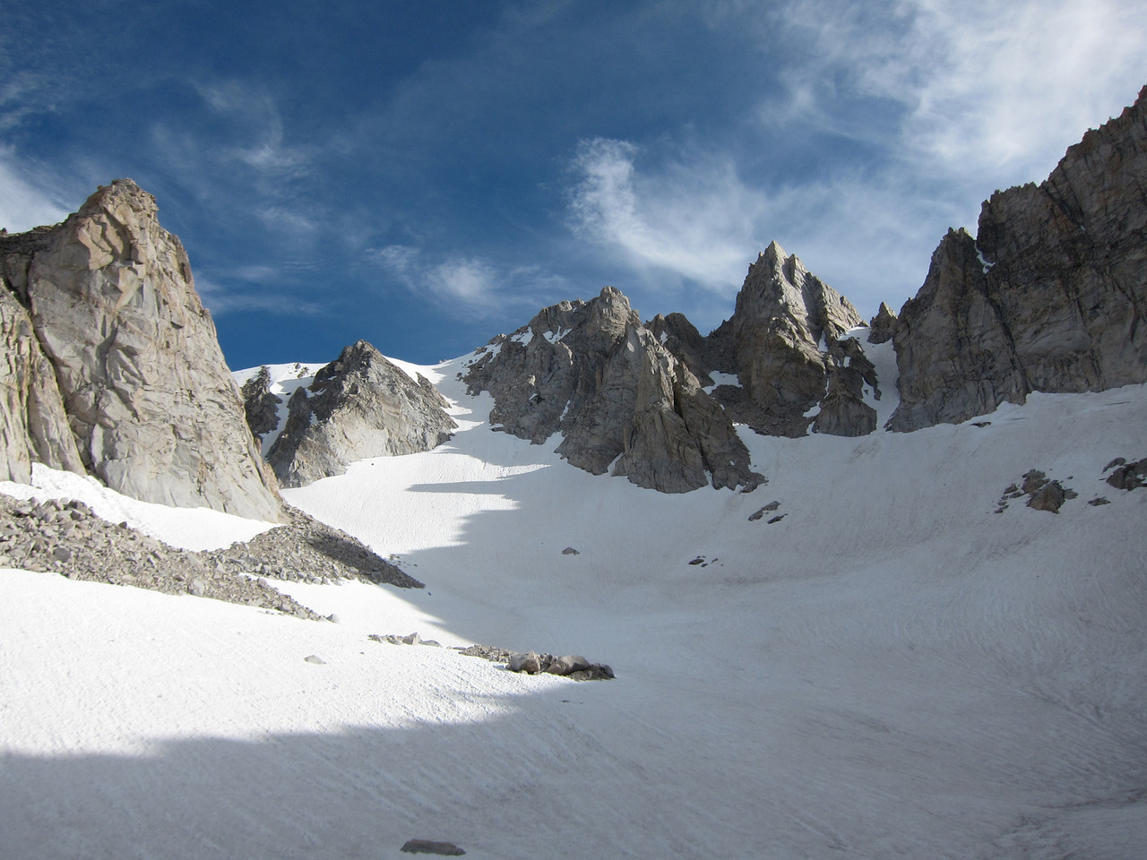
Dave took this at his highest point; it shows the bowl we'd have to cross. Note snow patch in left culoir
Furthermore, the culoir itself has a big patch of snow that extends from one side to the other; it's not clear that we could get around this on rocks.
We mull this over and reach a clear-cut decision: without ice ax and crampons there's absolutely no way we can get up these 2 areas of snow.
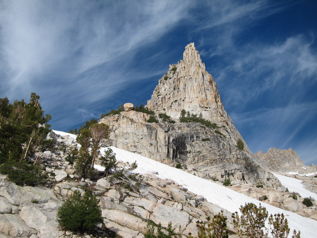
Looking for alternatives, we survey the terrain on other side of the snowfield. There's a huge needle of rock, which Dave incorrectly identifies as the Cleaver (it's more like the Awl). At its foot are some cliffs, and perched precariously on the edge of the top cliff is a gigantic rock, evocative of Wile E. Coyote and the Road Runner. We decide to pay this rock a visit the next day.
The light is fading as we descend to camp. It's getting cold, and I put on all my fleece and down. Dave's JetBoil won't light, but fortunately he has matches. He enjoys his freeze-dried Chicken Teriyaki and I have a Ramen bowl (salty!) and a chunk of salami.
I crawl into the tent and prepare to rest, while Dave goes out for a last photo-shoot.
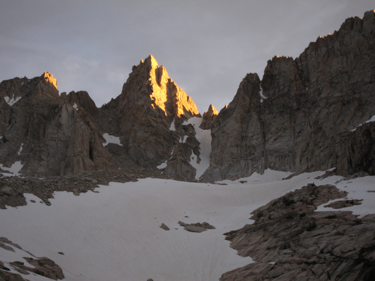
Matterhorn Peak at sunset
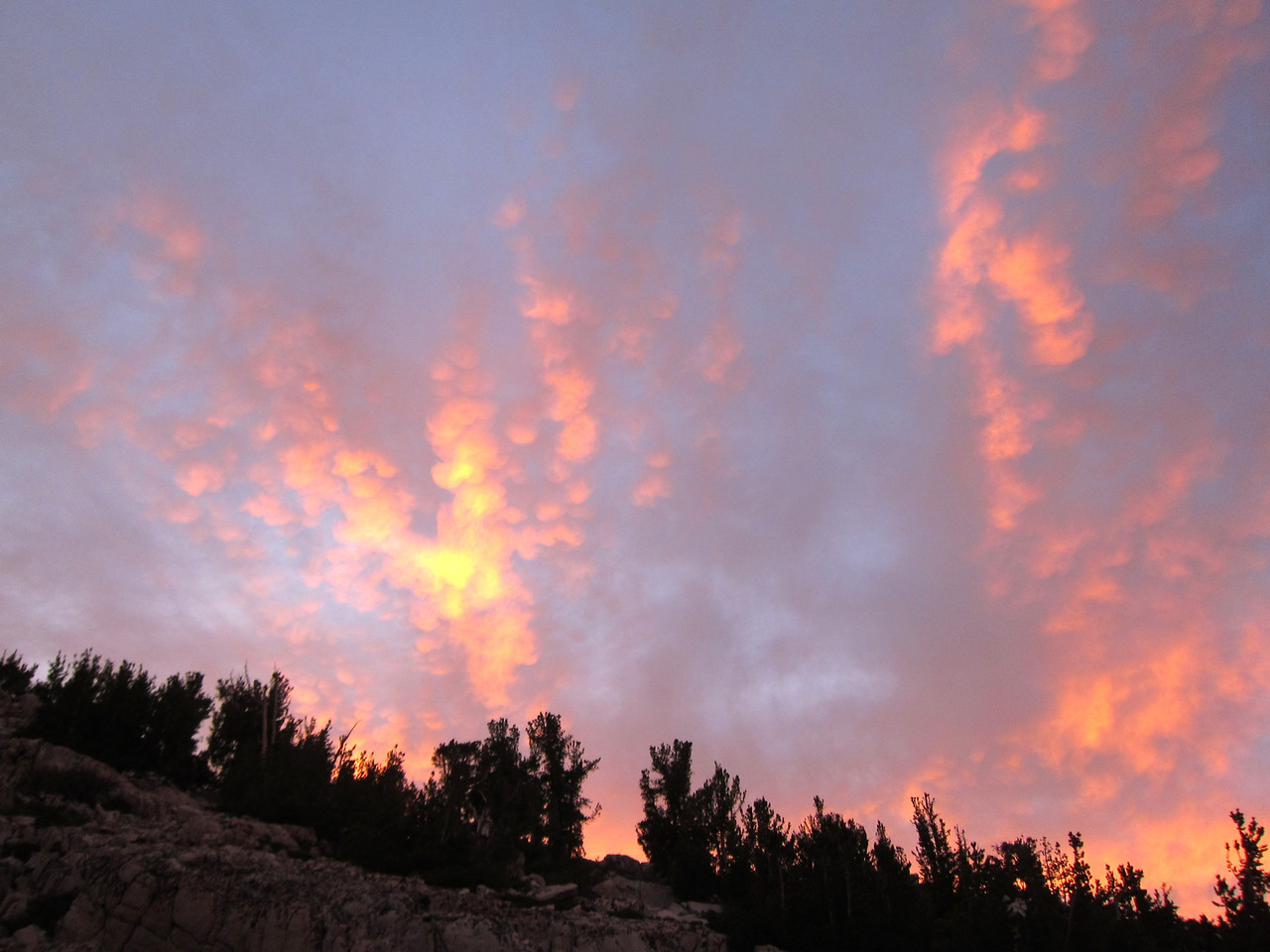
Dave retires as the full moon is coming up behind the mountains above us. It's windy but not super-cold, and in our down bags we overheat to some extent. We both have terrible sleep - me because of the nasal congestion I always get in cold/dry air, and Dave because of physical discomfort and my snoring (though my perception is that I never slept). The moon passes overhead like the hour hand of a clock. Mercifully it starts to get light.
Saturday 13 Aug 2011
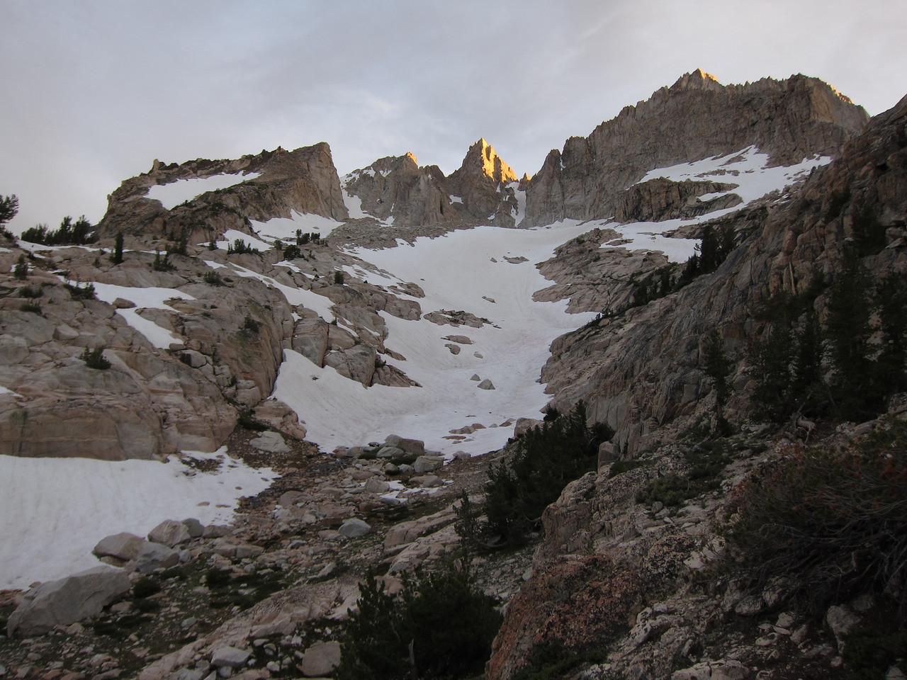
I drag my ass out of bed. I'm a little stiff, but after 2 packets of instant oatmeal, a steaming cup of Starbuck's instant coffee, and the warmth of the newly risen sun, I'm feeling pretty good, and life-energy returns.
Matterhorn Peak in the morning light
Dave takes some more pictures.
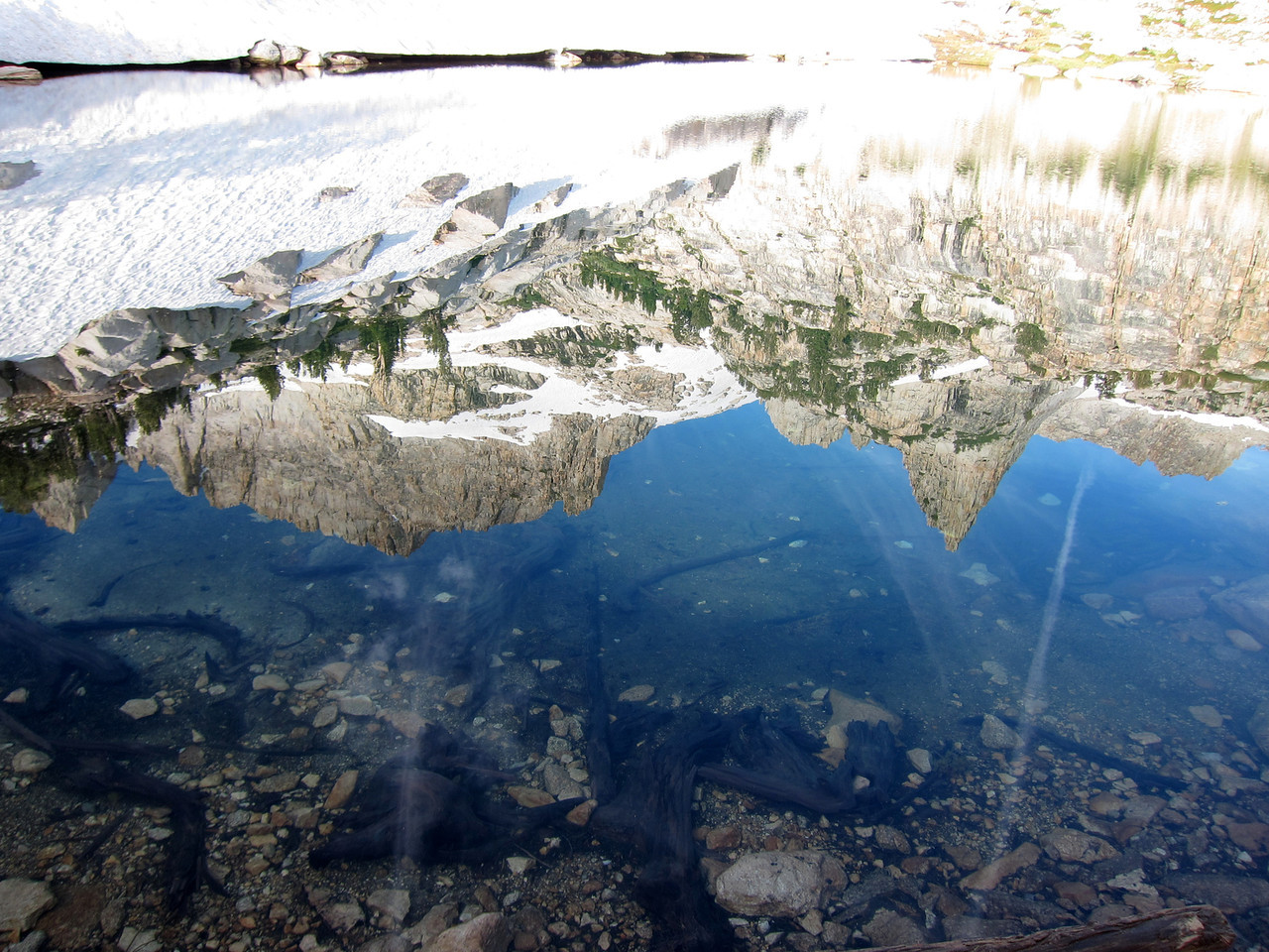
Fancy reflection shot
The Awl; Doddering rock barely visible
We set out up the ridge on the right side of the snow field. We're traveling light - just 2 water bottles in my day pack. The climbing, through a maze of boulders and stunted pines, is delightful, a sort of aerobic dance. Soon we reach the base of the cliff where giant rock is. The left side offers a way up, and soon we're at the rock. I dub it "Doddering Rock" in reference to my nontrivial age.
Doddering Rock
Mark Daly recently told me a story where, by repeatedly pushing a giant rock at a certain resonant frequency, he was able to set it to rocking. I try this, but this rock ain't budging. It would be climbable (V2 or so) if I had climbing shoes, but I decide not to risk a broken ankle.
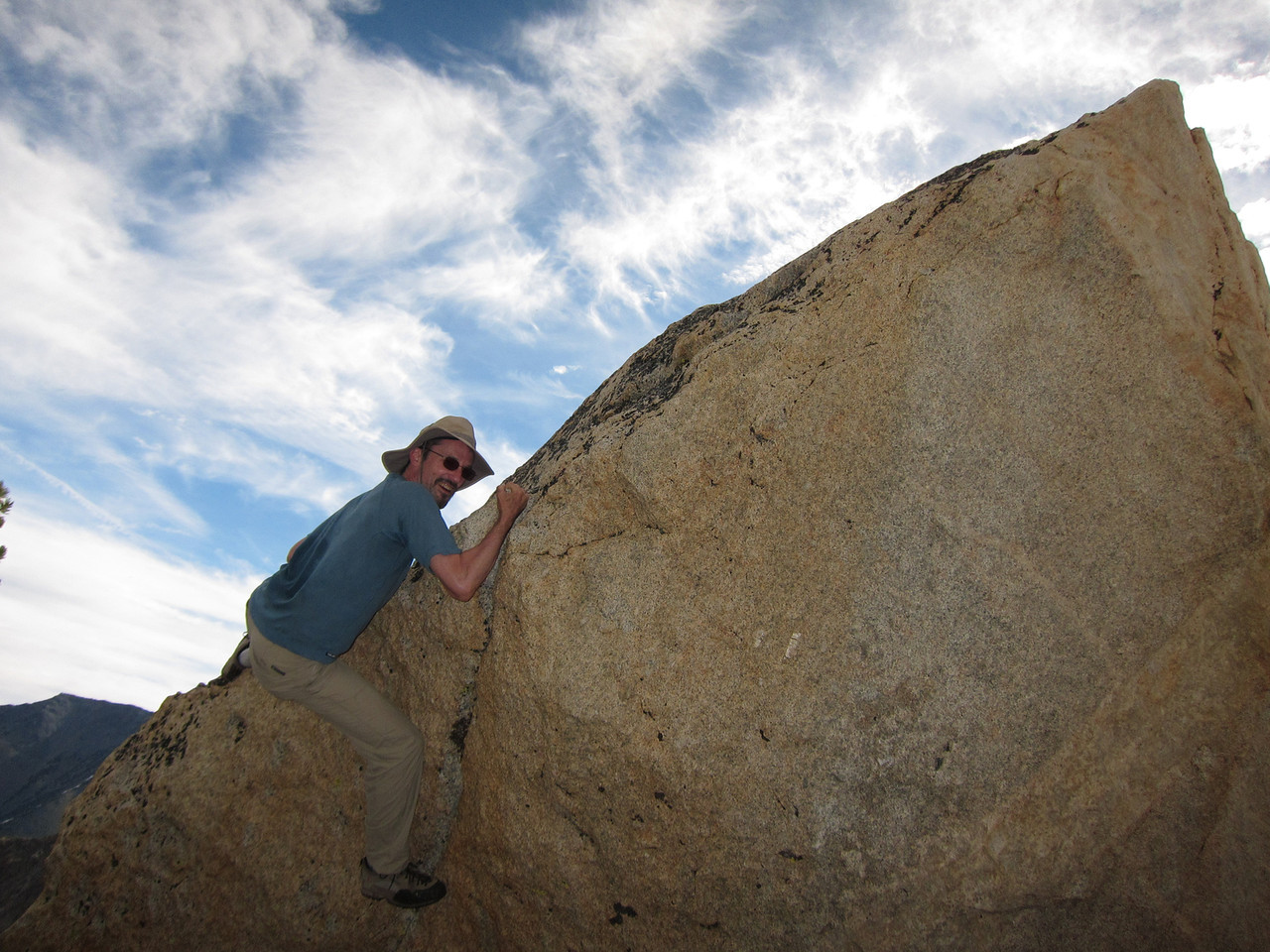
A half-hearted attempt
Tarn viewed from Doddering rock
The Awl is directly above us, maybe 250'. Although it's nearly vertical, Dave and I can discern a series of ledges that seem to be connected in a climbable way. We agree that if we had a bit more time, and climbing shoes, we'd give it a try.
Time to head back down. Dave navigates back to camp, which is a bit tricky. We break camp efficiently and at 11 we shoulder our packs, skirt the lake, and head down the steep/loose part.
If my sciatica is going to flare up, it's going to happen on the descent. I focus on maintaining neutral lower-back position and avoiding shock-producing steps on my left foot. This works - no back problems!
We work our way down the various sections of the trail. It's hard because of the packs, which raise our center of gravity and make us wobbly. The stretch of scree before the lower valley is especially long and tedious.
I notice that, on the way up, my brain recorded hundreds of images of little things - particular rocks, cairns, plants, mud. Coming back down, I recognize many of these: time-reversed deja vu.
After crossing the last rock slide we surprisingly lose the trail and have to sniff around for about 10 minutes.
As always, the last couple of miles drag on a bit. No signs of the horse race. At a point where the trail goes by a cascade, there is the depressing sight of some food strewn on the ground, its plastic container nearby. Who would do something like this? (hey: don't misunderestimate America). Dave picks up the container and carries it down.
Our car is a welcome sight. Dave wants a shower, and it turns out the resort has a coin-op shower, 2 minutes per quarter. A couple of guys in a van ask me about fishing. When I tell them I backpack they express interest, but only because of the possibility of fish in those high mountain lakes. I get a soft-serve ice cream cone and change into dry clothes.
Refreshed, we hit the road. We stop at the Shell station in Bridgeport for two gallons of gas ($4.89). We play a couple of games of Bratislava ("Skeleton Coast", "Going to the Sun Highway"). We fill up in Sonora ($3.63) and drive straight through to Oakland airport, arriving in plenty of time for Dave's 20:15 flight, and even enough time for me to see Noah before his bedtime.
Summary: a great trip, one of the best ever. We're not disappointed about not summiting; it was ruled out both by the snow conditions and by time constraints.
The next morning I have a slightly stiff lower back and itchy mosquito bites, but everything else feels great - legs, knees, feet. I'm very encouraged by this; there are still a few climbs left in me, apparently. I need to figure out some way to deal with high-altitude nighttime congestion; pills maybe, except they may have bad vascular effects.