Lion's Head Revisited
June 25, 2001 |
random trip report |
In August 1998, Dave Weinberg, Ron Kuivila and I made an attempt on Lion's Head Peak in the West Gallatin range, just outside of Yellowstone National Park. The attempt was unsuccessful, doomed by route-finding problems (we ended up on a mountain that was, in fact, not Lion's Head) and by logistical errors (we brought miniscule amounts of food and water). The failure has stuck, like a tiny piece of a granola bar, in our craw.
Three years have passed.
I'm once again visiting Ron and Bobbi
at their rustic villa in Lazy Acres, near West Yellowstone.
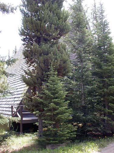
Ron and Bobbi's cabin.
Ron and I, grizzled but unbowed, pore over our maps late into the night, plotting our line of attack. I check the batteries in my new GPS. The womenfolk (Bobbi and Lynne) roll their eyes and discuss possible river rafting and shopping.
Monday dawns cloudy and cool. I've slept badly and am feeling weak and flu-ish. I borrow a walking stick from Bobbi. We drive a mile south on highway 20, turn right onto an unmarked dirt road, and drive a mile to a locked gate, where the women drop and Ron and me, and promise to leave a car by 5 PM (they need both cars for rafting).
It's 11 AM. The road jogs uphill and becomes a Jeep/ATV/snowmobile track. Instead of striking out across a meadow, as we did in 1998, we continue on the road, which winds uphill and past red-tinted cliffs.
We stop for a water break. Ron rummages through his pack. He has forgotten his water bottle - an eerily familiar omen. Fortunately he has a ziploc bag full of melon chunks, which are mostly water.
After 2 miles the road curves around the base of
some towering scree-skirted bluffs.
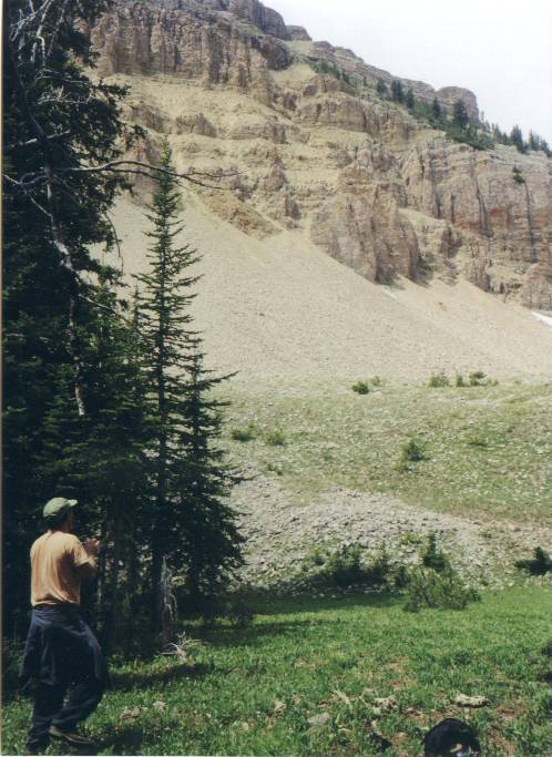
Ron skeptically examines Lion's Head.
This is clearly Lion's Head Peak, but Ron, who walked this same road a few days earlier with his brother Hank, insists that the true peak will be visible once we round the bend. This illusion is soon shattered. We stop, have some food, and plot our course: back across the base of the scree, then up a tree-covered ridge that goes to the summit.
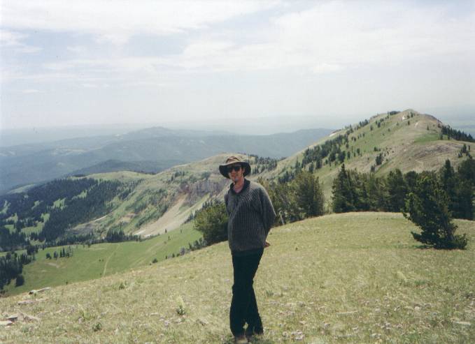
The easiest path turns out be a steep gully next to the ridge.
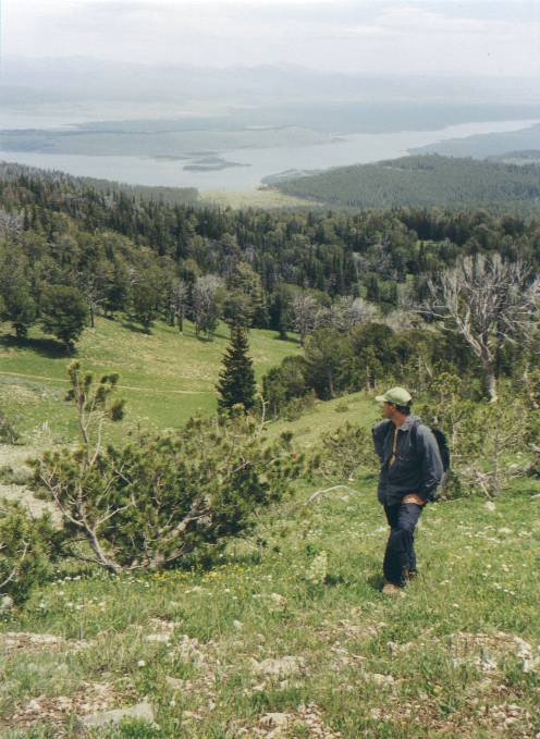
Starting out up the ridge. Lake Hebgen in background.
It's mixed dirt and rock, and so steep that we need to kick in with our toes and balance. Ron heads for the more solid rock along the left of the gully, and soon generates a rockslide reminiscent of our first trip. Fortunately I'm 100 feet to the right. There are many tiny shells that look like seashells but must be some kind of snail. A rock has what appears to be a fossil of a half-inch scalloped shell.
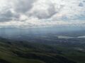
We gain about 1000' (8,600' to 9,600') in a brutal half-hour climb. The gully ends near the summit, which features a small cairn and a T-shirt flying from a stick. The view includes nearby Lake Hegben and, in the hazy distance, the back side of the Grand Tetons.
But mostly we're interested in Mt. Baldy, which lies about a mile to the south, and looks quite forbidding: sheer precipices on all sides. A ridge connects the two mountains, but it's useless for scaling Baldy; it ends at the base of some vertical cliffs.

Mount Baldy. Only ascent path seems to be ridge w/ trees. Targhee Creek is in the canyon between Baldy and the next ridge.
|
We plan our descent.
A fairly gentle ridge descends from
the summit of Lion's Head all the way to the trailhead area,
running along the top of the red cliffs we passed earlier.
Continental divide ridge. Red cliffs left of my neck. We set off down the ridge, following a deer trail. We pass what looks like bear scat. Ron: 'If it's not bear scat now, it will be by the time we get back'.
Ron finds an inflatible vinyl doll under a fallen branch.
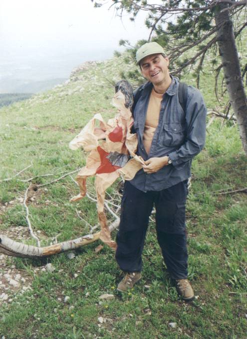
Ron's new friend. Note duct tape. Later I find part of a snowmobile windshield. These two pieces of plastic are, we think, linked at some level. The ridge has two medium-size knobs; we traverse around them to the left, then the right. The going is very easy. 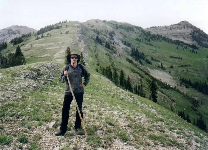
Near end of ridge, looking up to Lion's Head Peak (right). We look down on the meadow we labored over in 1998 and are gripped by vivid flashbacks. We have a bird's-eye view of our 1998 path up Baldy. Ron and I agree that Baldy should be done as a two-day trip, and that the best approach is along the nearly-level Targhee Creek, rather than all the up-and-down we did before. The ridge we're on is the Continental Divide; drainage to the left runs to the Atlantic; to the right, the Pacific. In honor of our sorely-missed friend David Gedye we conduct demonstrations of this phenomenon.
The ground is covered with wildflowers:
tiny yellow flowers like firework bursts;
cobalt blue wild iris; periwinkle; scarlet artist's brush;
and surreal daisies with violet leaves and gold centers.
We agree that this hike is one of the most spectacular ever.
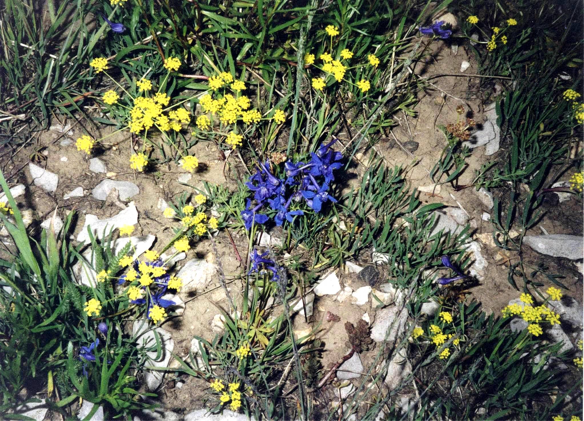
Some wildflowers (click for super hi-res version). The ridge enters some trees, and we look for clearing on the left leading down to the dirt road. We scramble left a bit. Ron expresses uncertainty about trail; is it across the valley, about a mile to our left? No sooner has he said this than we see the road about 30 feet below us. We reach the road, but it doesn't look familiar; there's a view of Lion's Head that we don't remember. This is where the GPS comes in handy. It tells us the road is going in right direction, and we're 1.13 miles from the trailhead. I.e.: this is the right road. If we had kept straight on the ridge we would have met the road. For future reference, the landmark is a group of three tilted rocks, each 20' wide, just uphill from road. We reach the trailhead around 4:15. No car. We continue down the dirt road to the highway, arriving there at 4:45. We wait until 5:30, then head for the cabin, leaving my walking stick with Ron's cap on top stuck in ground, like a grave marker, for the women to see. We take a side road and pass some old ruined log cabins. One of them has intact windows and two old refrigerators - very mysterious. We reach the cabin and rush to the BarcoLoungers with cold beers in hand. The women eventually arrive, with a weak story about getting stuck in traffic. We discuss compensation involving foot massages and the peeling of grapes, but the debt remains outstanding.
Injury reportMy shins and calves are very sore (possible residue from earlier running). Mild nerve-pain in left lower back, and medium back stiffness/soreness. Feet are mashed by slightly too-small hiking boots. Ron is sore but OK.Other notes from the trip
Lynne and I flew into Salt Lake City on Saturday 6/23
and got to West around 3 PM.
Ron drove us to Sawtell Peak, on the south side of Henry Lake.
The road goes all the way to the top,
which has a gigantic FAA radar dome.
We scrambled across some wild volcanic rock,
and surveyed a ridge walk to a series of higher peaks.
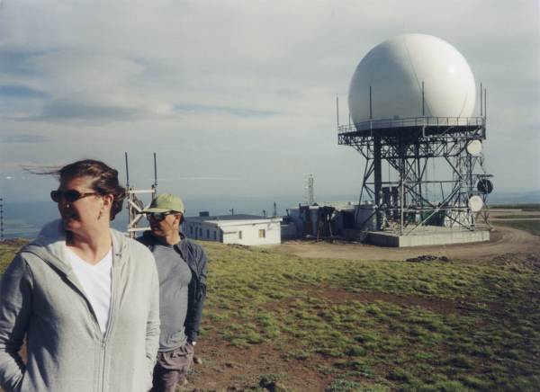
Lynne and Ron looking windblown. 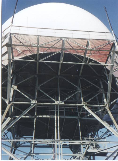
Me lurking in the dome. On Sunday we drove into the park and down to Old Faithful, mostly to look at the Lodge, an examplar of the National Park Rococo style. We did the lovely 5-mile round trip walk to Lonestar Geyser. Then, as evening approached and insects emerged, we headed for a stream and did some fly fishing. I appreciate the appeal of this arcane sport, though it doesn't grab me personally.
Then we drove past Lake Hebgen to Earthquake Lake,
where a 1959 quake dislodged an entire mountainside.
We visited a site labeled 'Building Destruction'.
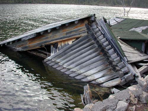
Building Destruction. A cantilever bridge sat by the road, up on blocks. 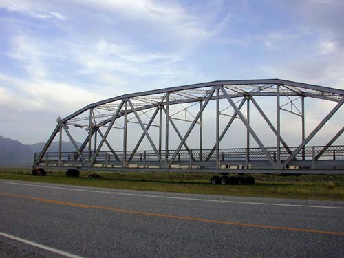
A bridge of Madison County. We made it back to Alice's Restaurant just in time to order trout. Monday, after the typically wonderful Bobbi dinner, we returned to the ruined cabins across the road. The crumbling boards and scattered artifacts (clothes, dishes, old newspapers) convey the feeling of complex and perhaps tragic life stories. On a whim we drove into West, got ice cream, and browsed in a wonderful bookstore.
On Tuesday Ron and Bobbi packed up a U-Haul trailer,
preparing for a 3-day drive back to Connecticut.
Lynne and I said goodbye and drove into Yellowstone,
enjoyed an up-close view of some bison
and struggled with tourist-revulsion as we toured
the Grand Canyon of Yellowstone.
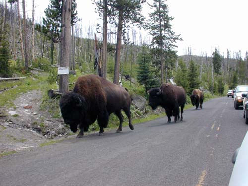
Bison on the road. 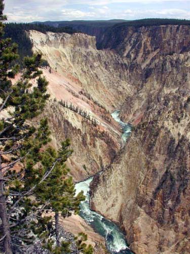
The grand canyon of Yellowstone.
Deciding we'd done enough driving, we headed for the Lake Yellowstone Hotel.
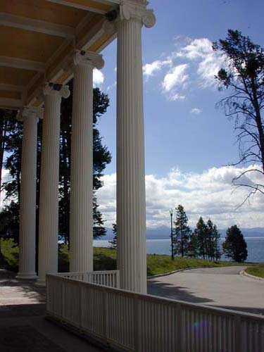
The Lake Yellowstone Hotel. Note swallow nests above pillars. This aging landmark had been restored in a tacky 1980's style. I played the piano in the immense lobby; later the regular pianist played a piece by Schubert/Liszt that I've been working on and humming. We went to the Bridge Marina, rented a powerboat, and toured the lake at high speed for an hour - lots of fun. We dined in the spacious but unexceptional restaurant at the hotel.
On Wednesday we made the long drive (~8 hours) back to Salt Lake City.
The Grand Tetons were spectacular; we took the road fork
that goes close to them.
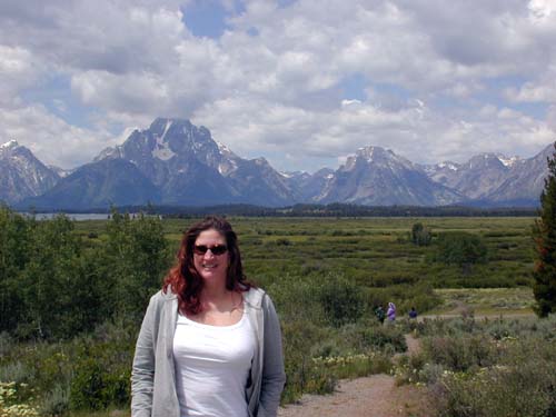
Grand Tetons indeed. I spent some time with binoculars, surveying the immense and intimidating face of Mt. Moran, looking for possible climbing routes. 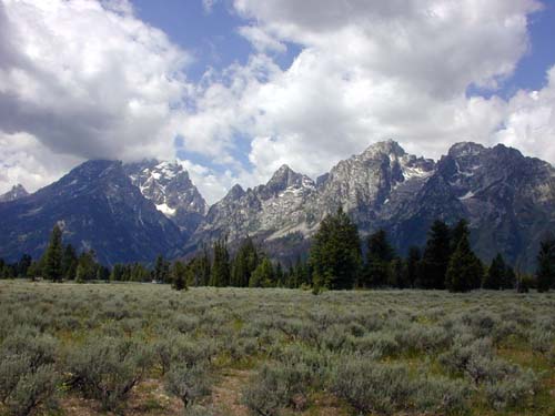
The Grand Teton (13,700') in clouds at left. Later we drove by the enticing-sounding Teton Climber's Ranch.
The drive down highway 89 through Jackson is spectacular.
We stopped in Afton at a store that sold espresso
and Christian inspirational goods.
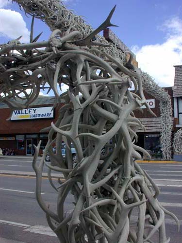
Afton antler arch -- the world's largest. The kindly woman told us to drive through Cokeville and Evanston, rather than Ogden; this turned out to be good advice. We stopped briefly at the Mormon Temple Square in Salt Lake. Two miles from the airport, I was caught in a speed trap and got a totally bogus ticket. Note to self: drive slow near airports.
|